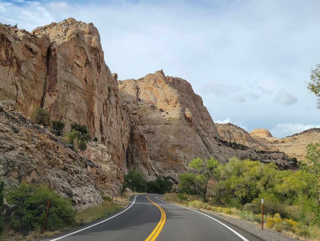
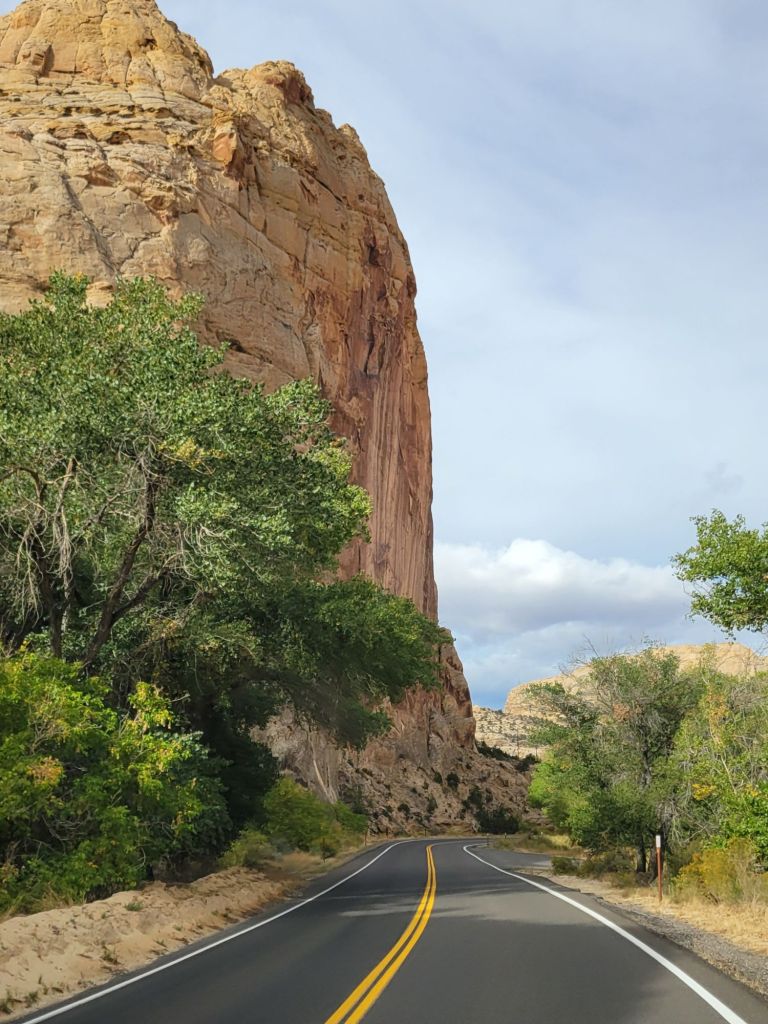
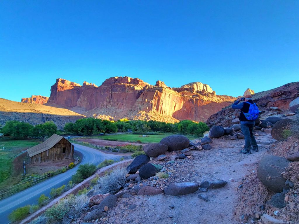
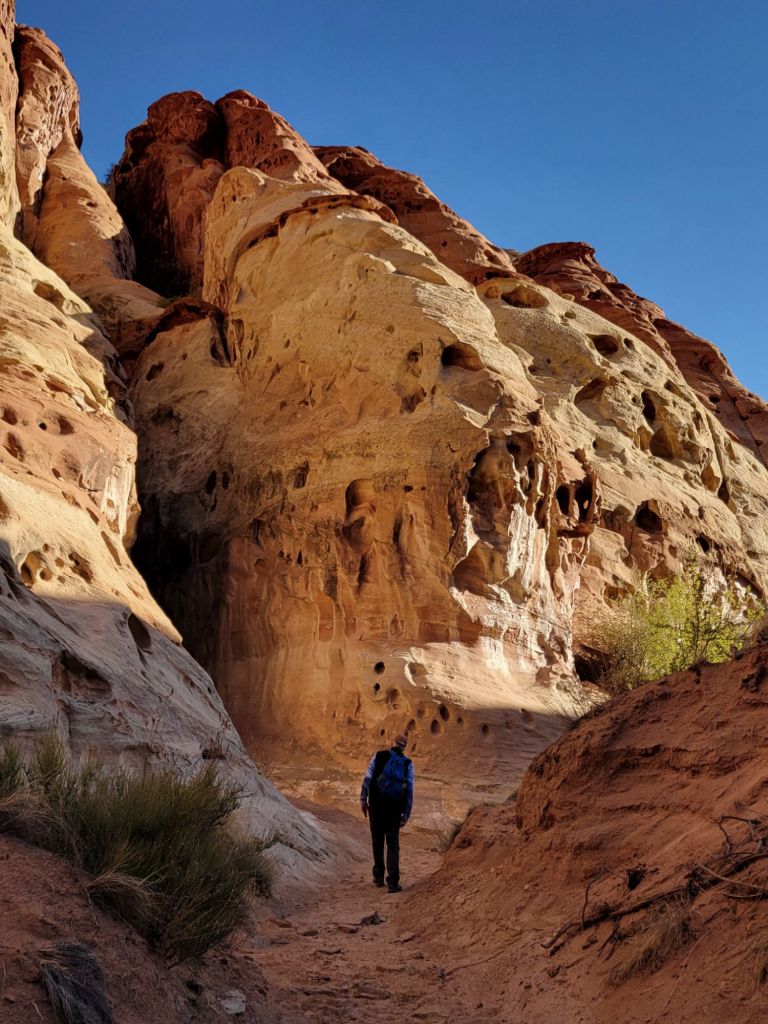
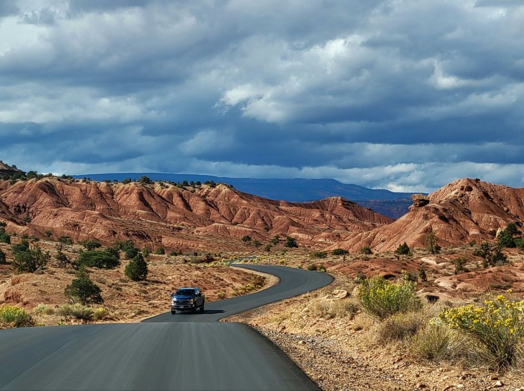
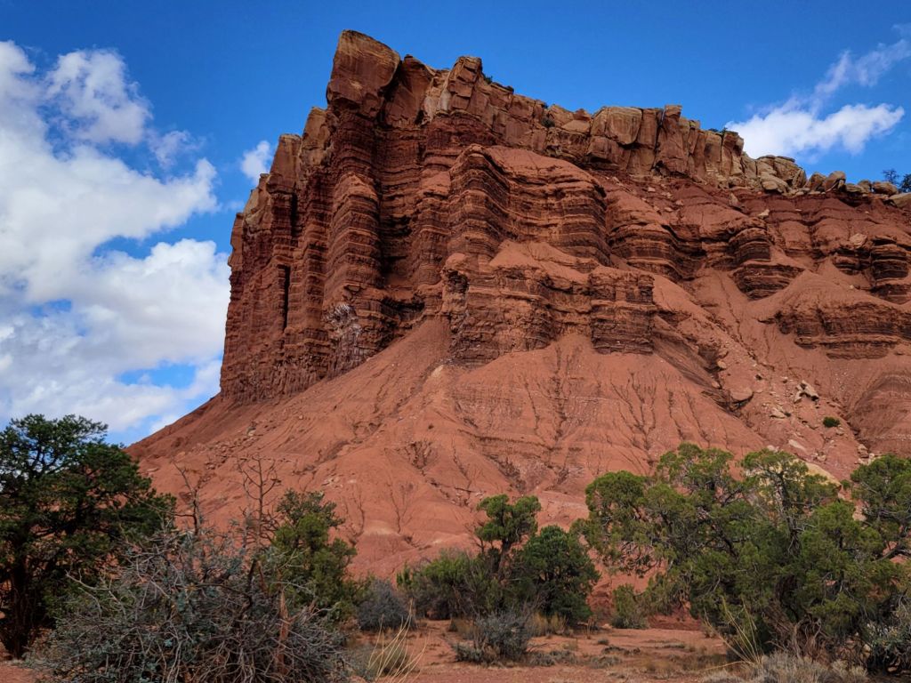
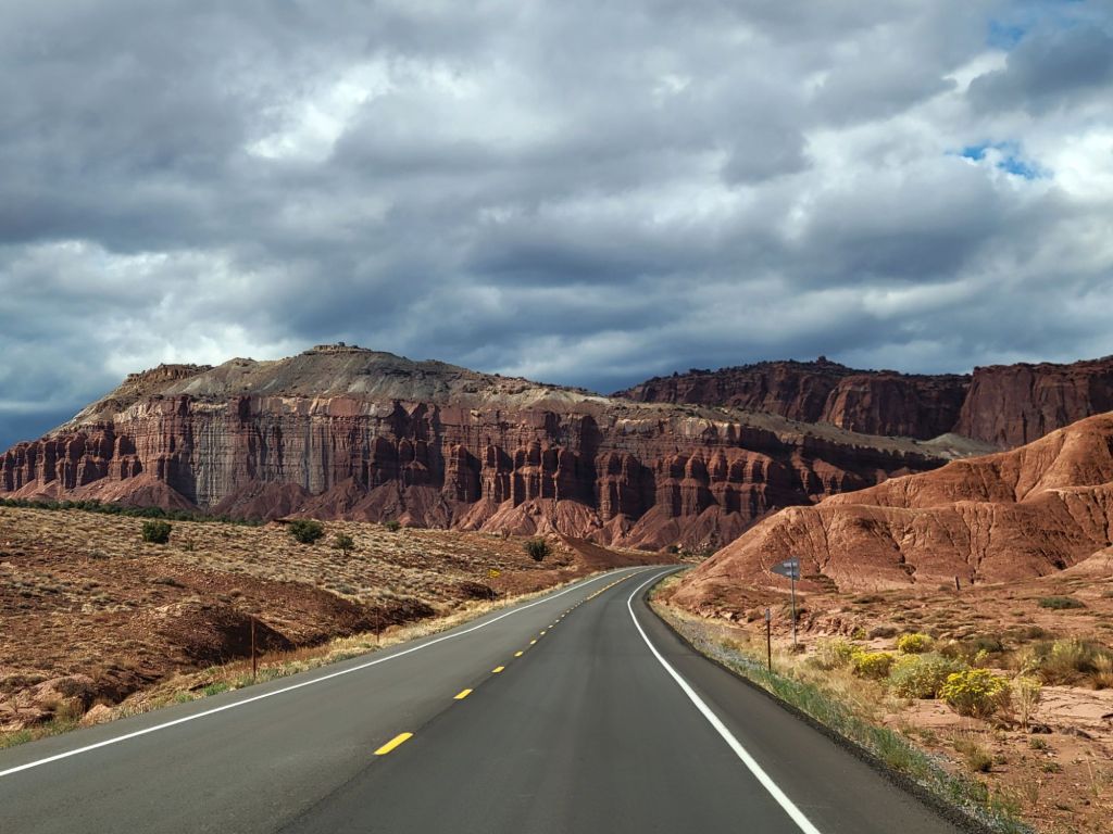
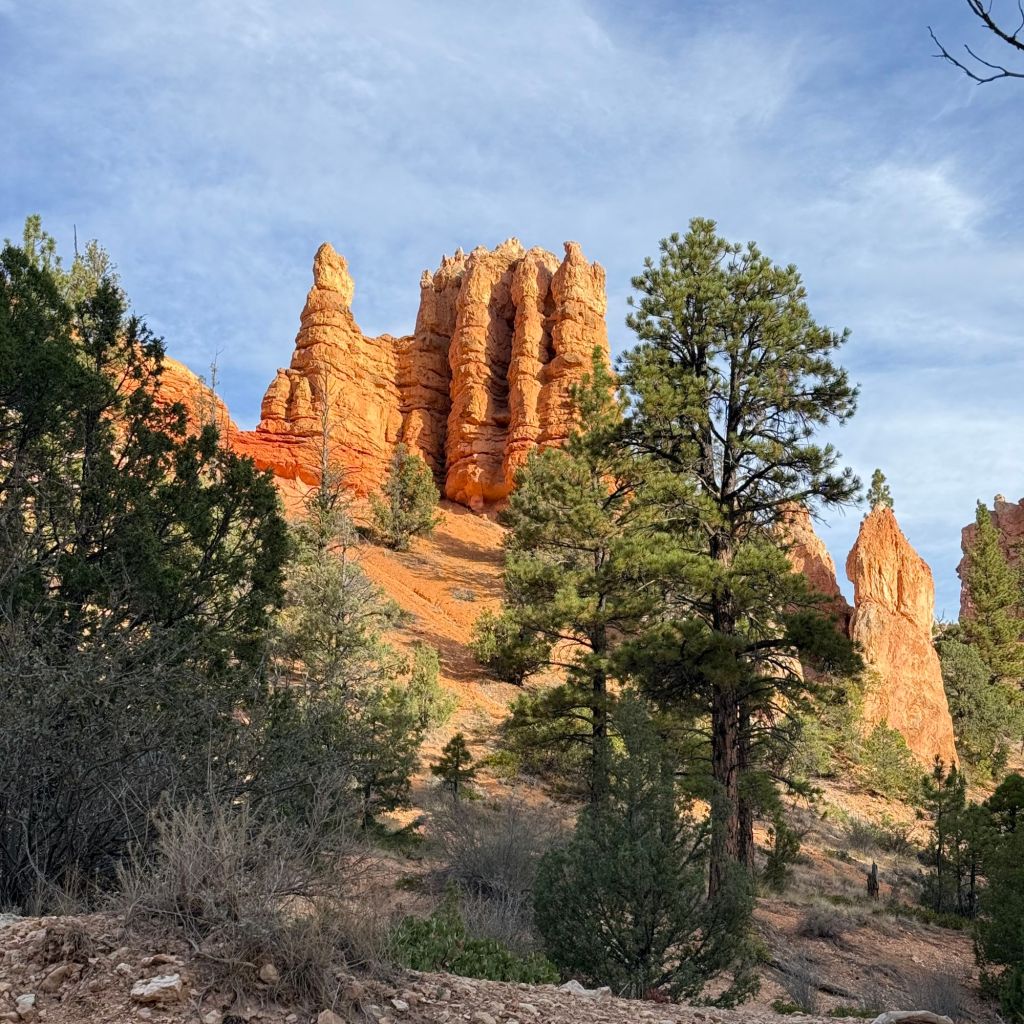
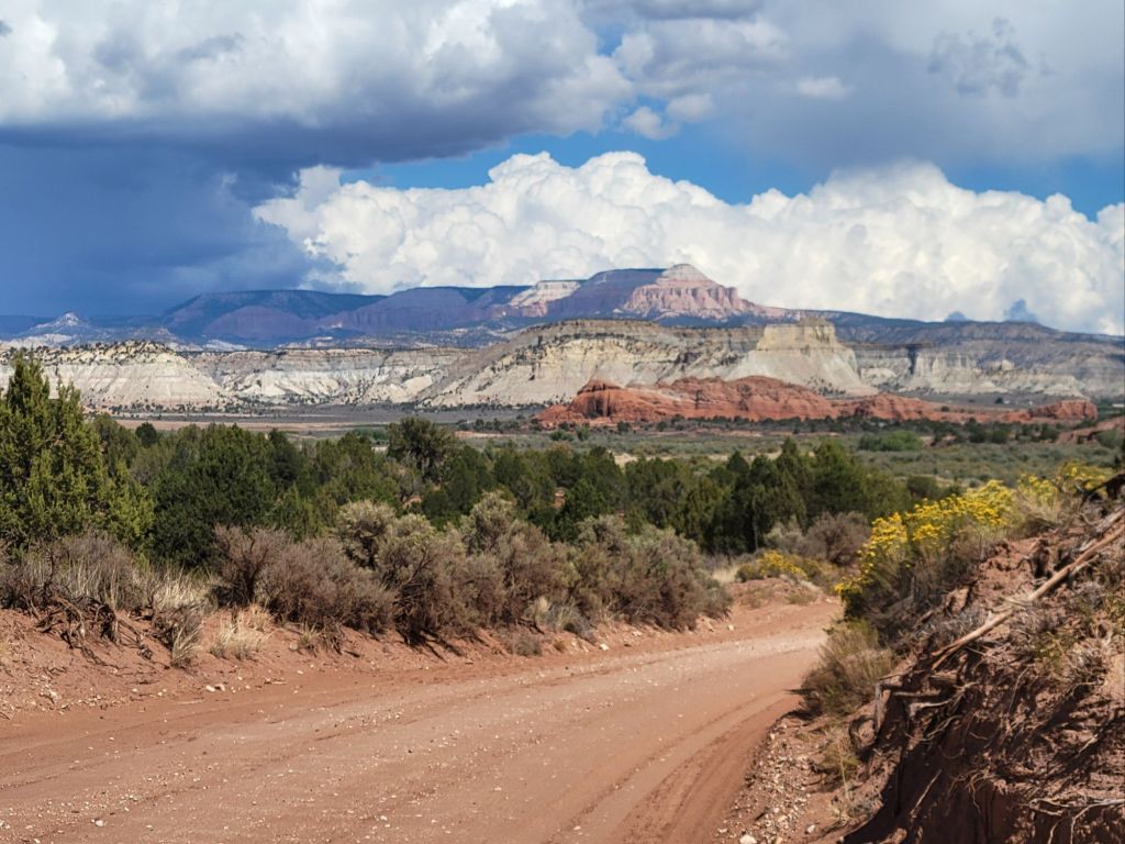
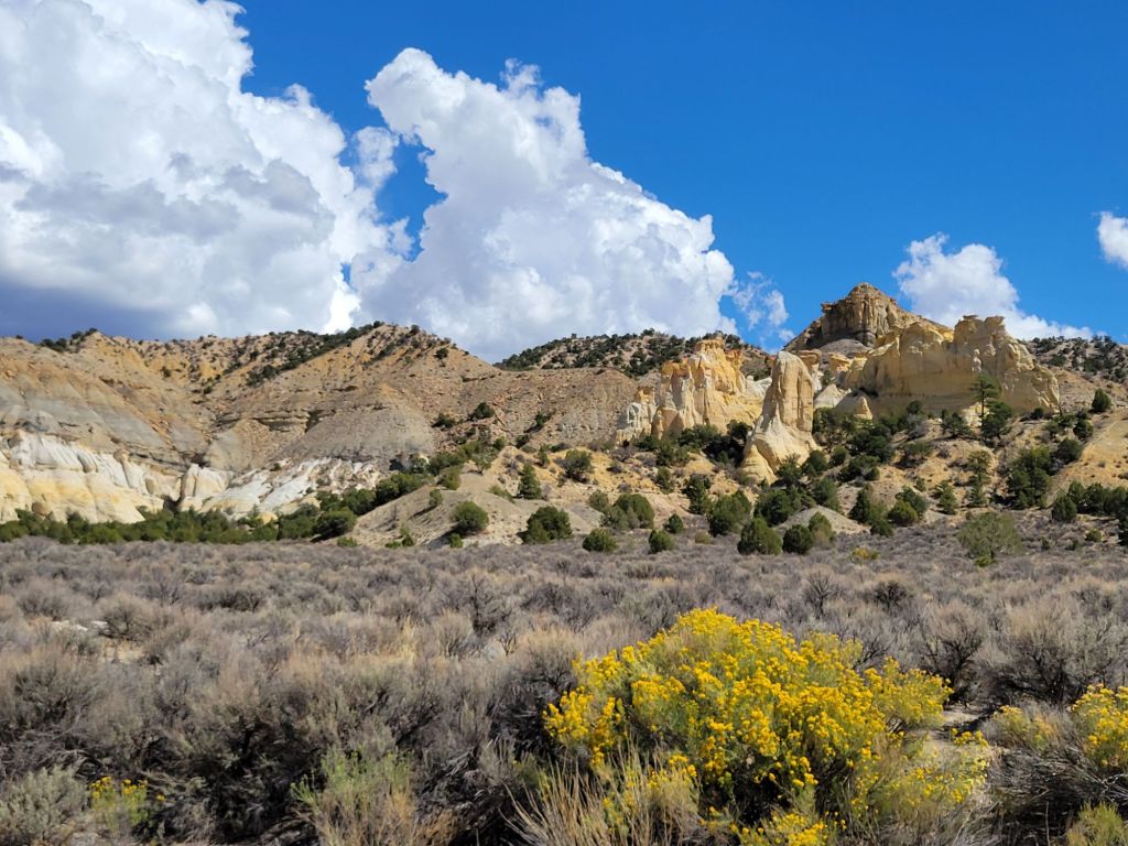
In an effort to take it a bit easier today, Greg and I headed down Route 24 to hike the Grand Wash Trail, a flat and fairly short hike through a dry stream bed and canyon.
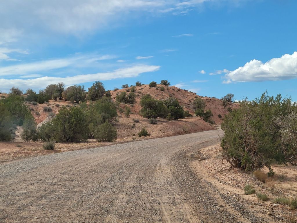
The views along Route 24 were beautiful in the early morning sunlight.
The hike itself didn’t get off to the best start.
As Greg was trying to descend a slight slope into the stream bed, he slipped on the sand, fell, and ripped open his hand on a piece of wire.
So we headed back to the car to patch him up before continuing on.
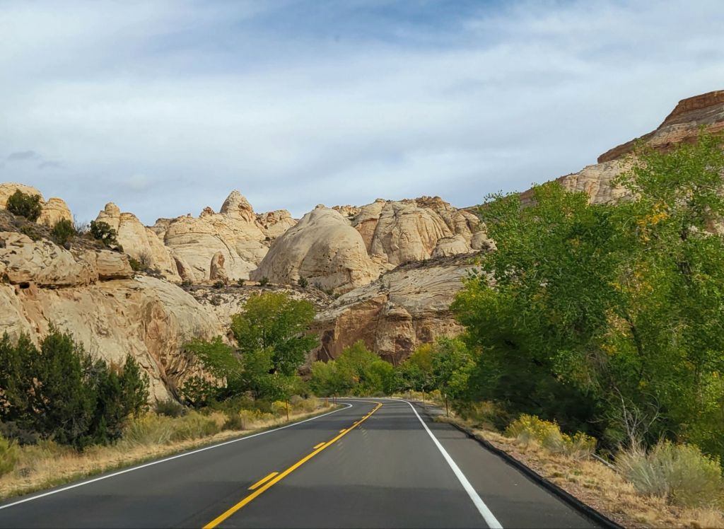
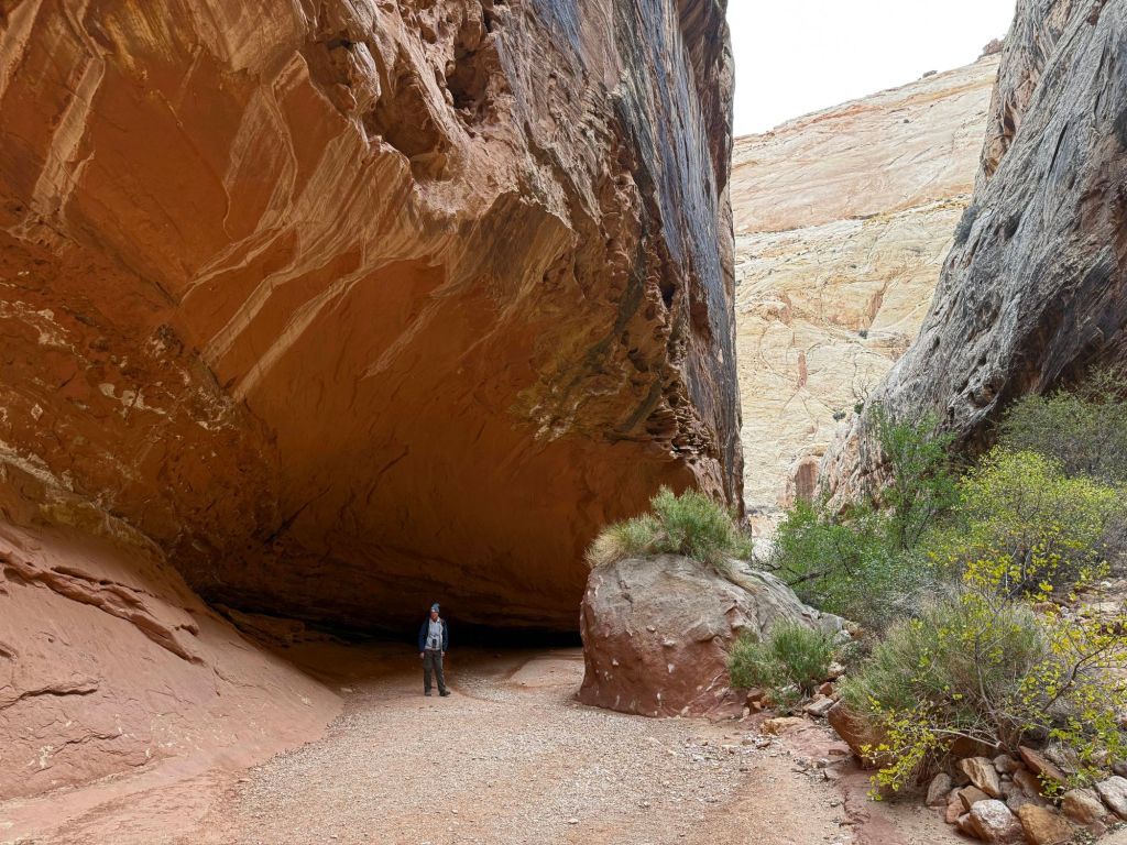
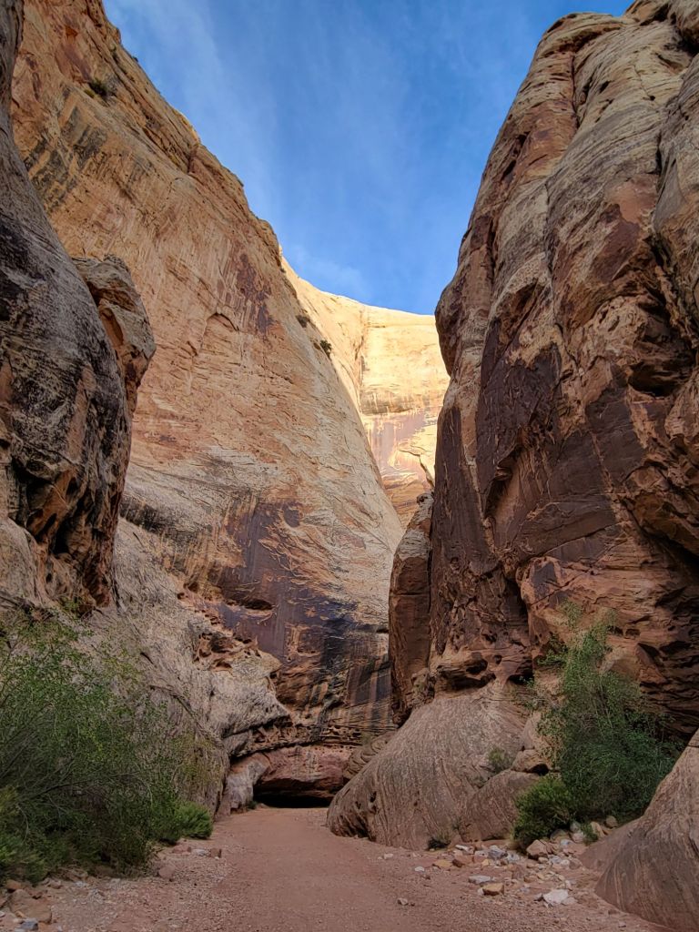
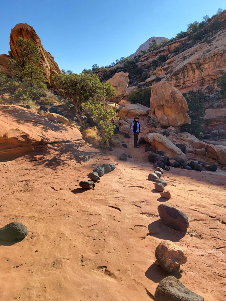
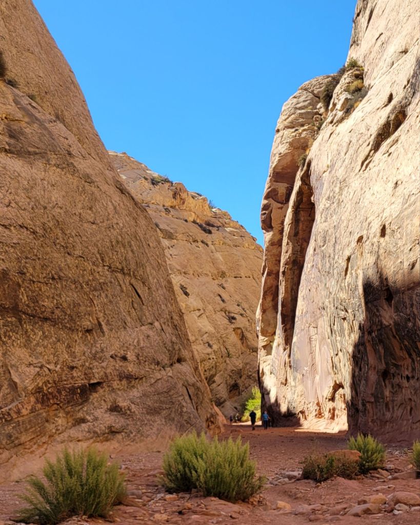
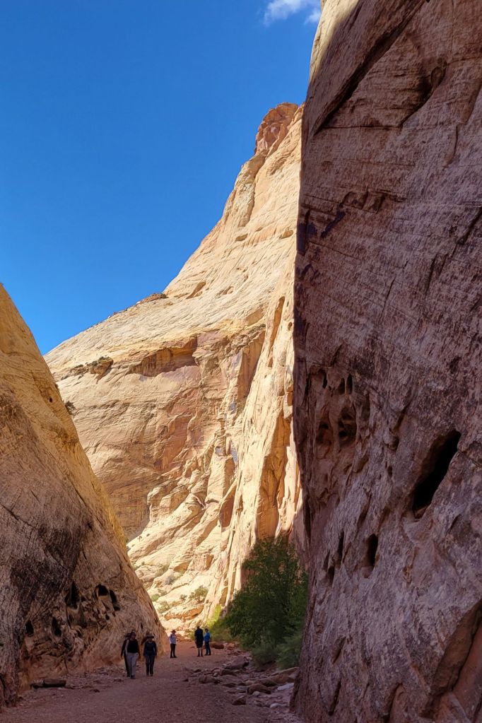
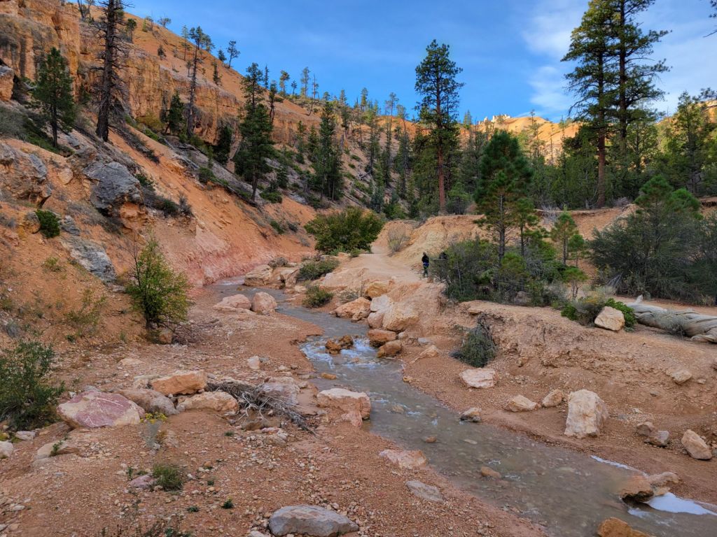
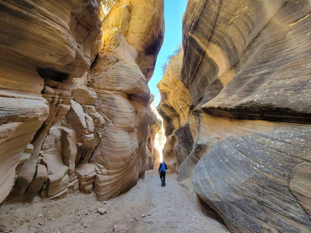
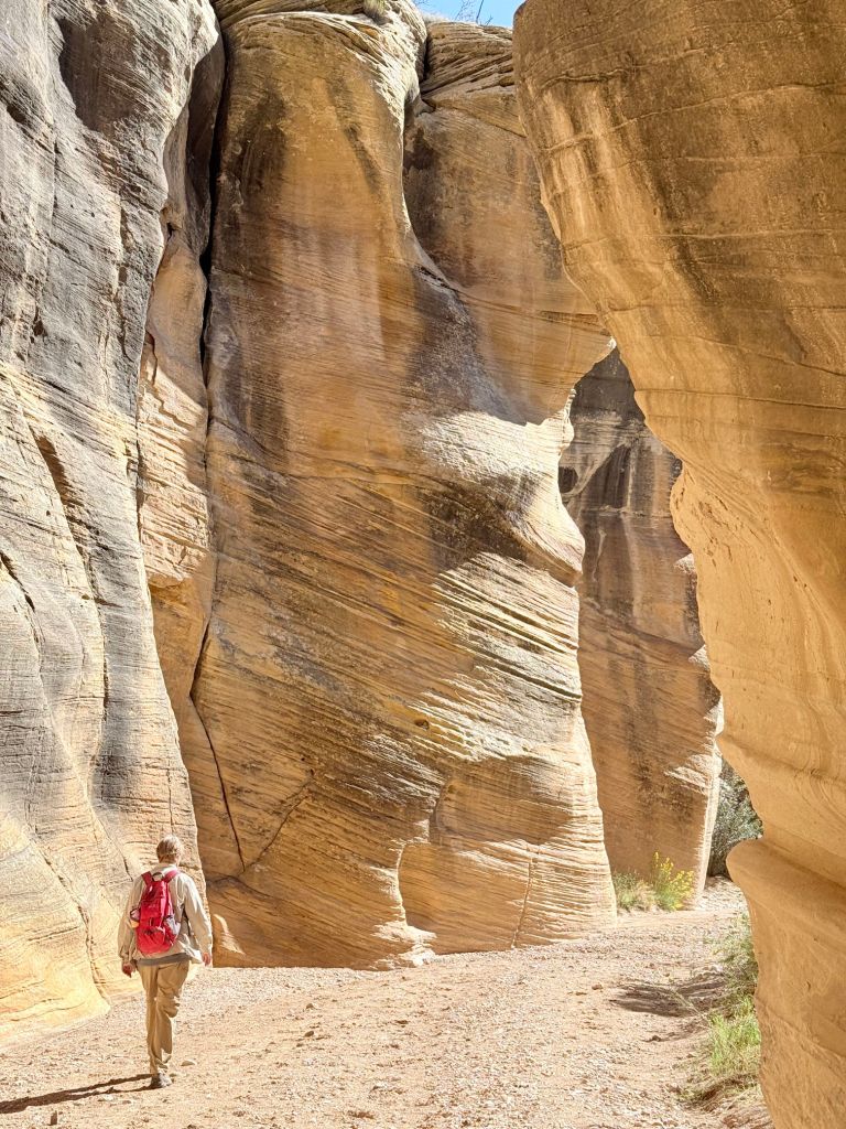
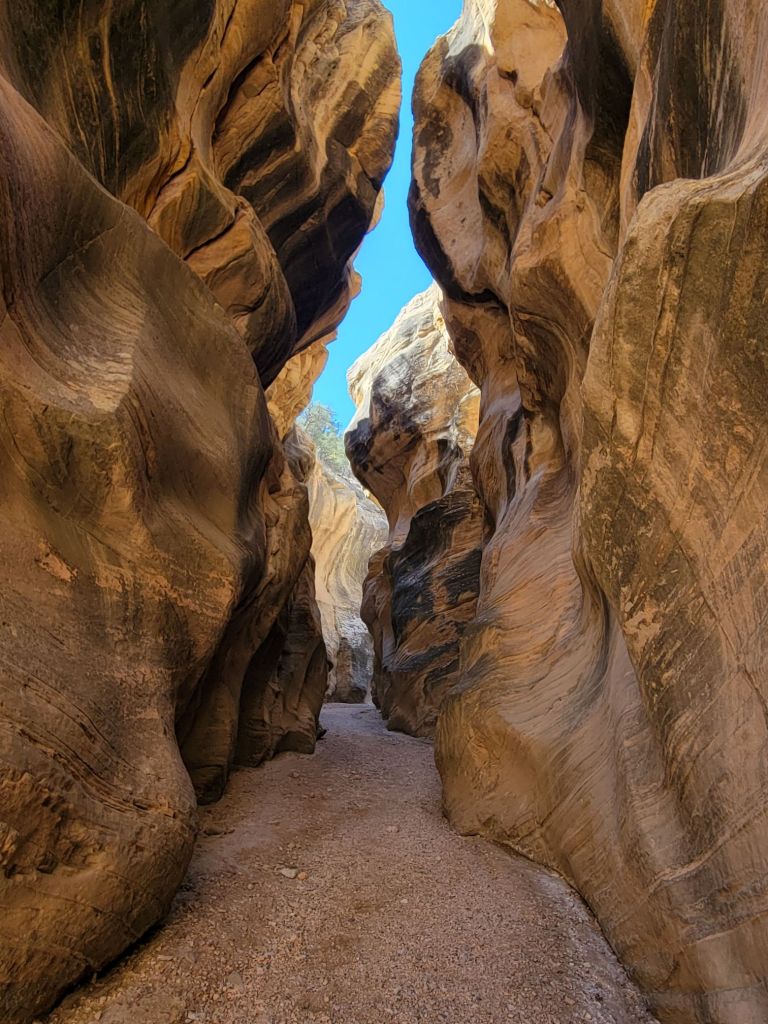
The trail was delightful, though.
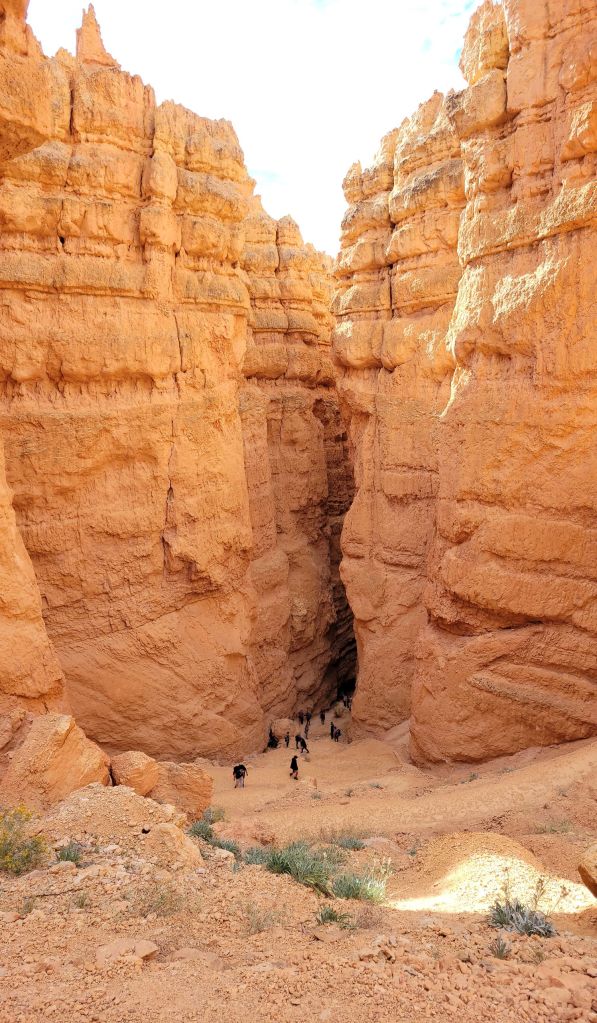
See the tiny people in this photo?
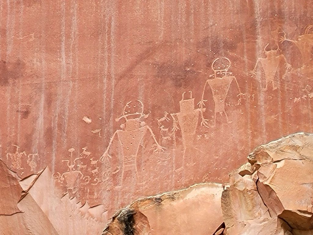
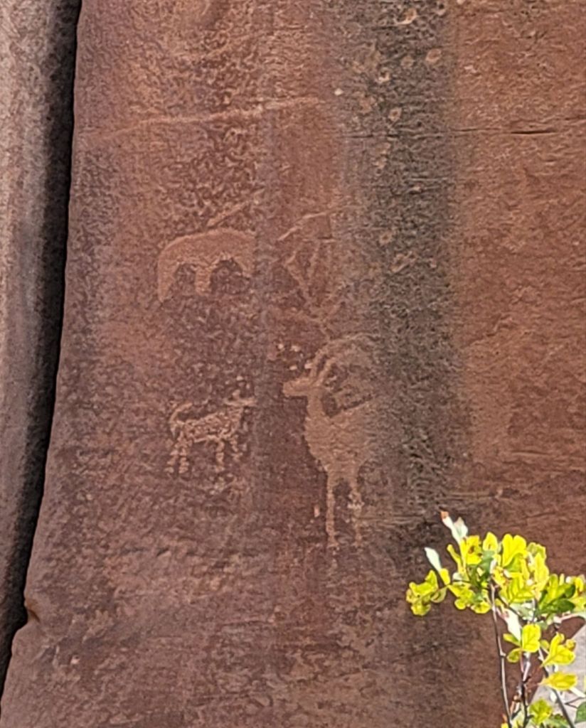
Petroglyph Panels
After our hike, we headed down Route 24 to an area where Native Americans had carved petroglyphs into the rock walls.
There was another tourist there who had an incredible ability to spot the petroglyphs, despite how small and faded they were. If not for him, I suspect I would have missed seeing about 80% of them.
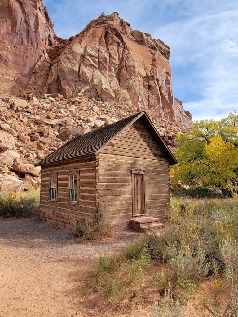
Fruita Schoolhouse
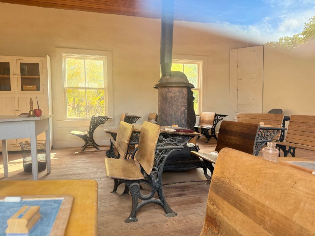
Next, we drove a short distance to the Fruita Schoolhouse. Unfortunately, it was locked, so we were only able to get photos from the outside and looking through the windows.
This is where the small Mormon community of 10 families that lived in Fruita schooled their children and held community events.
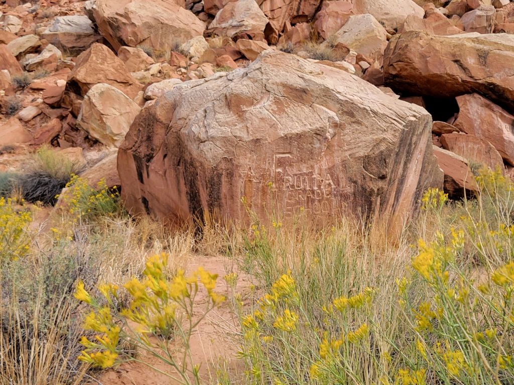
Photo taken through the windowBehind the schoolhouse is this rock. Someone carved “Fruita Grade School” into it, and generations of children carved their names into it as well.
After stopping by the schoolhouse, Greg and I headed back to the campground, where we enjoyed a very relaxing afternoon and evening doing absolutely nothing. (Well, except for grilling beef tenderloin for dinner. Yum!)
This is the first time Greg and I have hiked a trail where I have found myself saying, “Nancy, you are an absolute idiot for doing this.”
It wasn’t because the trail was particularly difficult. It wasn’t.
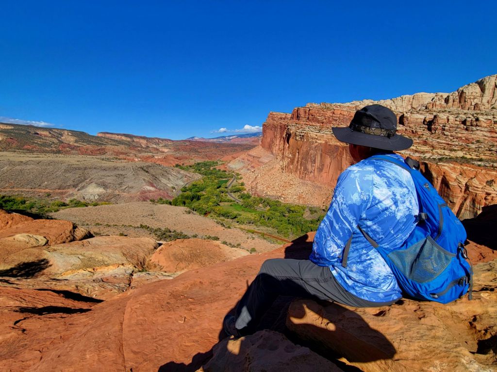
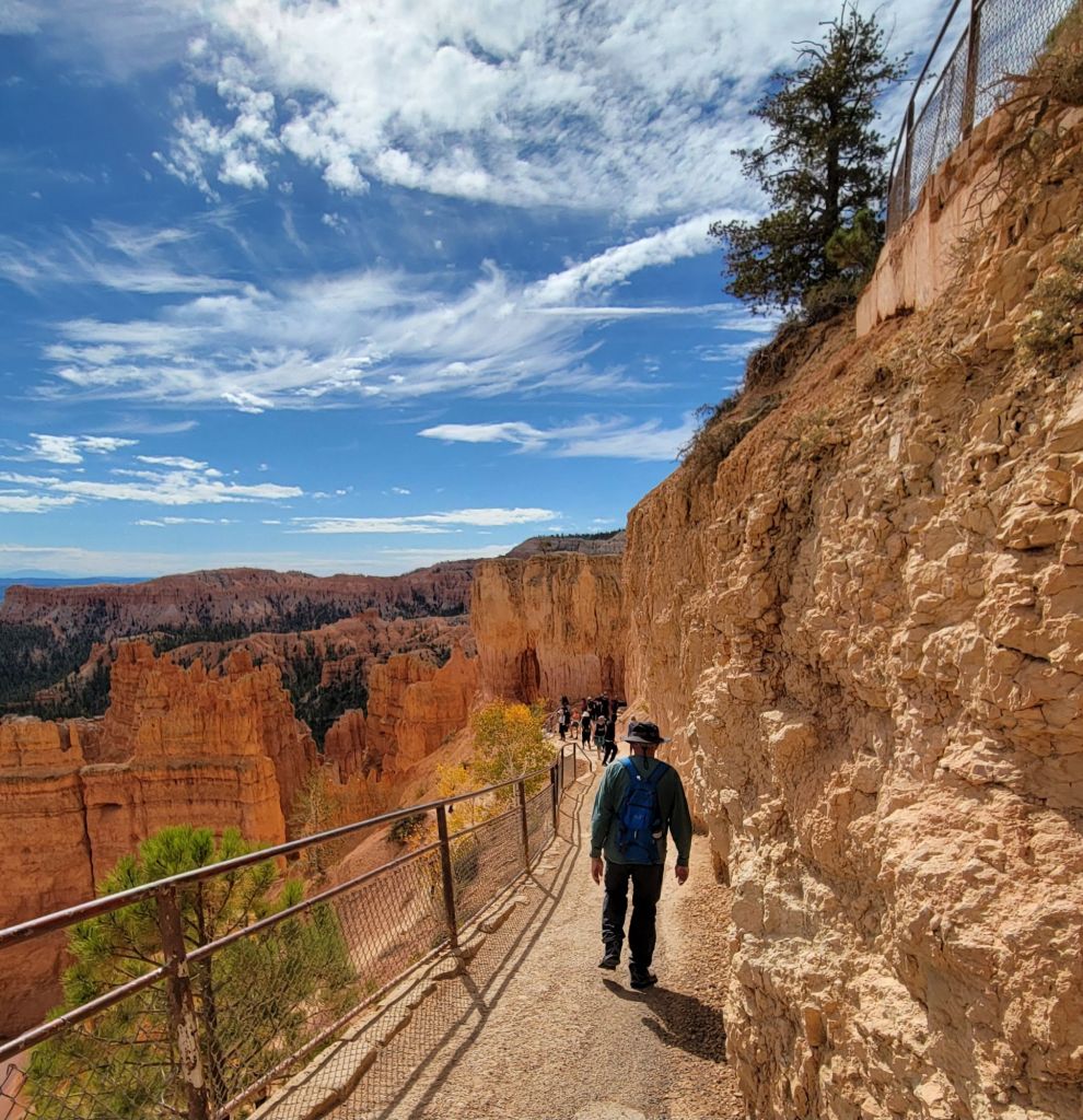
I was simply feeling tired and shaky. The beginning of the hike involved climbing 440 feet up a mountain, and there were times when I paused on the trail and tried not to let dizziness overcome me.
Partway up the mountain
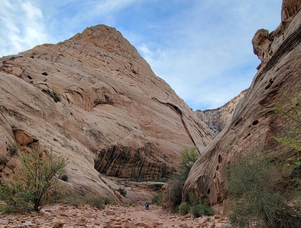
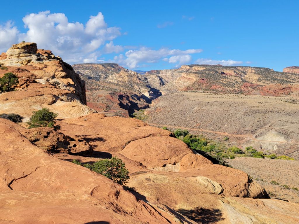
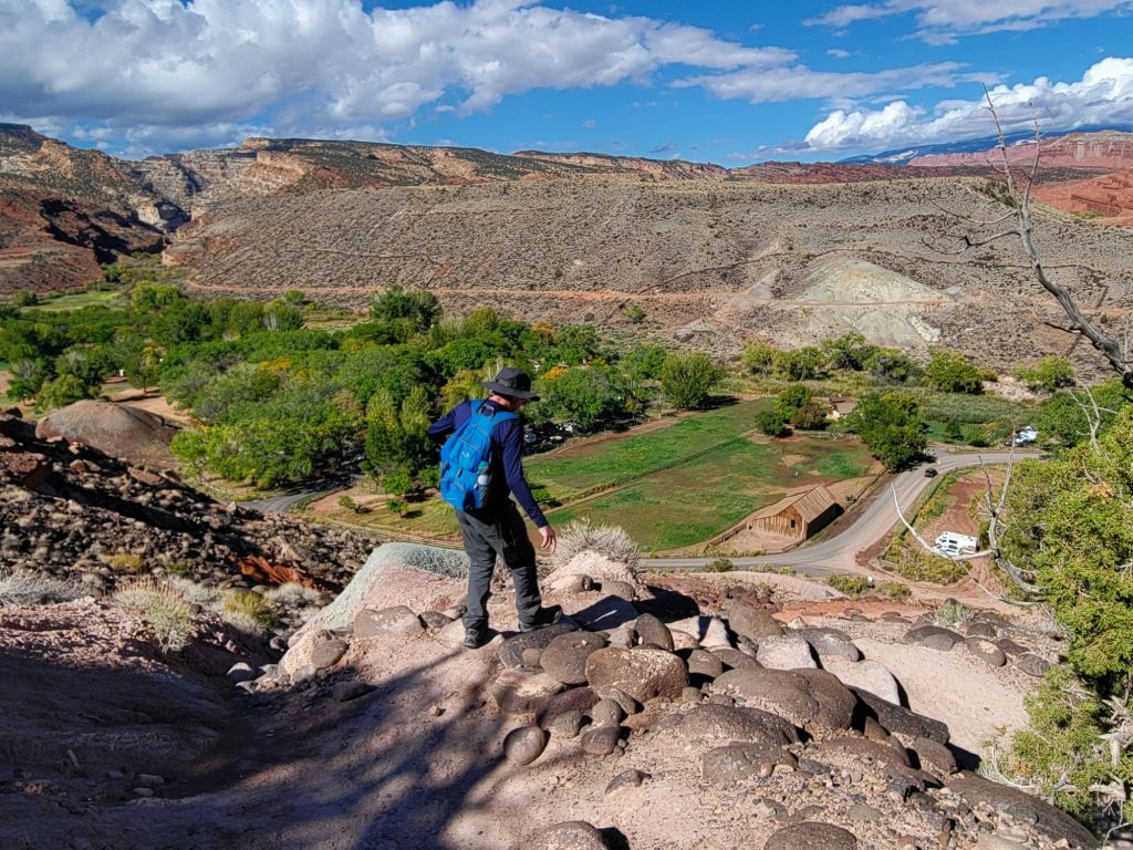
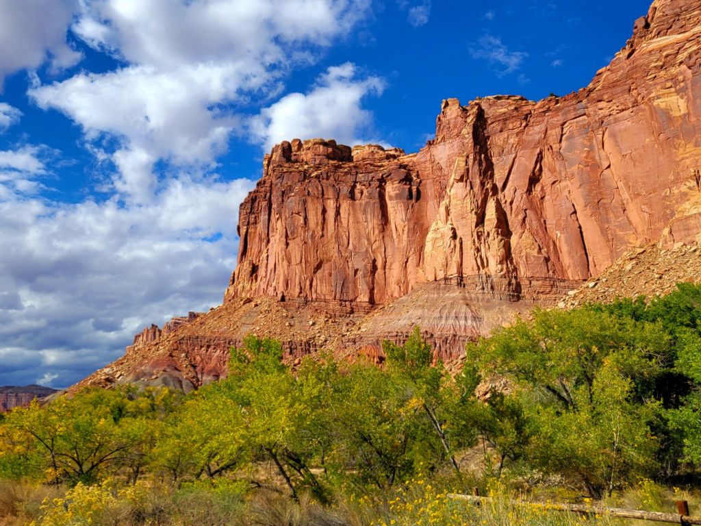
That said, once the hard part was over, we had a great time wandering through the canyon.
Through the canyon and heading toward the last 300-ft climb to the overlooks View from North Overlook View from South Overlook Greg, enjoying the view The view from the other direction Heading back down the mountain
After we finished the hike, we stopped by the Gifford House and purchased one of their famous pies (we bought cherry).
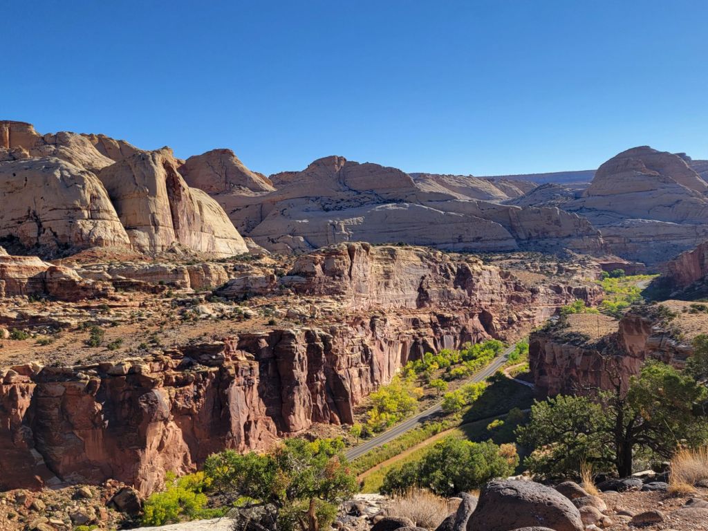
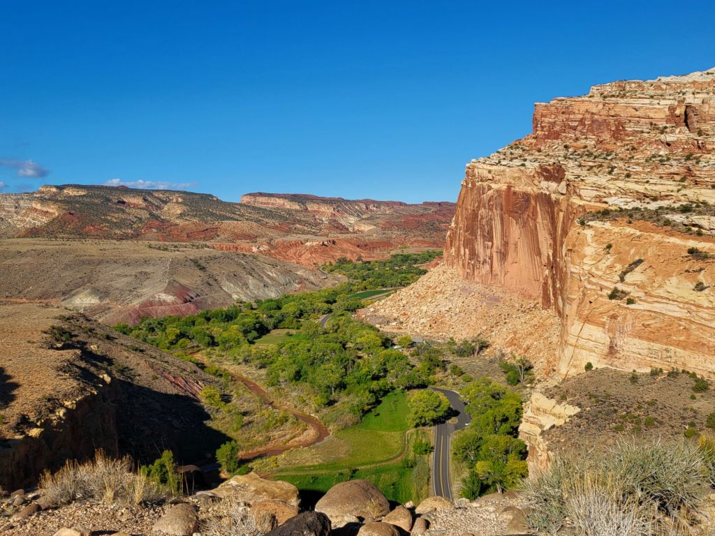
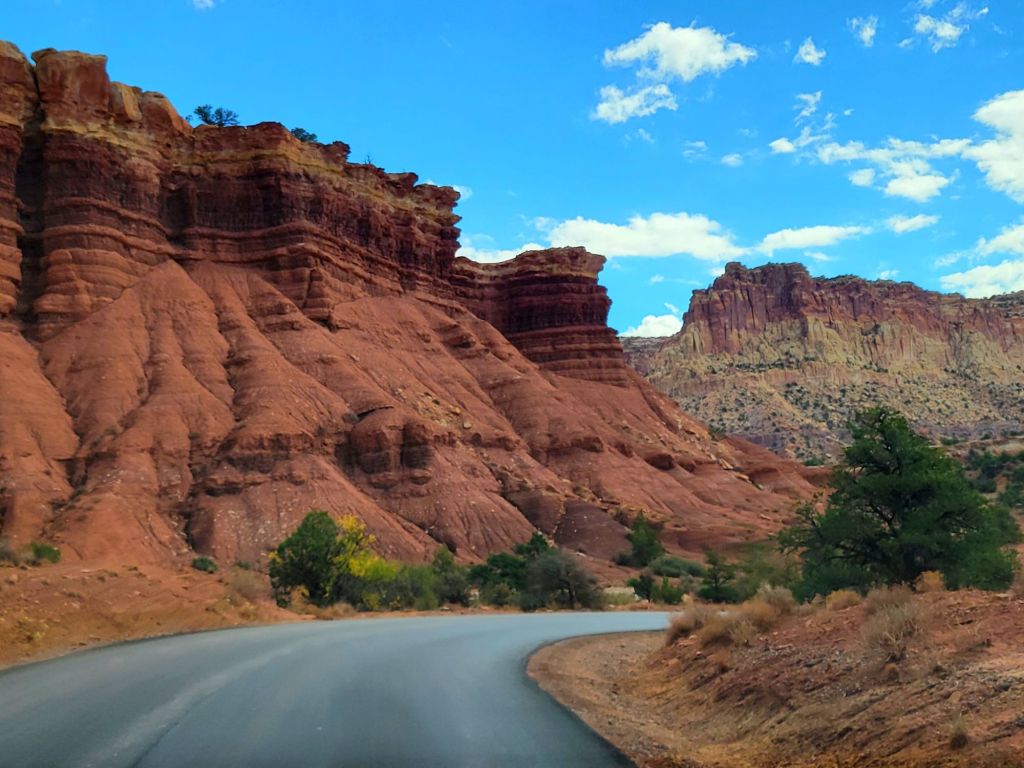
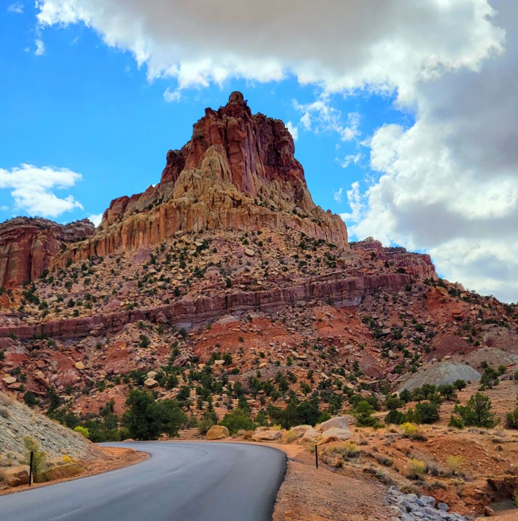
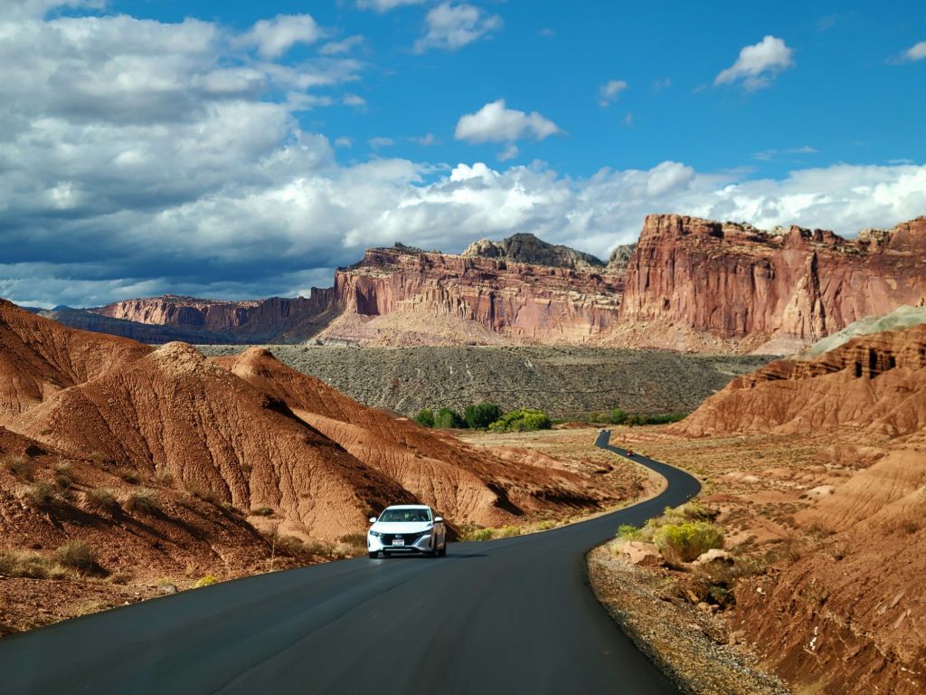
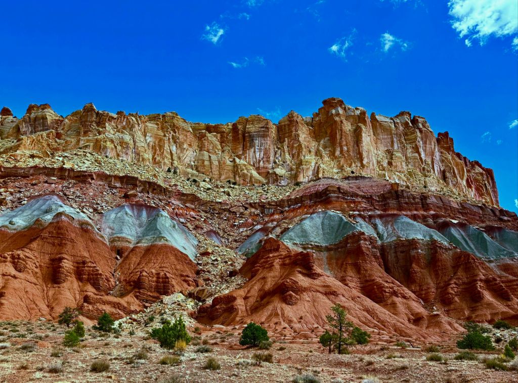
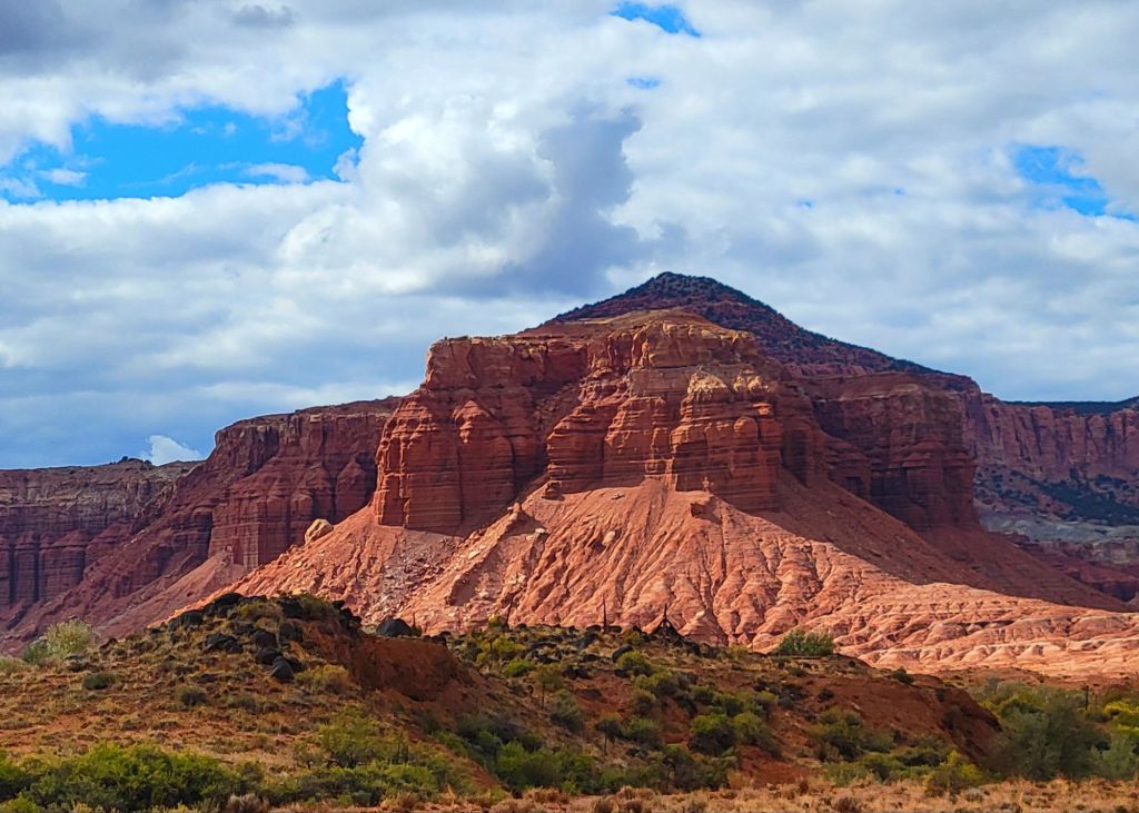
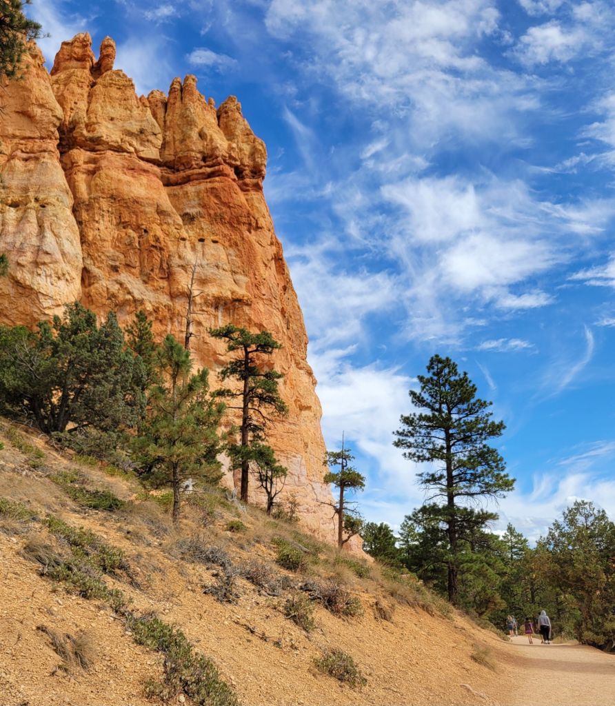
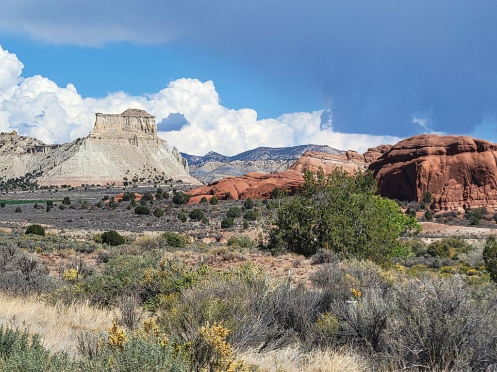
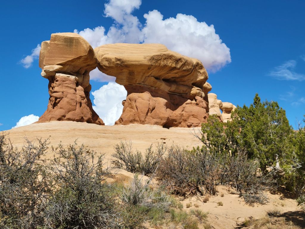
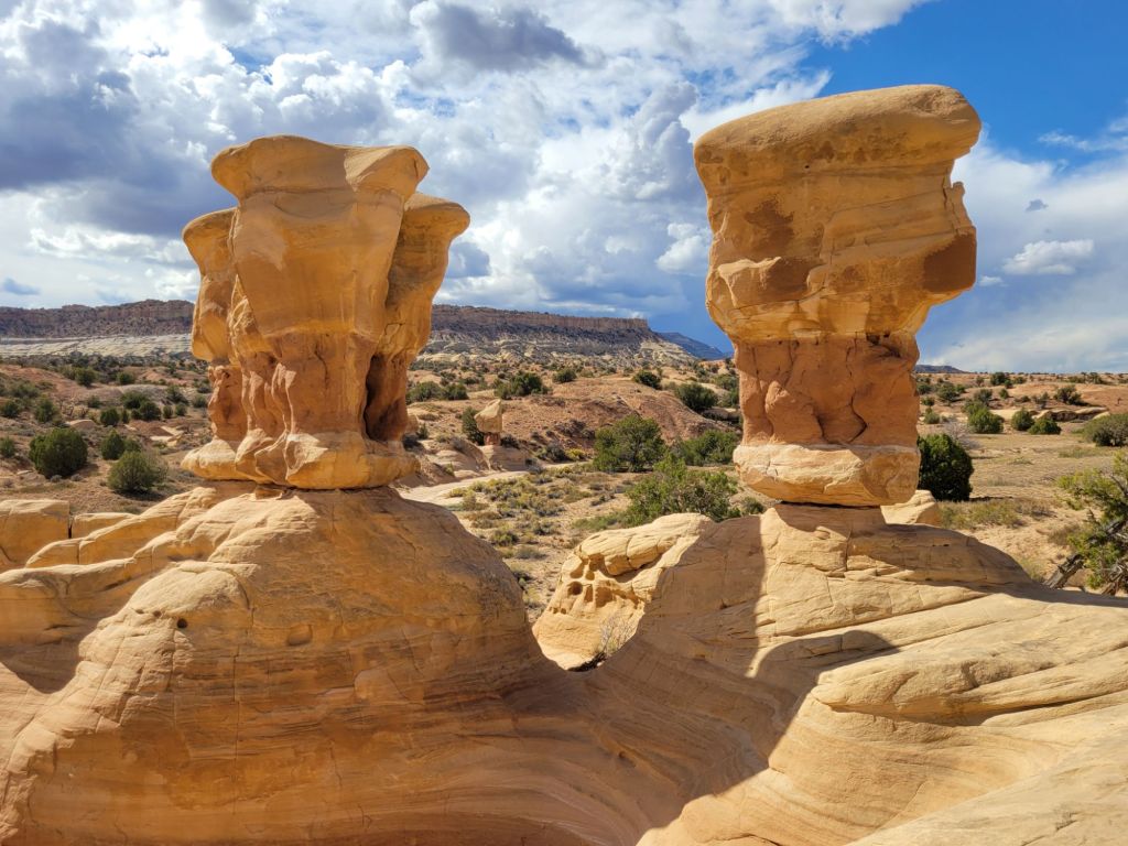
Scenic Drive
Next, we hopped in the car and drove the 8-mile scenic drive.
Capitol Gorge Road
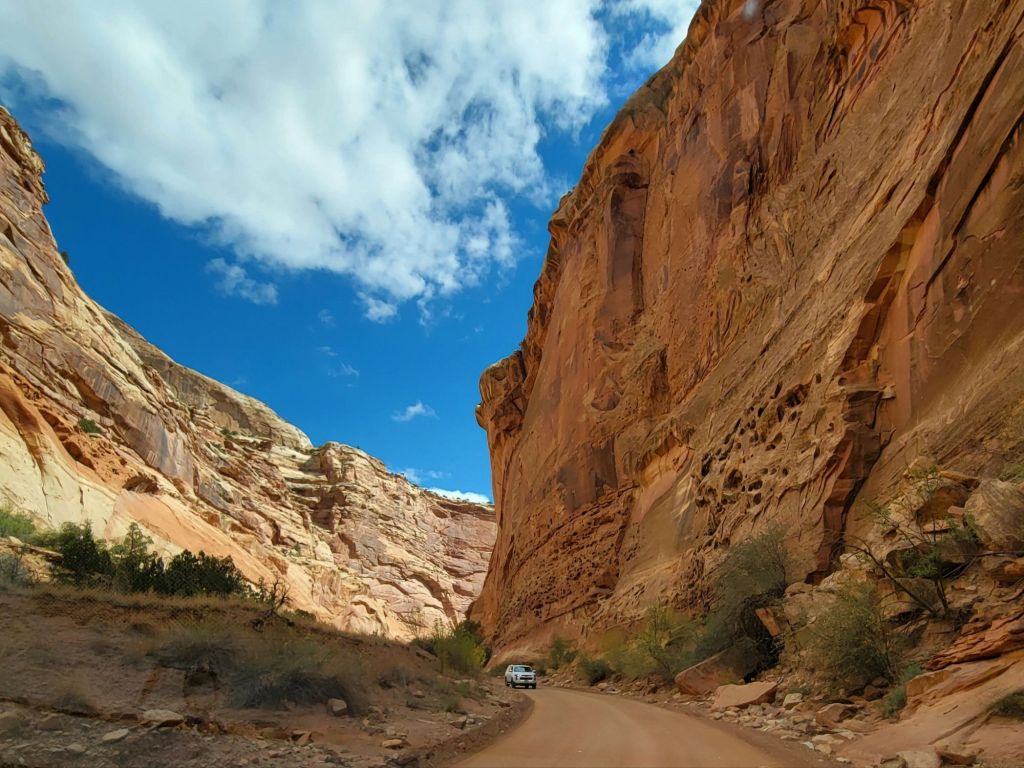
At the end of the Scenic Drive is a gravel road called Capitol Gorge Road. Thankfully, it is only about a mile long because it is narrow with blind corners and rock walls — not Greg’s cup of tea.
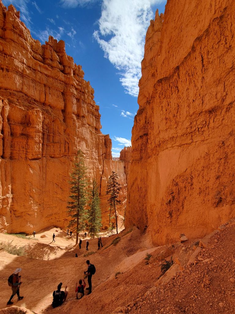
Capitol Gorge Trail
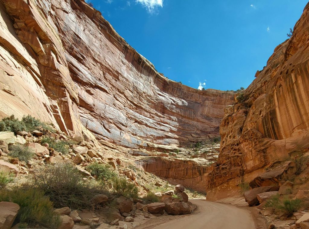
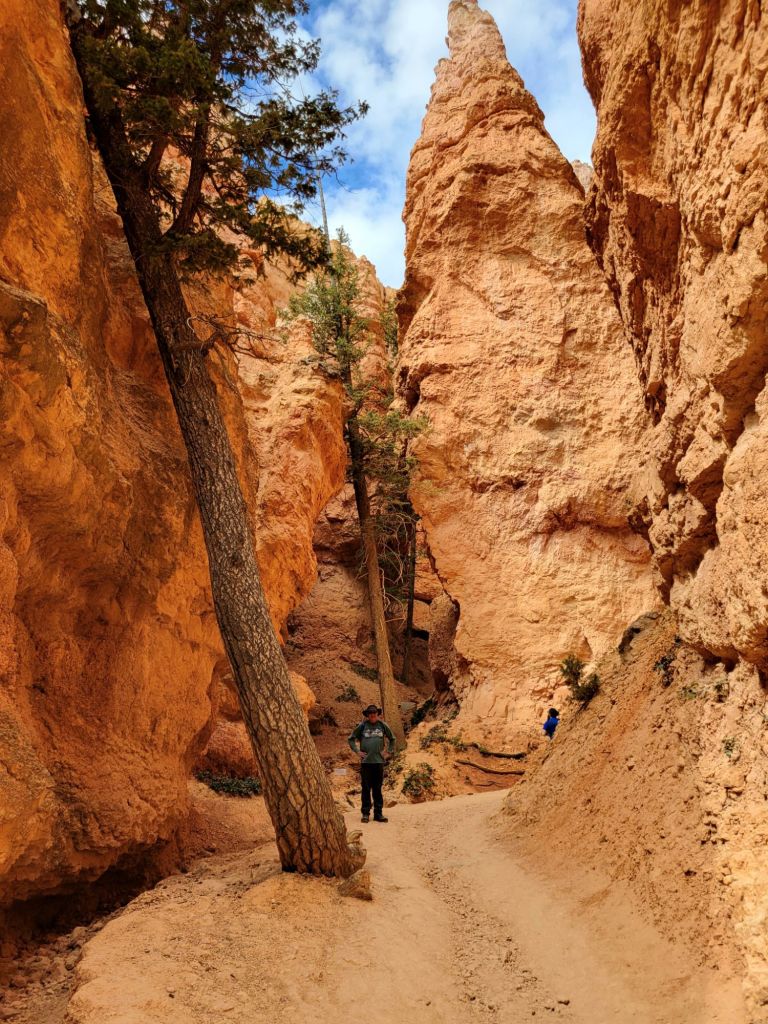
At the end of Capitol Gorge Road is Capitol Gorge Trail. This is an easy and fun hike through a slot canyon.
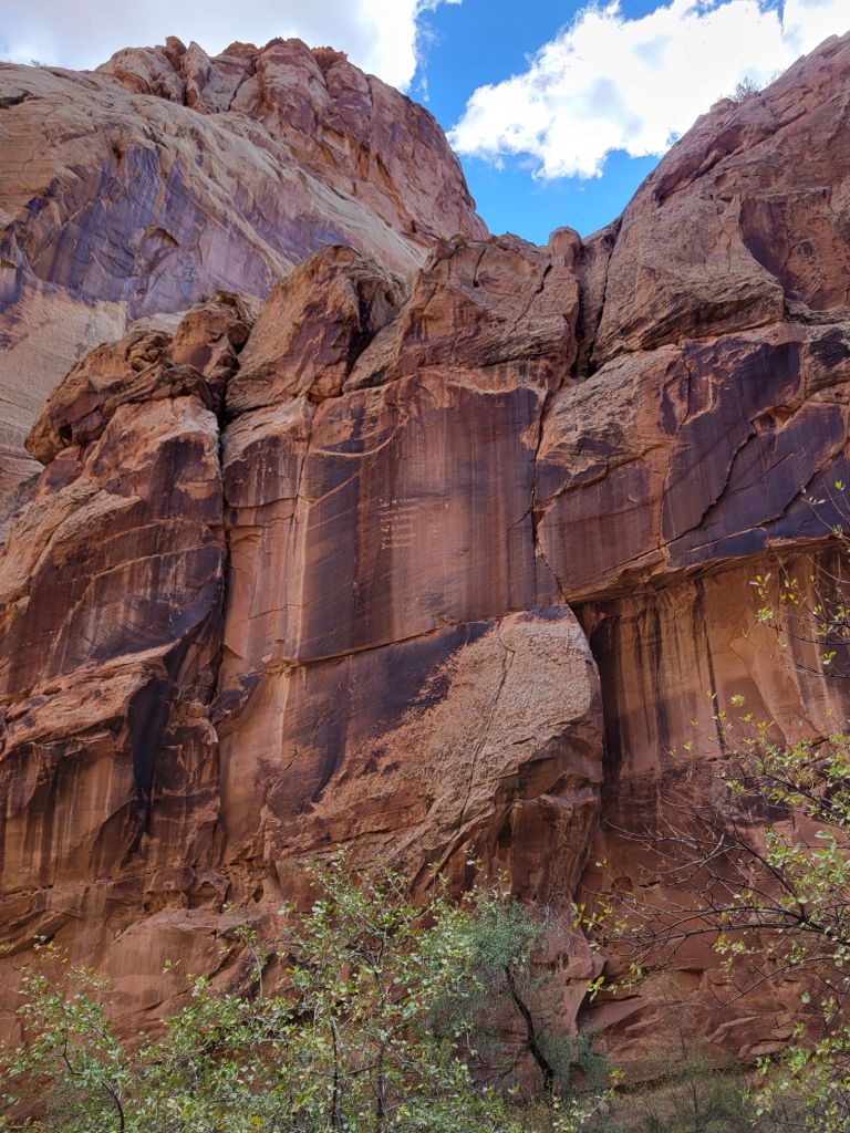
Along the trail, Native Americans carved petroglyphs into the canyon walls.
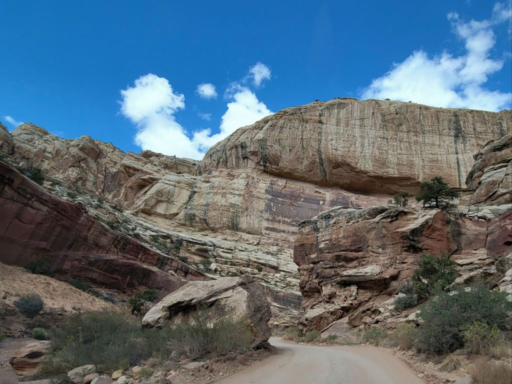
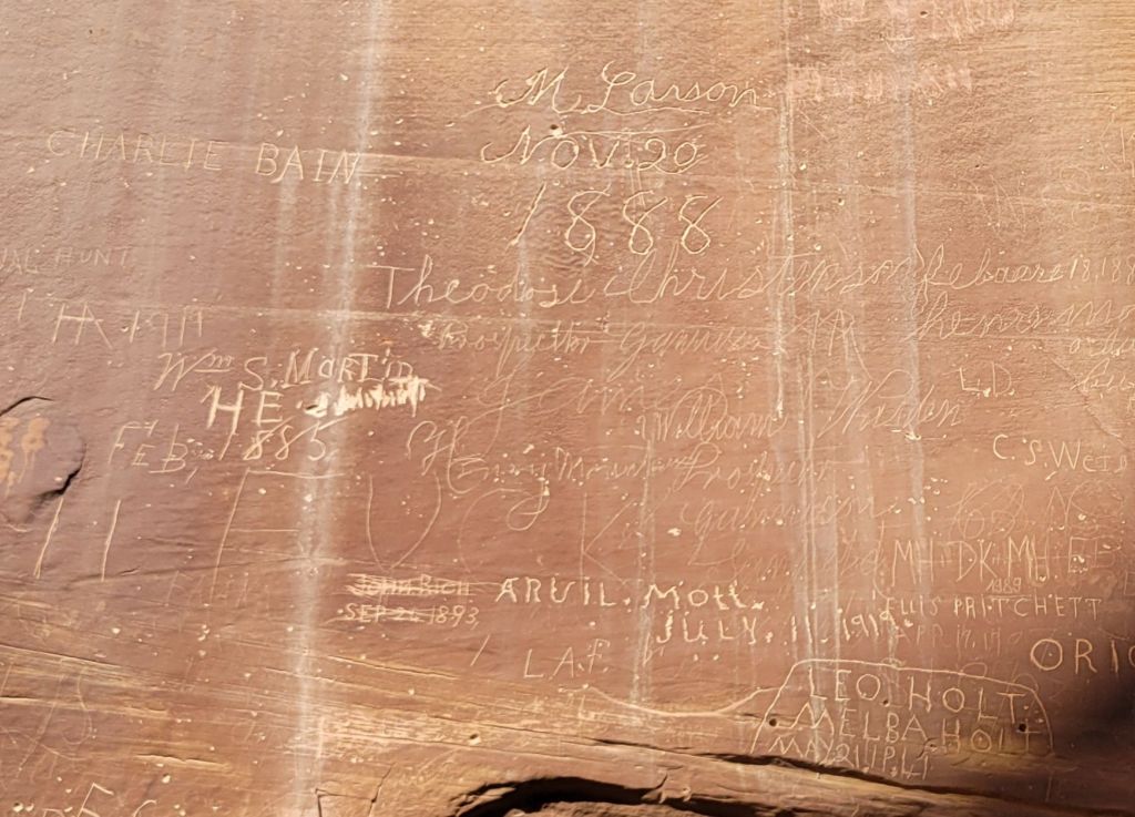
And pioneers carved their names into the canyon walls as they passed through.
The Pioneer Registry There is a list of names about halfway up the rock wall. Who knows how they managed it!It’s hard to get a sense of how tall those rock walls are without people in the photo to add perspective.
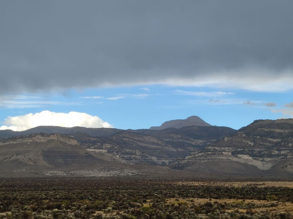
I took a few more photos of the scenery on the way back to the campground.
We did not set our alarms last night because the weather forecast predicted a greater than 50% chance of rain until 11:00 a.m. this morning.
The weather forecast was wrong.
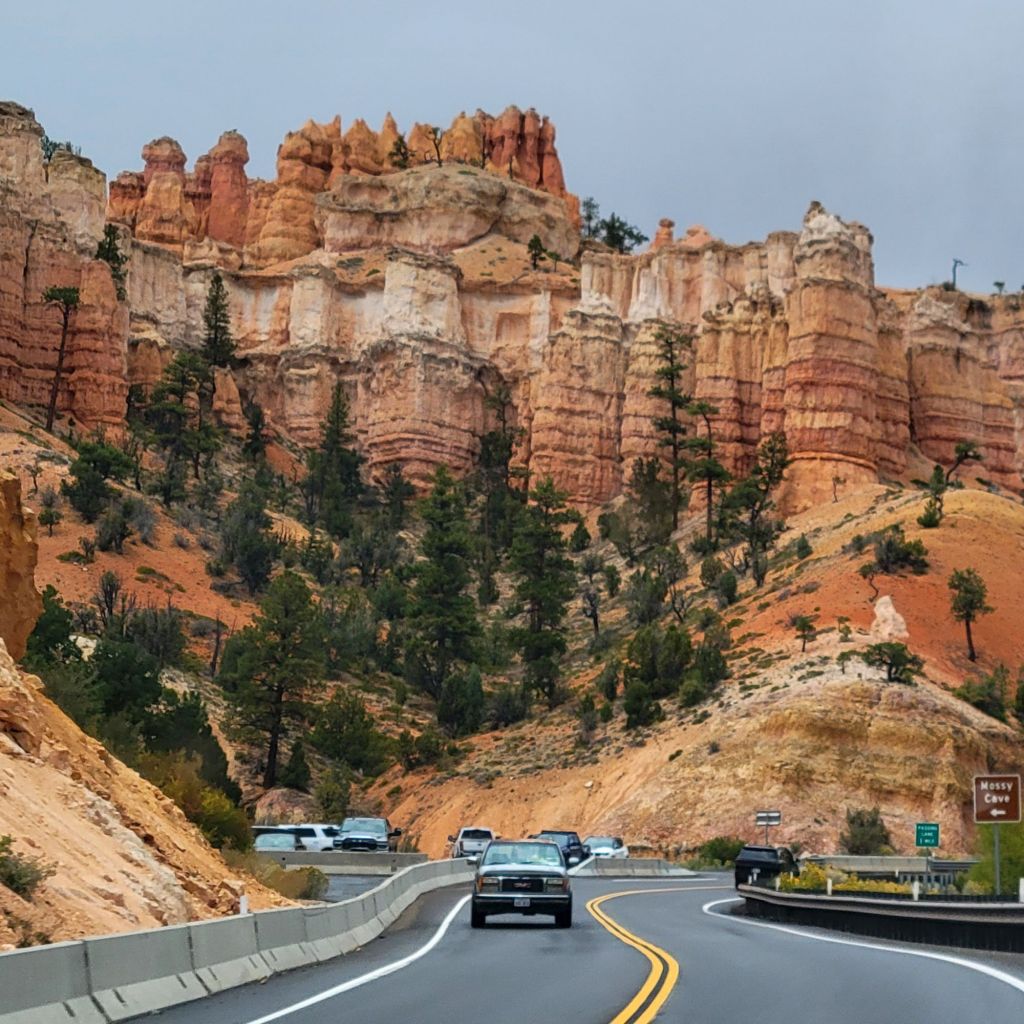
When we woke up, the chance of rain had dropped dramatically, so we got ourselves together and headed to the Mossy Cave Trail, which is a short trail just outside Bryce Canyon National Park. It leads to an unspectacular small cave and a quite lovely waterfall.
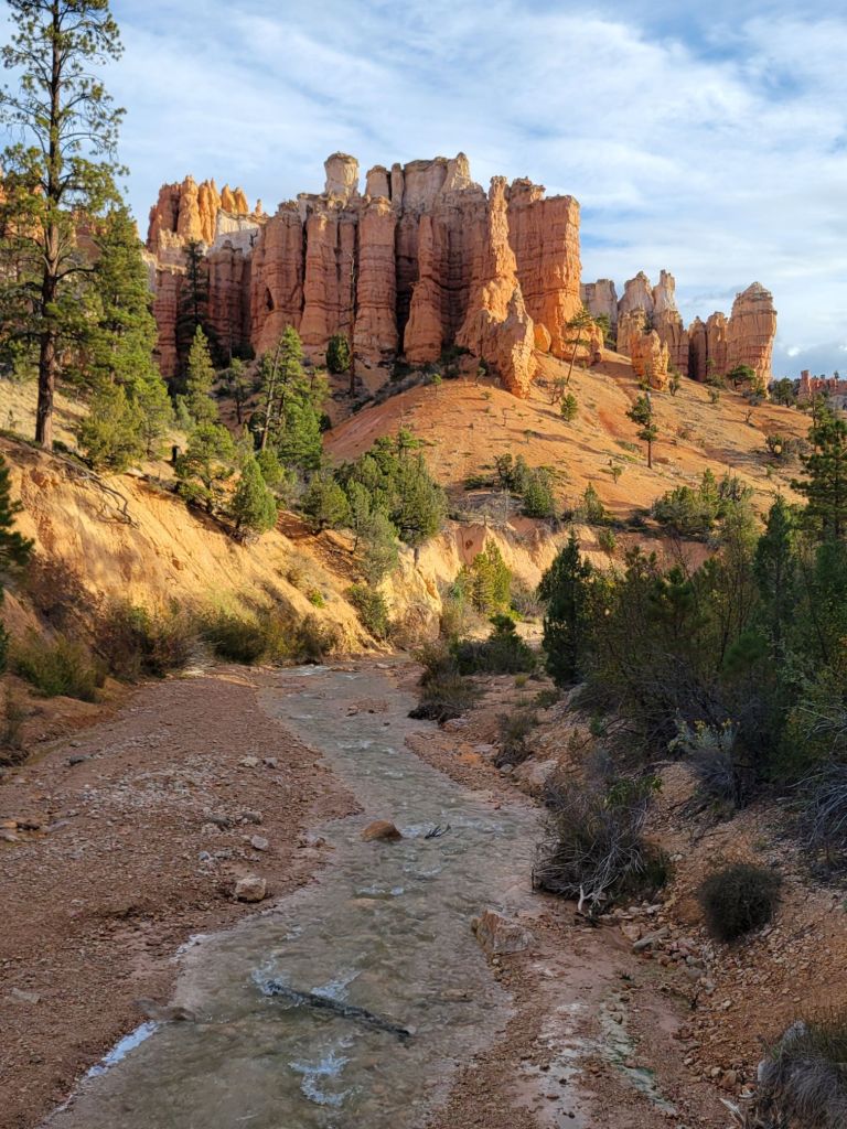
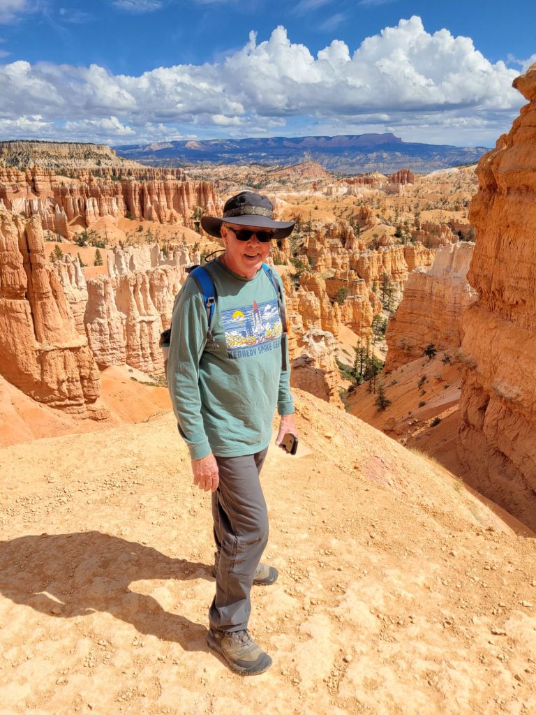
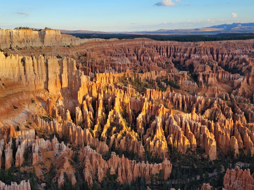
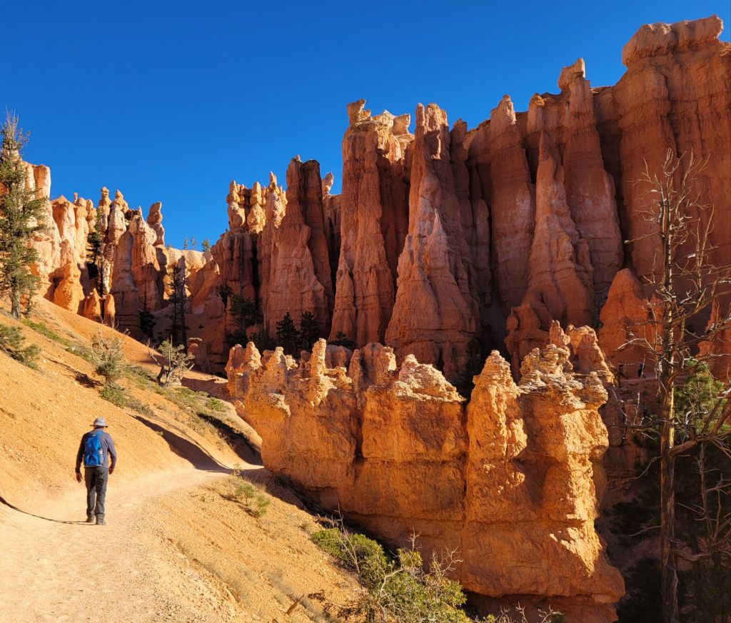
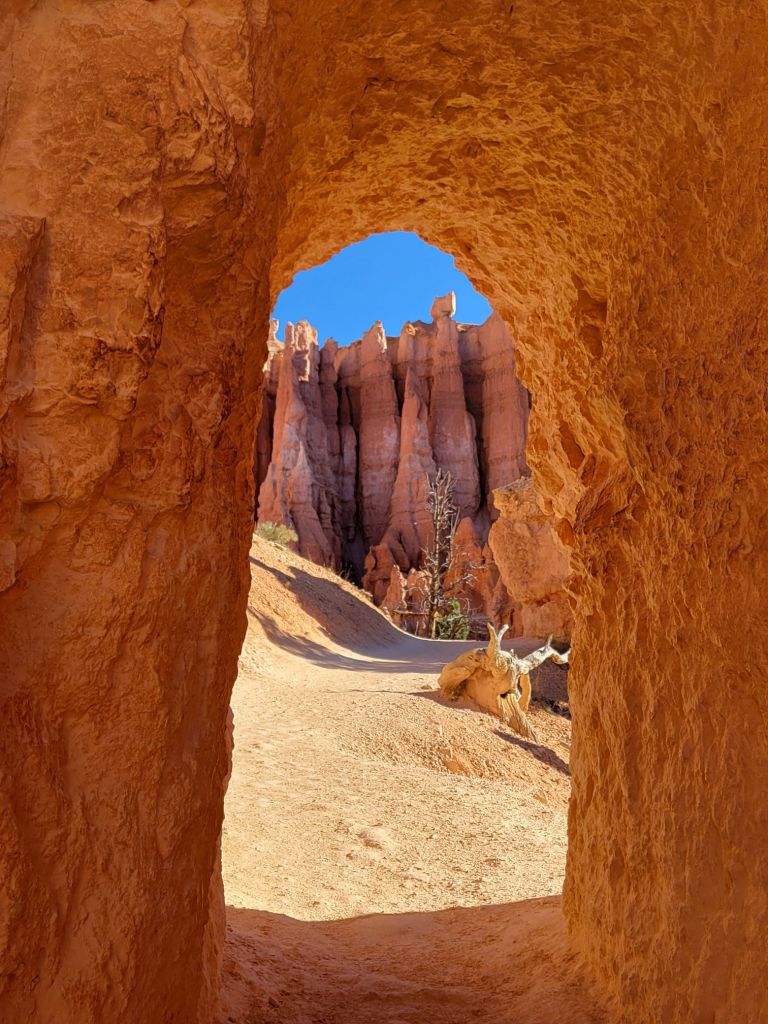
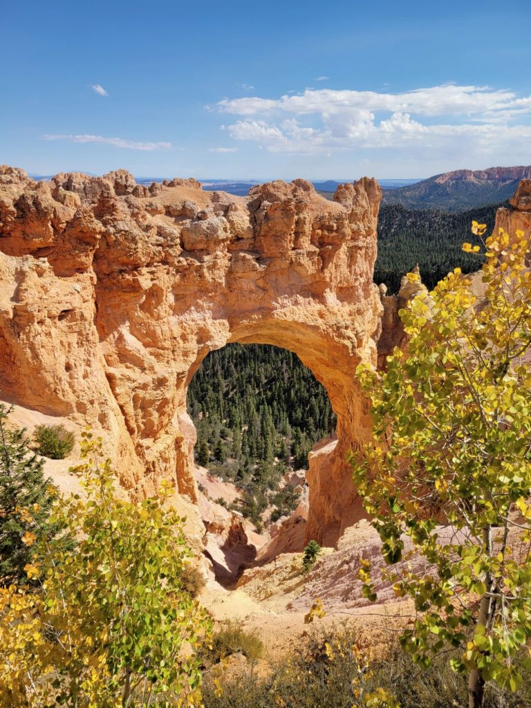
Navajo Loop Trail and Wall Street
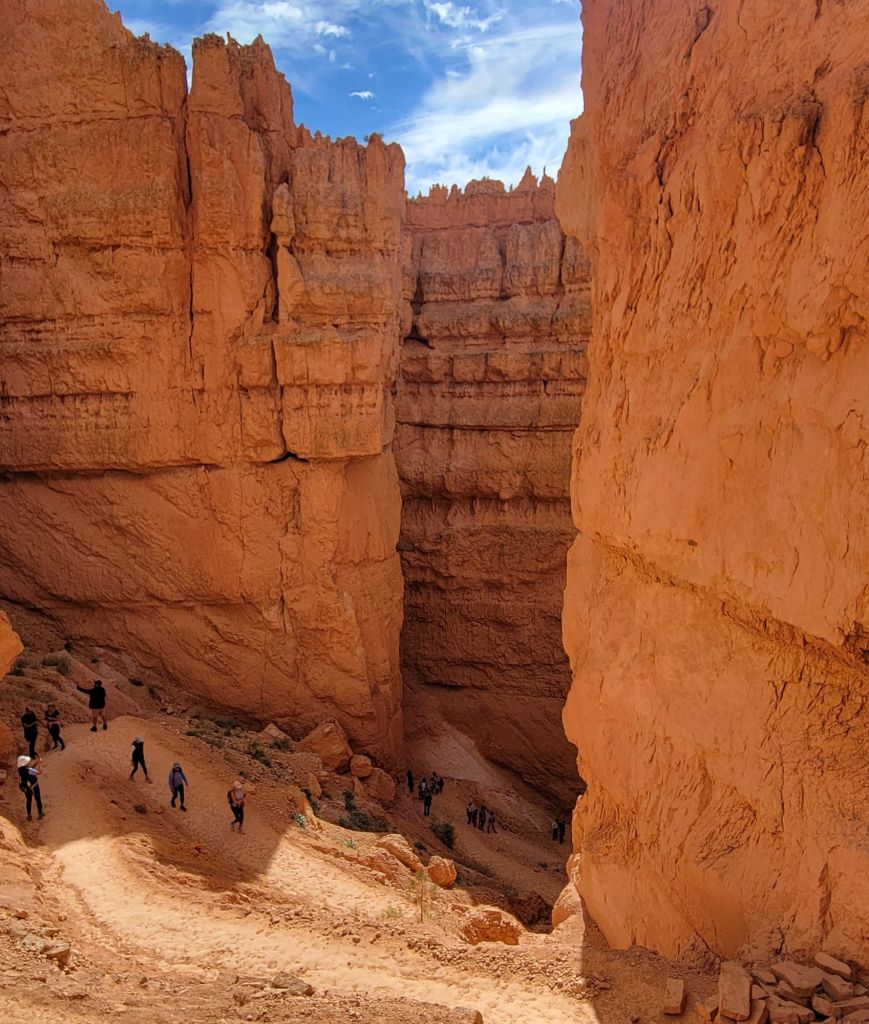
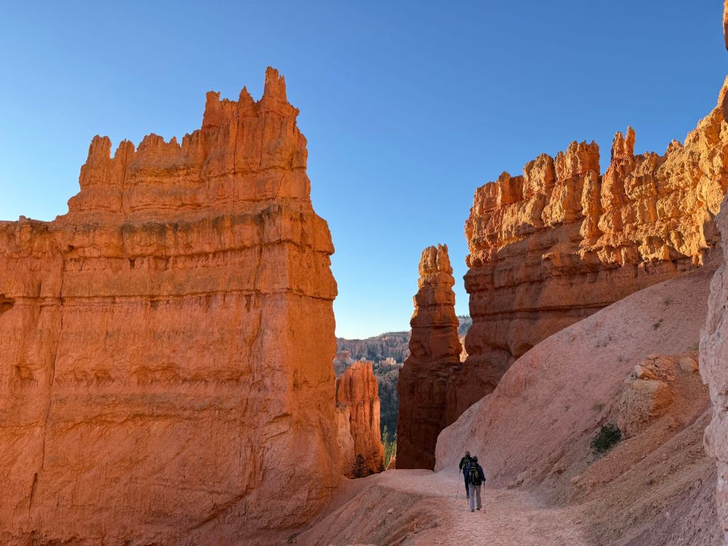
I finally got my wish to do Wall Street.
Greg had decided that he should not do any more hiking, but he agreed to drive me over to Sunset Point so that I could hike the Navajo Loop Trail and Wall Street.
On the way, he told me that if he could find a parking place, he would join me on the hike. Yay!
Miraculously, we found a parking spot, so off we went!
It was SO. MUCH. FUN.
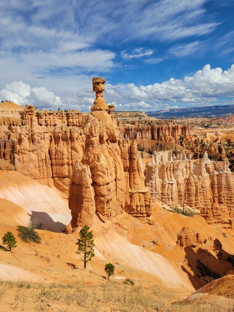
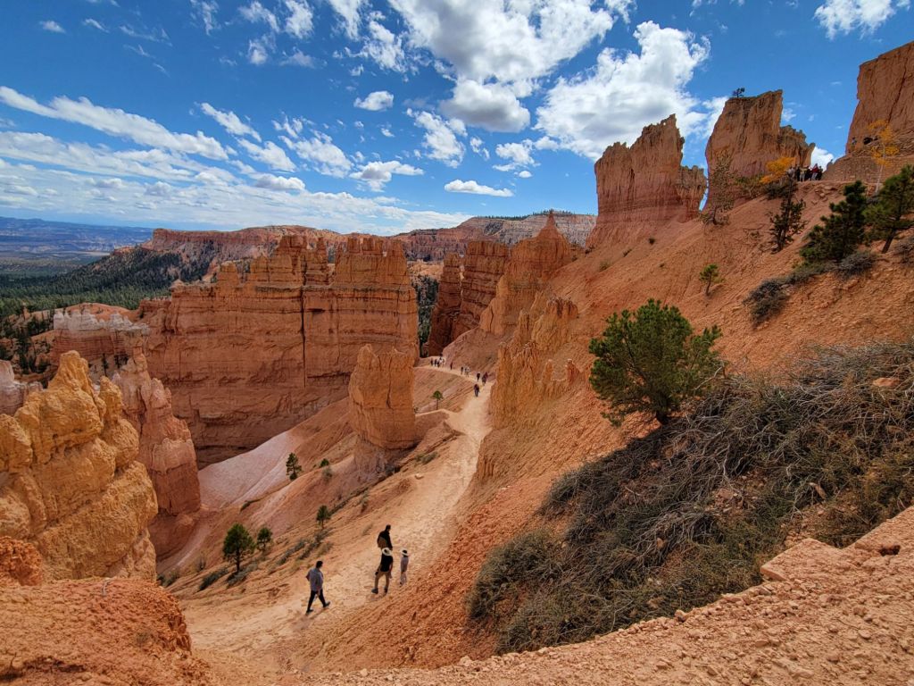
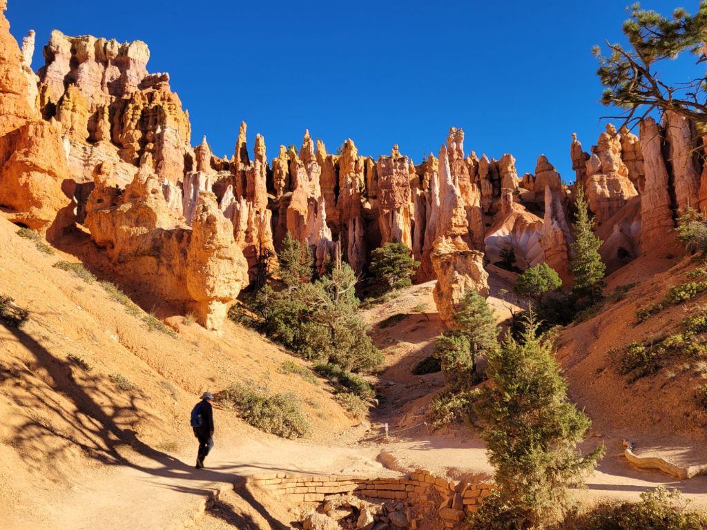
Starting off on the Navajo Trail Working our way down……and down……and downThose suckers are tall!Walking through the hoodoos Working our way back upTaking a break to admire the viewThor’s Hammer Almost there!
We made it!
After our hike, we headed over to Bryce Lodge to check it out. There was a pizza restaurant there called Valhalla Pizzaria, and we couldn’t resist treating ourselves to pizza for lunch.
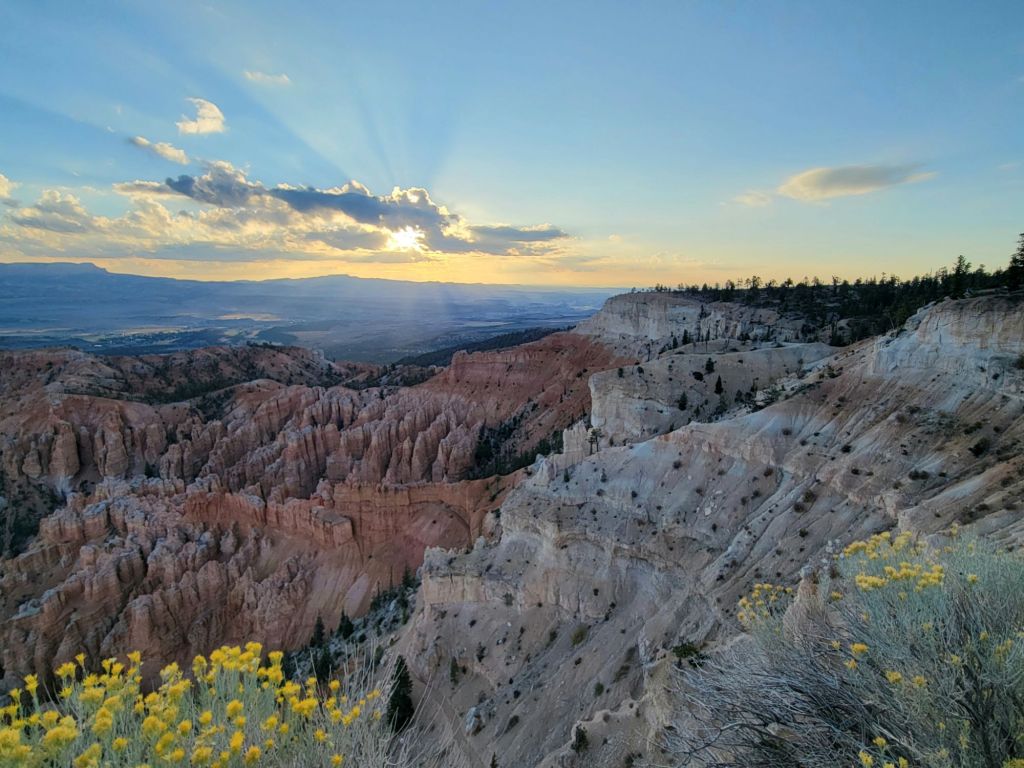
We made a spur of the moment decision this morning to stop by Bryce Point before heading to our next destination, Willis Creek Slot Canyon.
No wonder the parking lot was full yesterday. This overlook provides an amazing view of the Bryce Canyon Amphitheater!
We got there a little late. The sun was already up. And to make matters even more annoying, a group of folks who must have been on a photography tour had set up their tripods all around the overlook. Despite that, I got one or two photos that pleased me.
After Bryce Point, we stopped at Upper and Lower Inspiration points to take a few more photos.
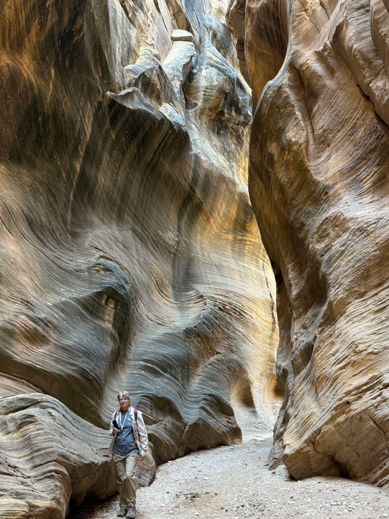
Willis Creek Slot Canyon
Okay. I recognize that no other slot canyon can compare to Antelope Canyon in Arizona, but since I haven’t been there yet, forgive me for saying that Willis Creek Slot Canyon is awesome.
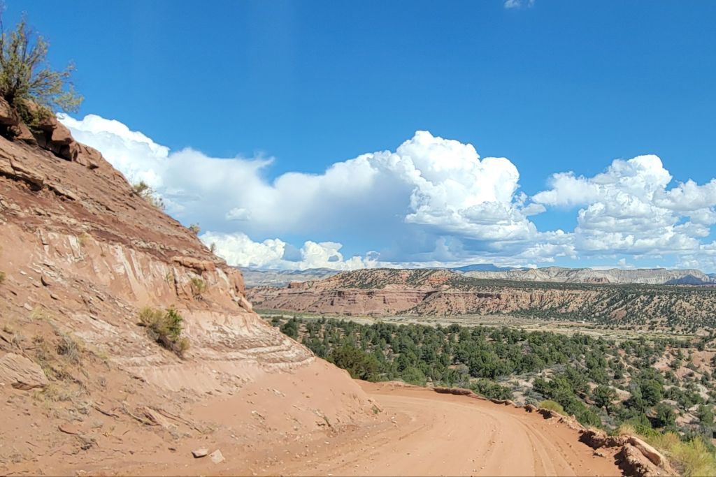
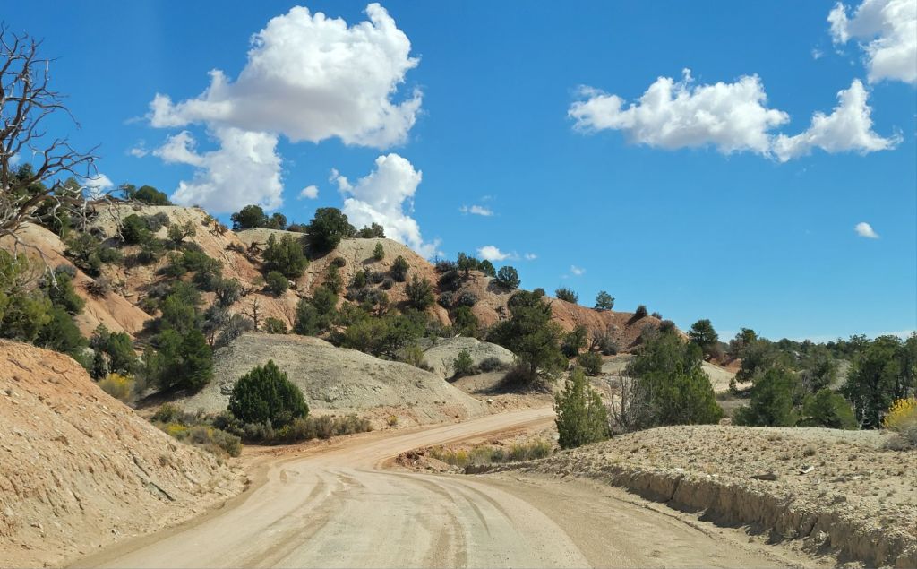
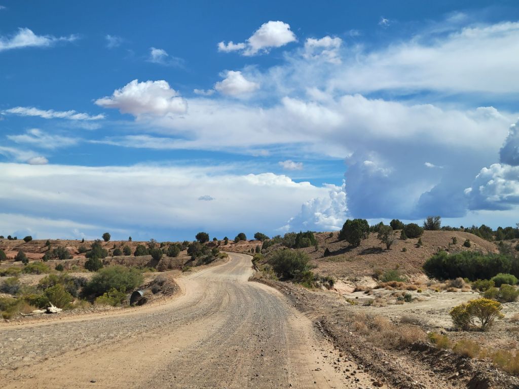
To get there, though, was no easy feat. It involved a seven-mile drive down a teeth-jarring BLM dirt road with a washboard surface, sharp turns, and steep inclines. Greg handled it like a champ. (There may have been moments when I shrieked.)
We also encountered a cow in the middle of the road at one point.
I had hoped that since we got there early, and since it was not an easy place to get to, we would be the only ones there. No such luck. Despite that, there were many times as we were walking that we were completely alone.
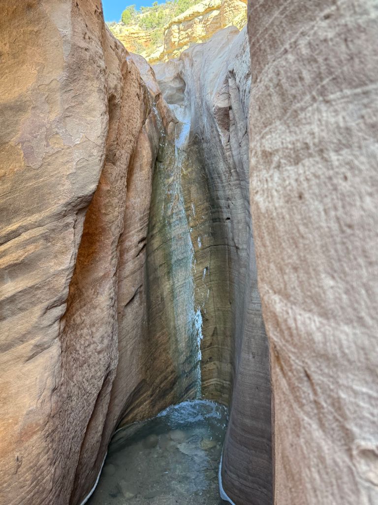
Another couple who were hiking the slot canyon showed us how to take vertical panorama shots, which give a much better sense of how tall things are. Some of these photos were taken using that method, and some were not, which explains why some of the walls look taller than others. Plus, there were about four slot canyons in all on the hike, each a little different than the one before.This was a tiny little waterfall in one of the crevices of the canyon wall.
At one point a hummingbird flew in front of Greg. It paused about a foot in front of his face and looked him over before flying away. I was standing right behind him and got a really good view of the hummingbird. It was so cute!
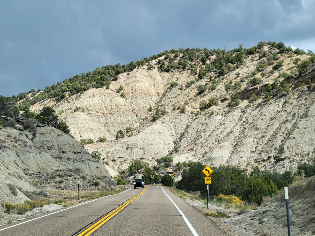
Scenic Byway 12
Next, we decided to drive down Scenic Byway 12 to Devil’s Garden. Along the way, we encountered beautiful views and hail.
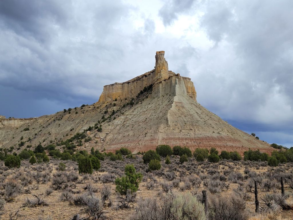
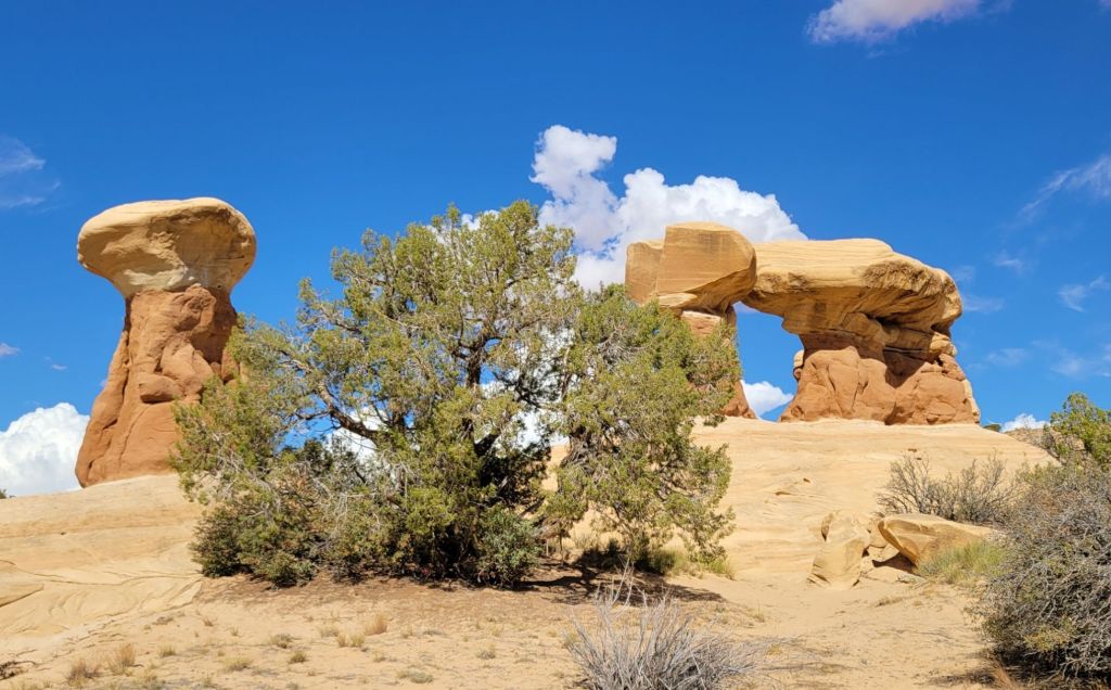
Devil’s Garden
Devil’s Garden is a small area of hoodoos out in the middle of nowhere.
To get to Devil’s Garden, we had to drive 12 miles down another BLM dirt road. When Greg realized that, he almost turned around to head back to Bryce Canyon, but it had taken us an hour and a half to get there, and I didn’t want to leave without seeing what we had come to see.
By the time we finished driving that 12 miles, Greg’s good mood was gone.
On top of that, thunderstorms were looming. After 10 minutes of wandering through the hoodoos, Greg decided it was time to head back. He didn’t want to be stuck on that dirt road during a downpour. I didn’t blame him.
I would have loved to have spent a little more time wandering through the hoodoos, though. It was fun!
And just to prove that there were indeed thunderstorms…
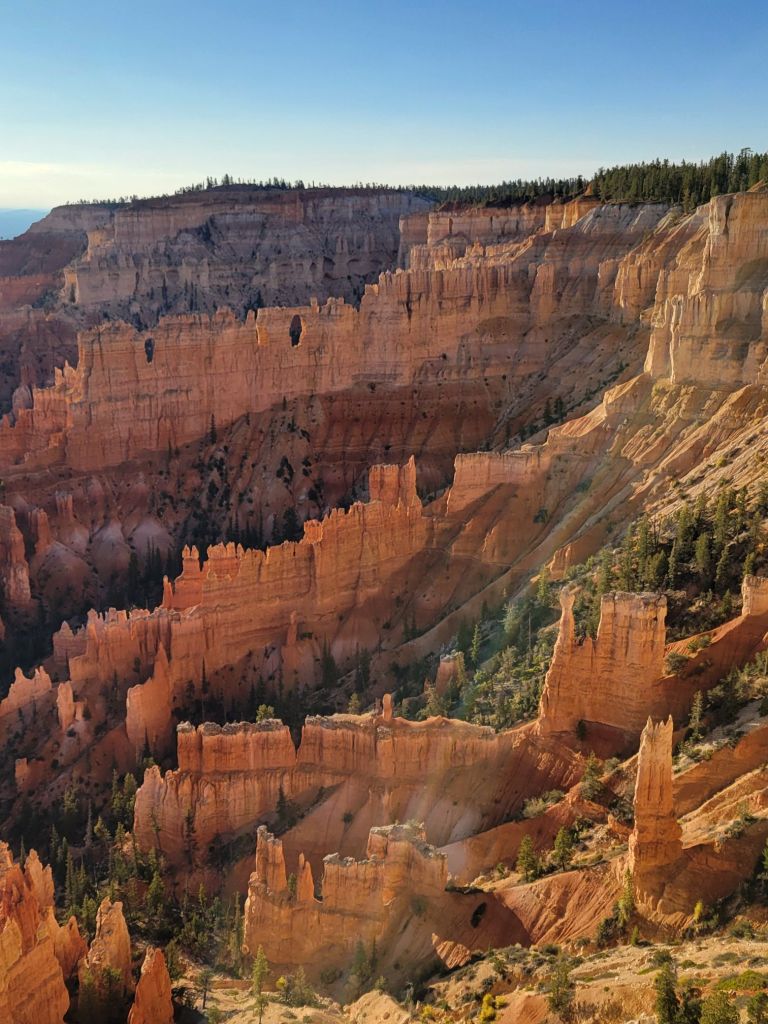
On the way back, we got to see a different angle of the hoodoos in Bryce Canyon National Park.
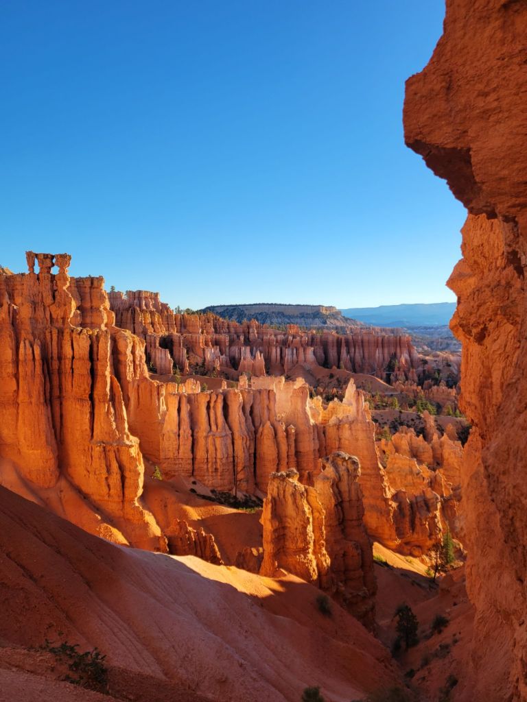
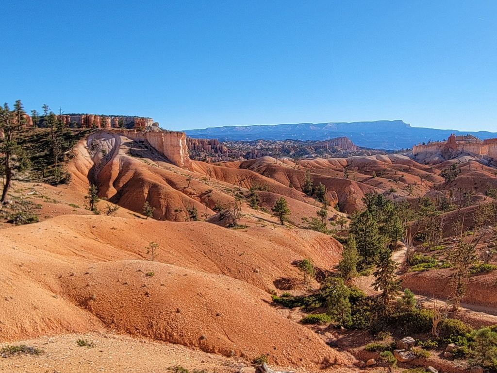
This morning we hauled ourselves out of bed at dawn (I’m not a fan of these early mornings) so that we could get to Sunset Point before the parking lot filled up.
From there, we hiked the Navajo Loop trail down into the Bryce Canyon Amphitheater.
Then we hooked up with the Queen’s Garden Trail.
And ended up at Sunrise Point.
Sometime before we leave, I would like to do the Navajo Loop Trail to the Wall Street Trail. I really want to wander through the maze of hoodoos.
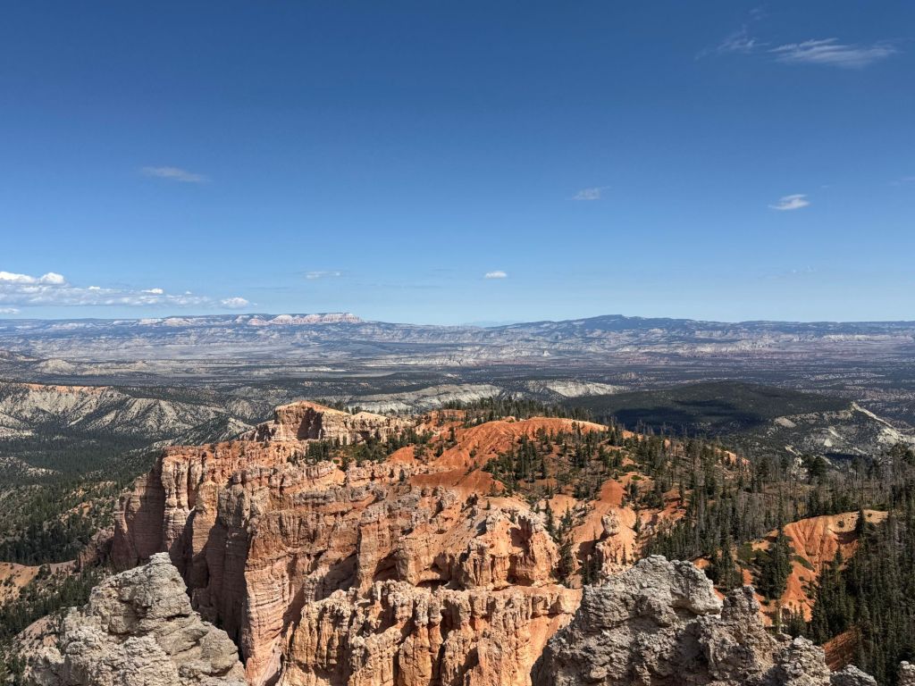
Rainbow Point
After lunch, Greg decided it was time to terrify me again.
We drove the 18 miles to Rainbow Point, the highest point in Bryce Canyon National Park, at over 9000 feet above sea level. I had to keep my eyes closed for the last eight miles.
To our annoyance, the parking lot was packed. Greg ended up parking illegally in a “government vehicles only” slot. (He claims he didn’t see the sign. Ha!)
This was one of the rare times I didn’t mind breaking the rules. After that hair-raising trip up to Rainbow Point, I was damned if we were going to leave before seeing it!
It was interesting, but nothing I would have been devastated to miss.
After snapping a few photos as quickly as we could, we headed back down the mountain, stopping at various overlooks along the way.
My favorite by far was Natural Bridge.
We wanted to stop at Bryce Point as well, but there was a ranger blocking the road and a sign that said “lot full.” Argh!
Ugh. Crowds.
We have discovered that if we want to find parking at any of the lots in the national parks, we need to arrive by 9:00 a.m.
That’s no problem for our first stop of the day, because we’re usually arriving between 7:00 and 8:00 a.m. But anything we want to do after that becomes a challenge.
It’s really annoying.
On the other hand, the weather has been absolutely beautiful, and if we were doing this in the summer, we would be fighting both heat and crowds.
Foreign tourists
For those of you who might be wondering what it is like to tour the national parks while Trump is gleefully antagonizing non-Americans, let me say that it seems to have had little effect on tourism.
I would guess that between 15 to 20% of the tourists in the parks right now are foreigners. People are speaking French, German, Asian languages, and lots of languages that I can’t identify.
Today we met someone from Belgium, and we camped next to an Israeli family when we were in Zion. (They were absolutely delightful!) After they left, several young Germans took their place. On our other side were some middle easterners.
I have loved hearing all the different languages and chatting with people from all over the world.
Oh, and I haven’t noticed a decrease in service within the parks. I can’t say that the rangers in the visitor centers have been all that helpful, but there doesn’t seem to be a shortage of workers.
My hips are starting to get stiff from all the exercise we’ve been doing. This morning I lost my balance trying to get my leg over the crossbar of my bike and toppled right over. Thankfully, nothing was injured but my dignity!
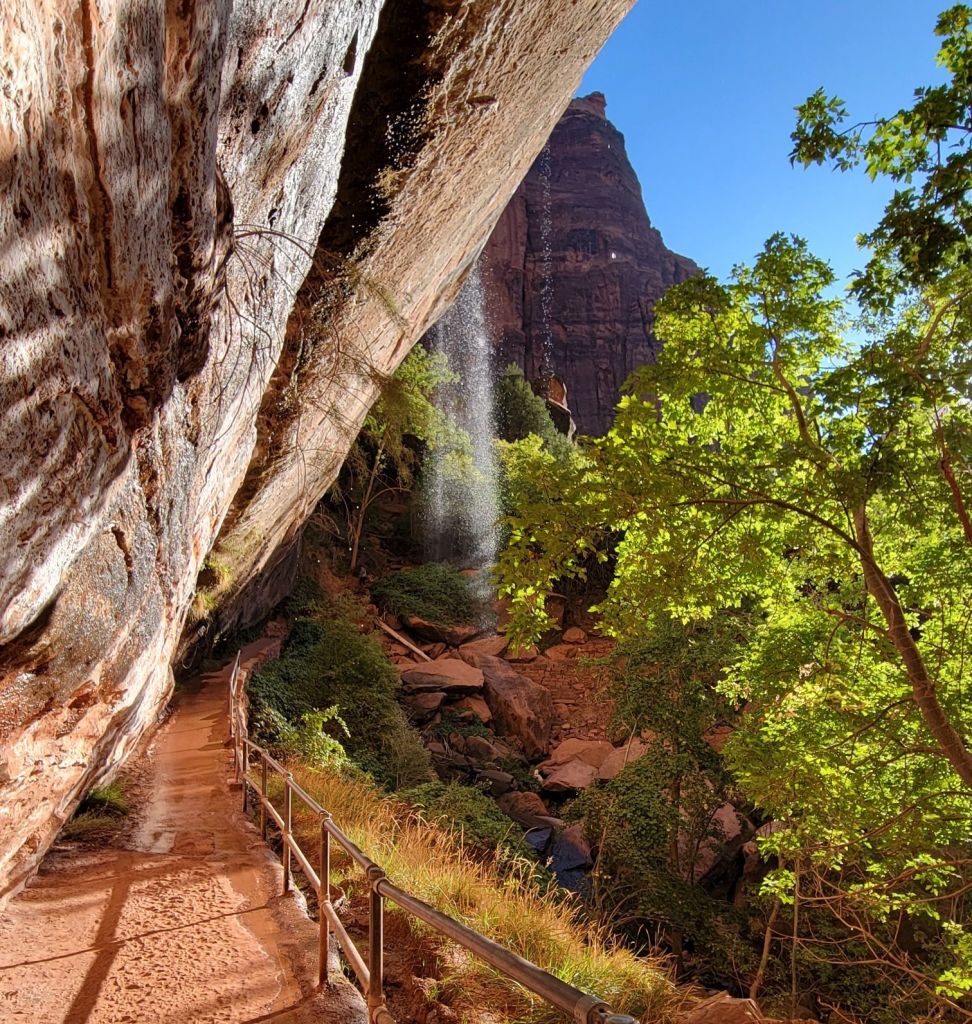
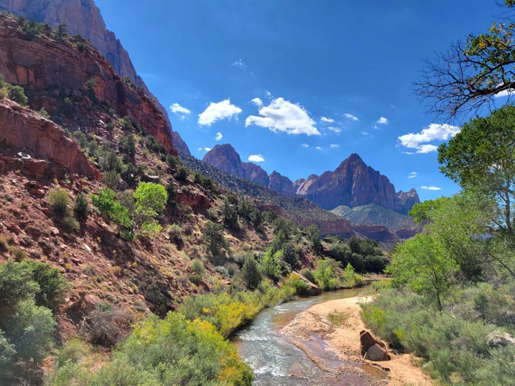
Today we rode our bikes up to the Zion Lodge to hike the Emerald Pools Trail.
This photo was taken on the Pa’rus Trail.
The views along the walk to the Lower Emerald Pool were beautiful.
Below is a photo taken at the Lower Emerald Pool. The waterfall was difficult to see unless you took the photo directly into the sun. I lucked out with this one.
The trail went on from the Lower Emerald Pool to the Middle and Upper Emerald pools. However, Greg decided at this point that it would not be a good idea for him to continue.
Between the six miles of walking the day before, the 16 miles of biking, and a poor night’s sleep, he decided to err on the side of caution. I decided that I should do the same. (We need to have enough strength and energy left to do Bryce Canyon!)
Before heading back to the campground, we stopped by the Zion Lodge for a snack and a moment of rest in the beautiful lobby.
Once back at the campground, Greg took a nap while I scrolled Blue Sky. Then Greg fixed a leak in our sink (we hope).
Then it was time for our next adventure.
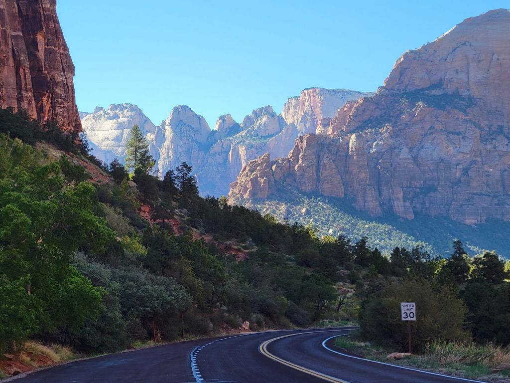
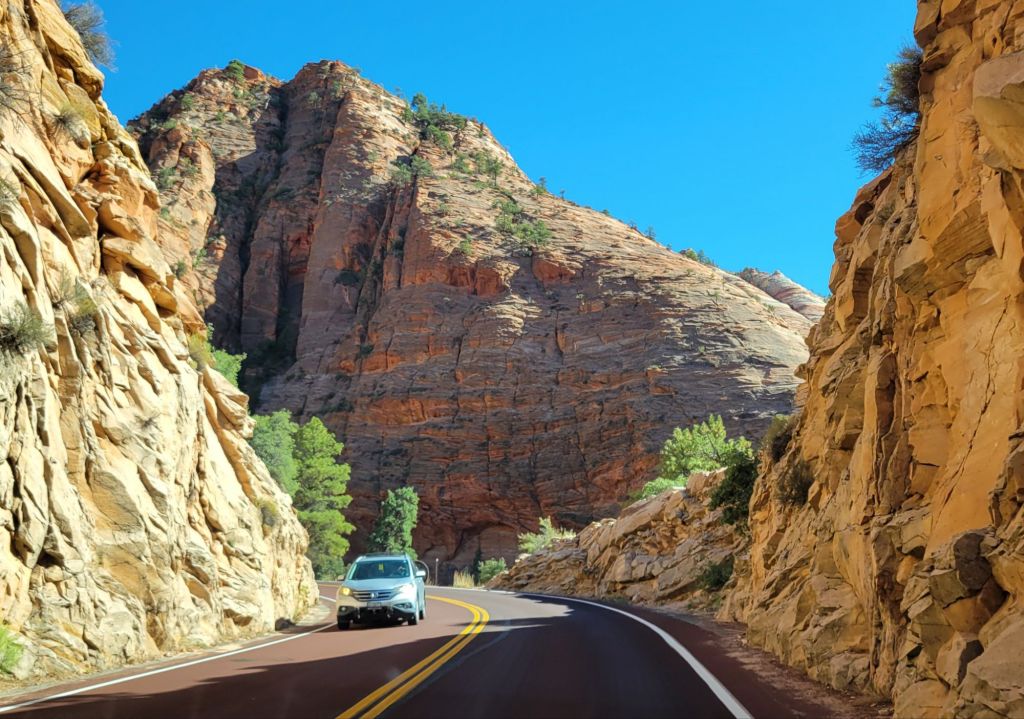
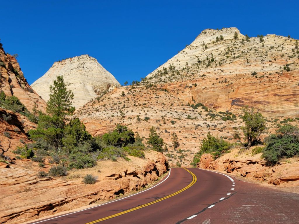
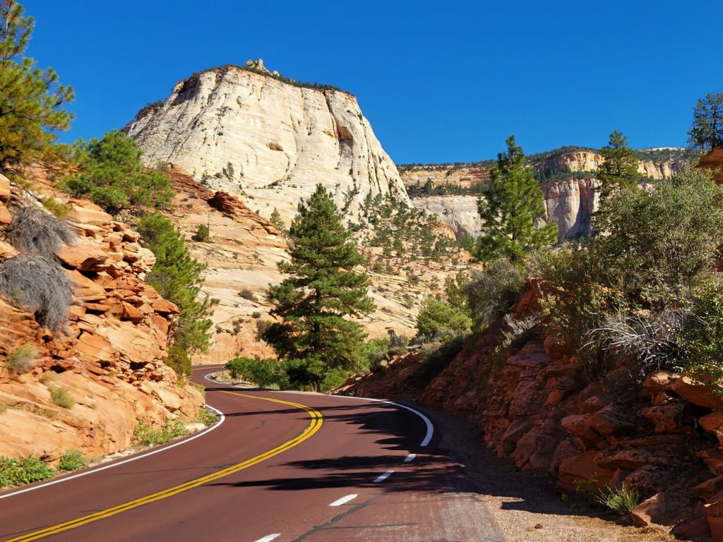
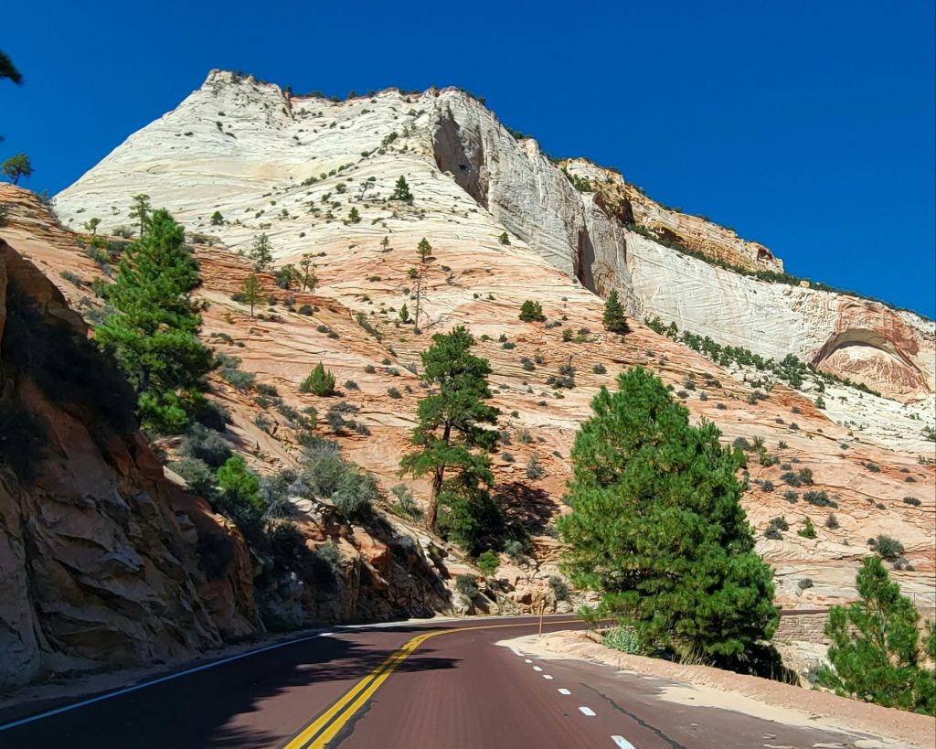
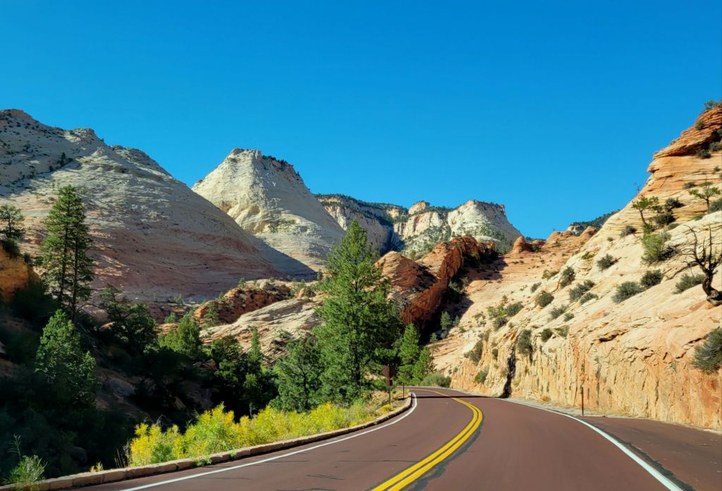
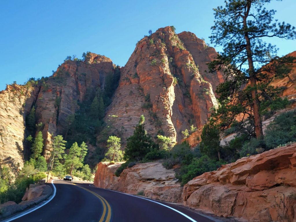
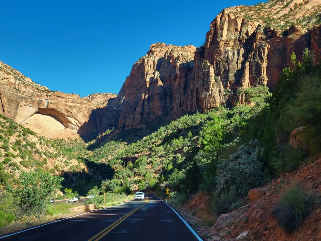
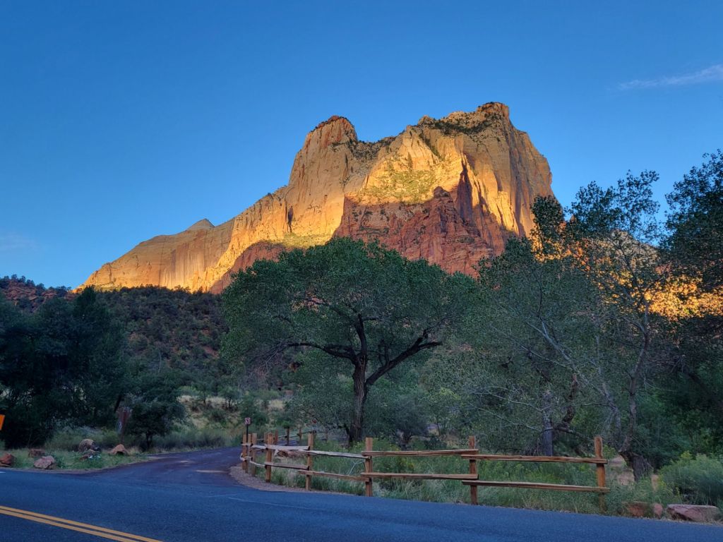
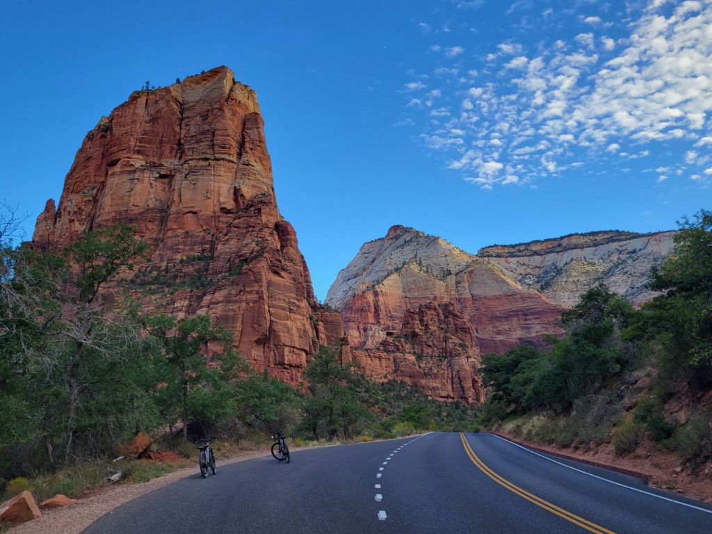
The Zion-Mt. Carmel Highway
No camping trip would be complete without Greg trying to terrify a few years off my life.
This time, that attempt involved a drive along the Zion-Mount Carmel Highway.
The Zion-Mount Carmel Highway is another one of those mountain roads with steep drop-offs and serpentine turns. And no shoulders! It also includes a mile-long narrow tunnel.
Luckily for me, I was so busy taking pictures through the windshield that I didn’t have a lot of time to fear tumbling over the edge of a cliff.
Some of my favorites:
The colors and shapes, oh, my! I was in heaven.
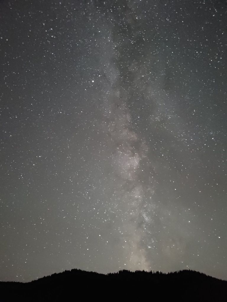
The Night Sky
Once it got dark, we drove the car over to the visitor center and walked to a new campground that is still under construction so that Greg could see if he could get any good pictures of the Milky Way with his new camera.
While he worked on that, I lay on my back in the dirt and admired the starry sky. Sometimes it’s nice to remember how small and insignificant we are to the universe.
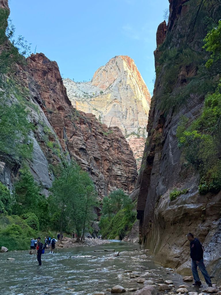
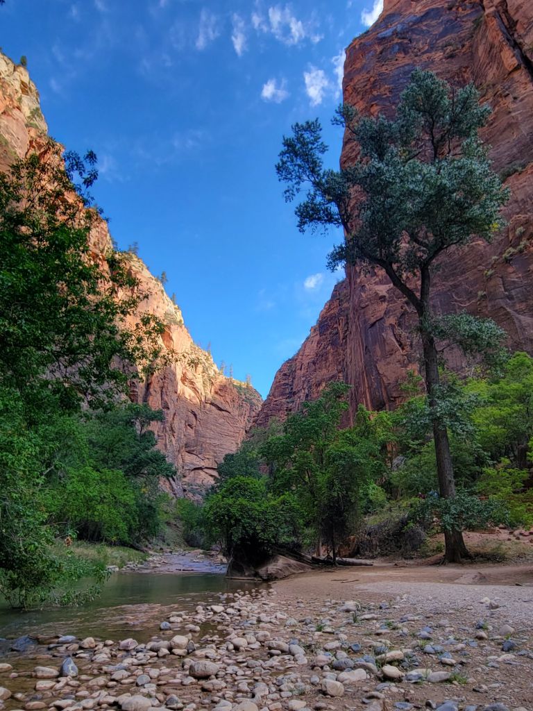
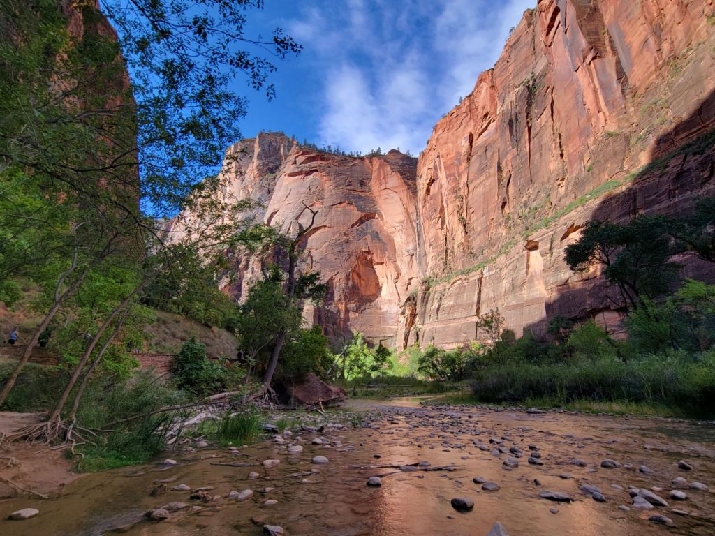
We were up early again this morning. This time, we rode our bikes all the way to the last shuttle bus stop at Zion National Park, the Temple of Sinawava.
There are two trails that are very popular at Zion National Park. The first is called Angels Landing, and it involves a challenging and death-defying climb.
The top left-most corner of this mountain is Angels Landing.
The second popular hike is called The Narrows, which involves hiking through the Virgin River.
Folks heading down The Narrows.
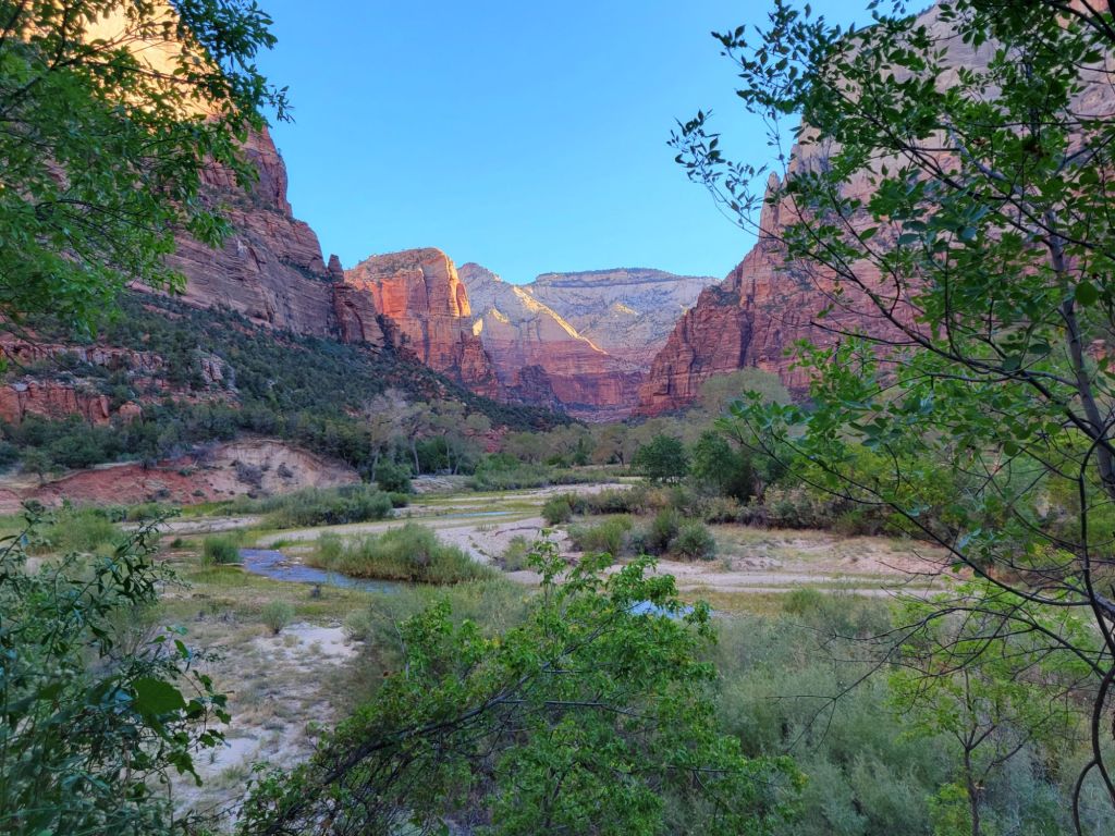
Greg and I chose not to do either one of them. However, to get to The Narrows, you have to hike the Riverside Walk Trail. That was our goal for today.
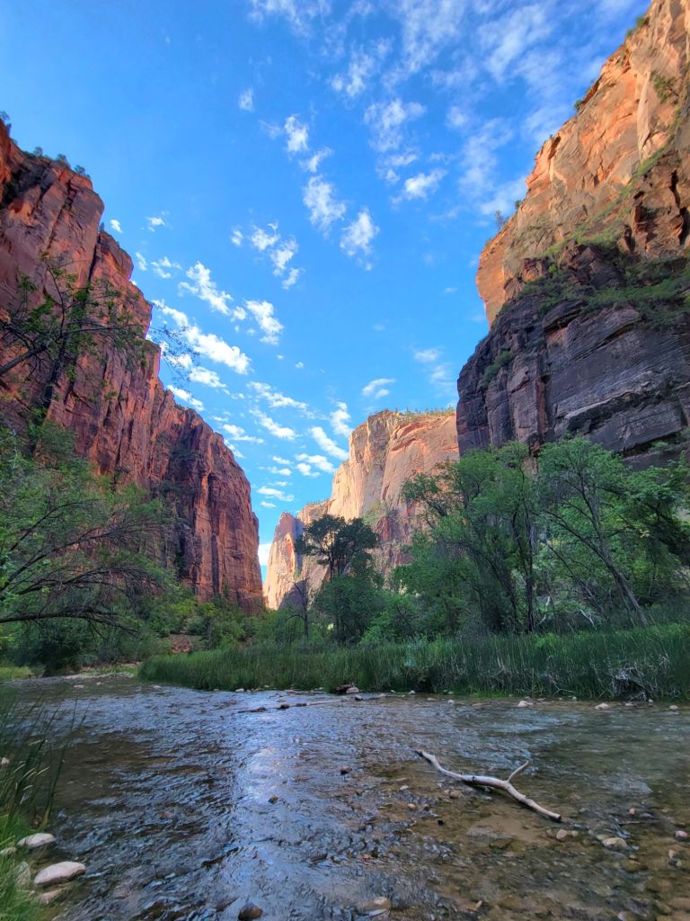
It was a beautiful walk along the Virgin River.
Once we were finished doing the Riverside Walk, we headed back to the campground, stopping along the way to take photos. Here are some of my favorites from today.
Despite only doing one hike, I still managed to get 16,000 steps in today.
Once back at the campground, we did laundry and relaxed for the rest of the day.
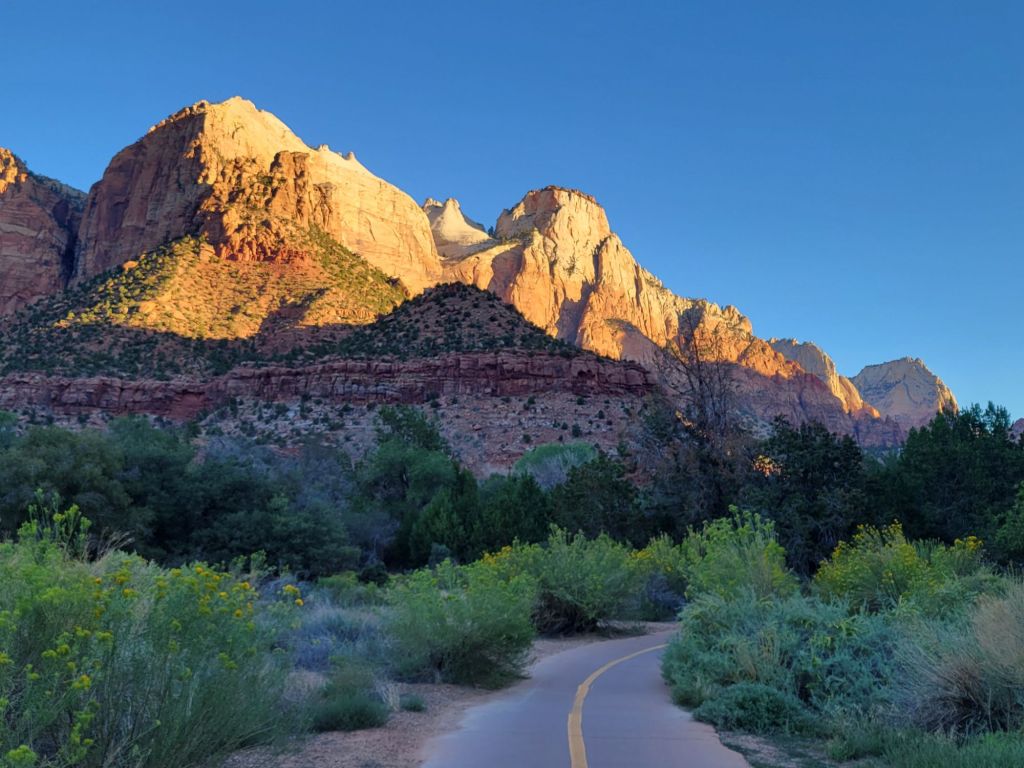
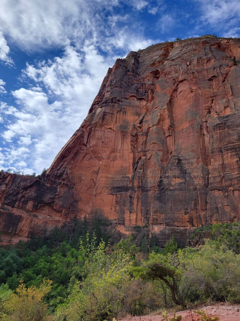
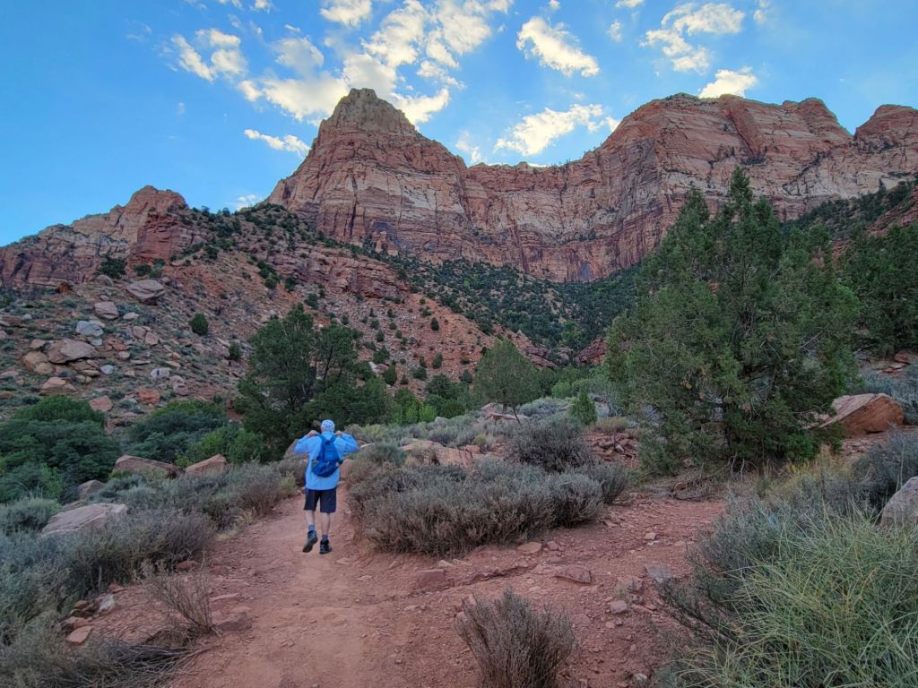
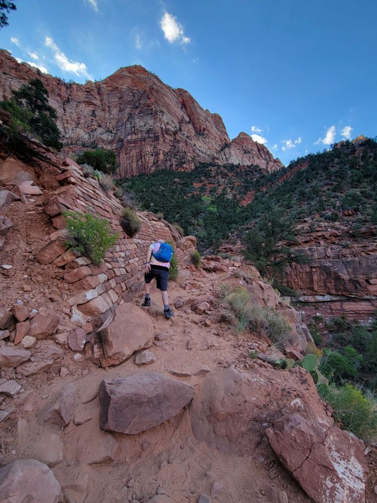
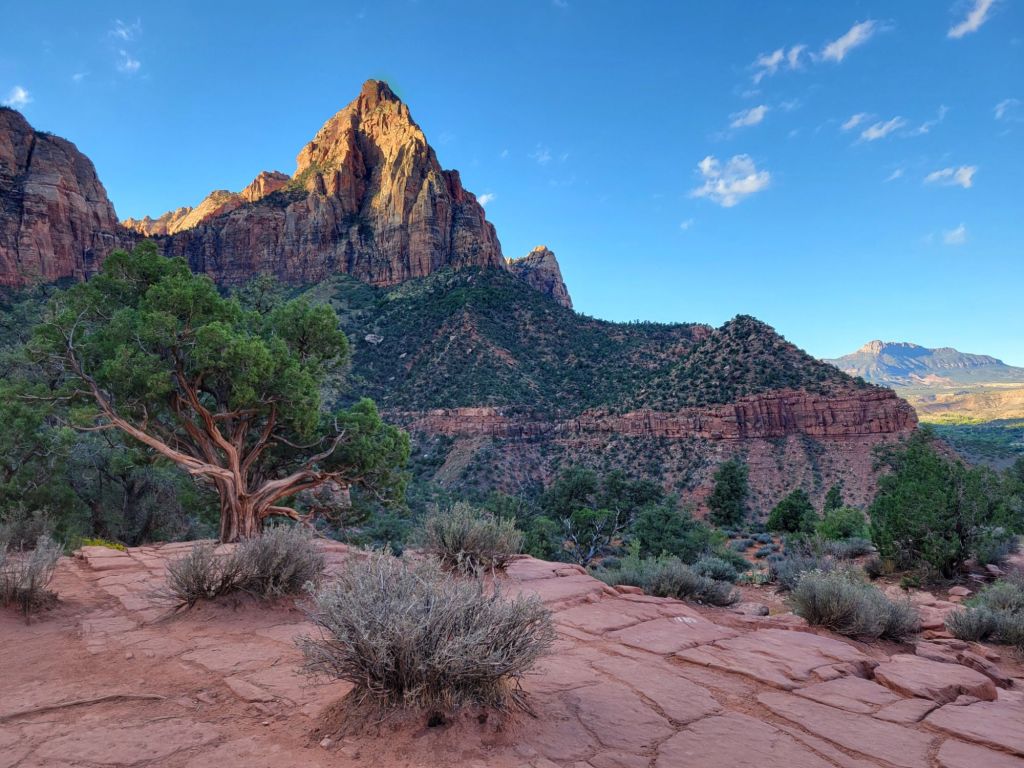
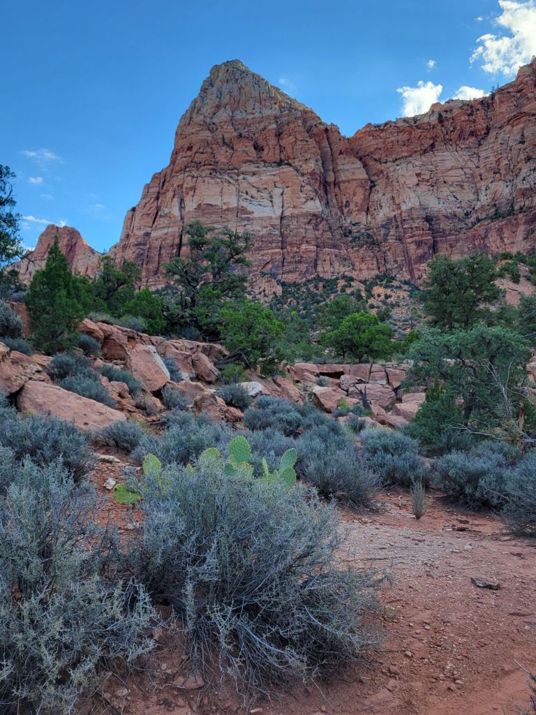
We started our adventure in Zion National Park by riding our bikes to the visitor center early in the morning and then hiking the Watchman Trail.
The Watchman Trail is a 3-mile round trip hike to an overlook of Zion Canyon and Watchman Mountain.
Greg did amazingly well with the rocks and sand.The Watchman I love the various shades of blue and green in this photo (This is not a photo of the Watchman).
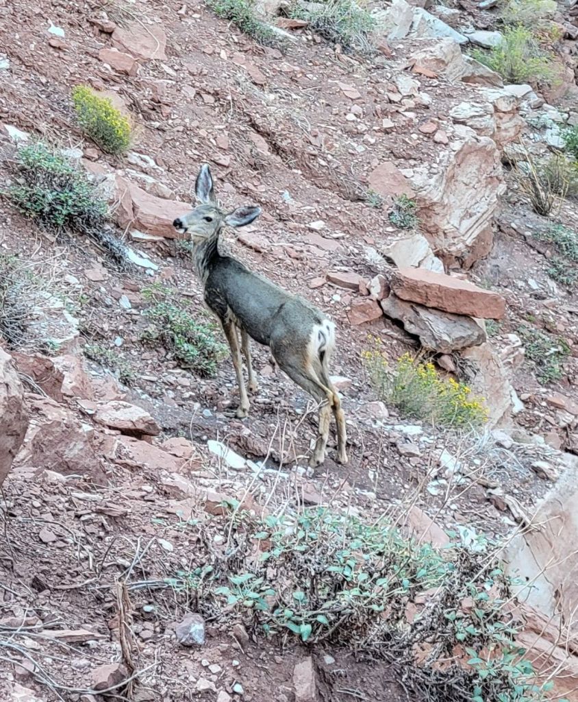
On the way down, we saw two deer.
This is a photo of one of them.
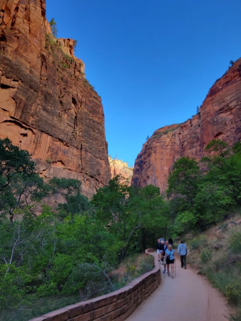
After stopping in at the visitor center, we hopped on the bikes and rode the Pa’rus Trail to the main road through Zion National Park.
At this time of the year, the only ways to access this road are via park shuttle or bike.
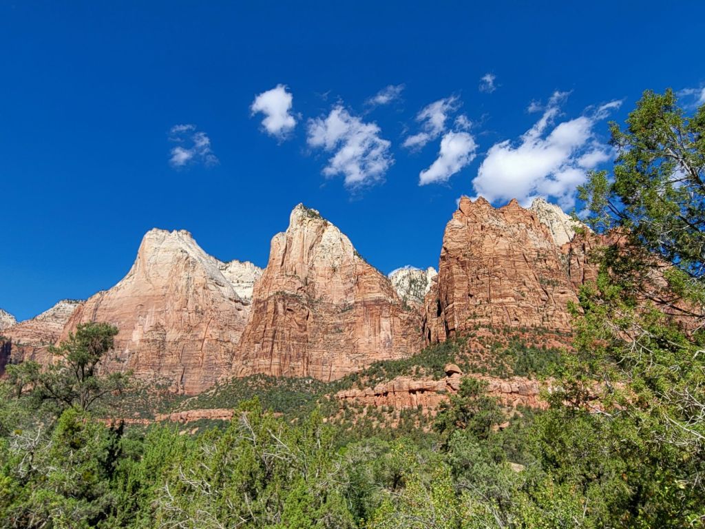
Court of the Patriarchs
We rode as far as Court of the Patriarchs before turning around.
Court of the PatriarchsA view of the Virgin River, taken on the way back to the visitor center
Kolob Canyons
After cooling off at the camper, we headed to Kolob Canyons, which is in the northwest part of Zion National Park. It takes about 45 minutes to drive there.
The views were stunning. Better yet, we didn’t have to do any hiking!
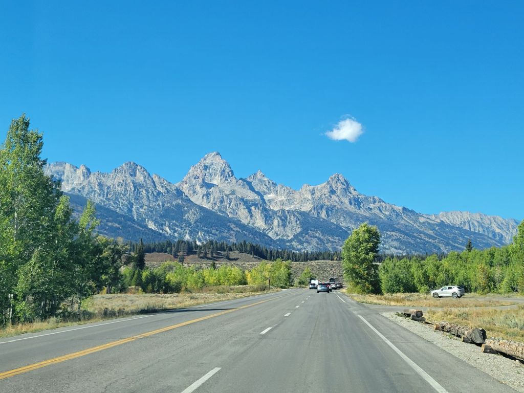
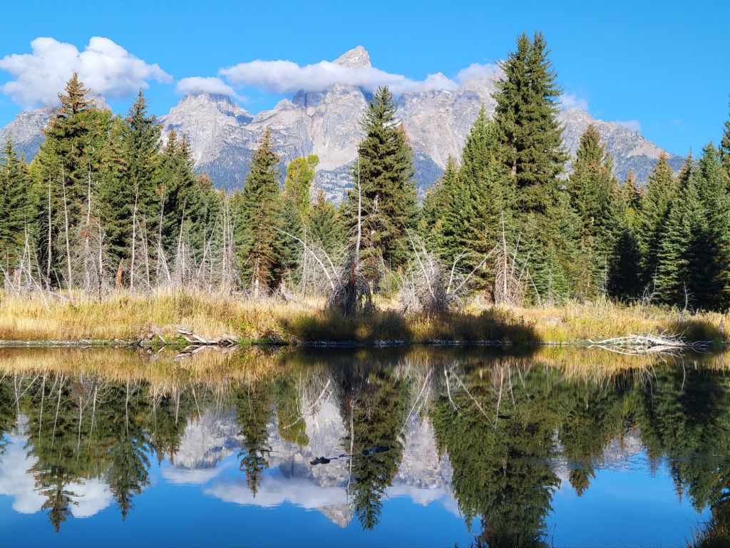
On Thursday, our plan had been to get up and out the door by 6 a.m. so that we could take photos of the Teton mountain range at sunrise from Oxbow Bend Overlook, which was about an hour away.
But when Greg’s alarm went off at 5:30, he admitted that he would rather go back to bed instead. The hike around Jenny Lake had wiped us both out. Consequently, we decided to relax for the morning. There was nothing in the park that we felt a strong need to see by this point.
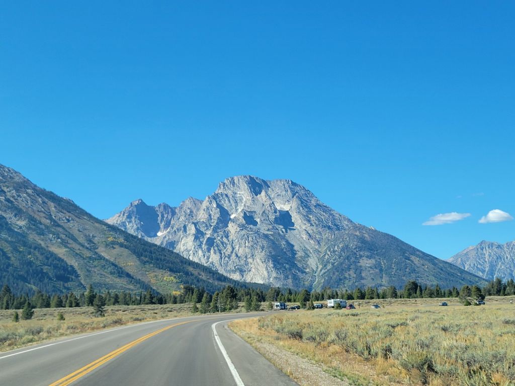
In the afternoon, we headed to Signal Mountain Lodge because we had tickets for a rafting trip down the Snake River.
On the way, we stopped to take a few more photos of the Teton mountains.
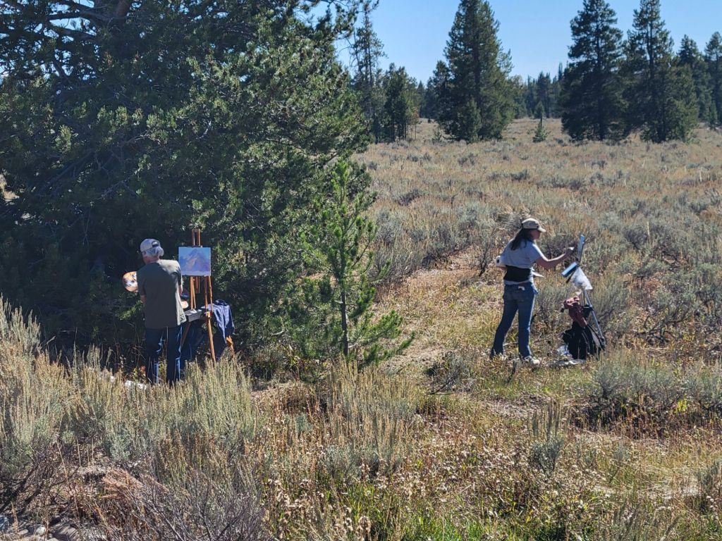
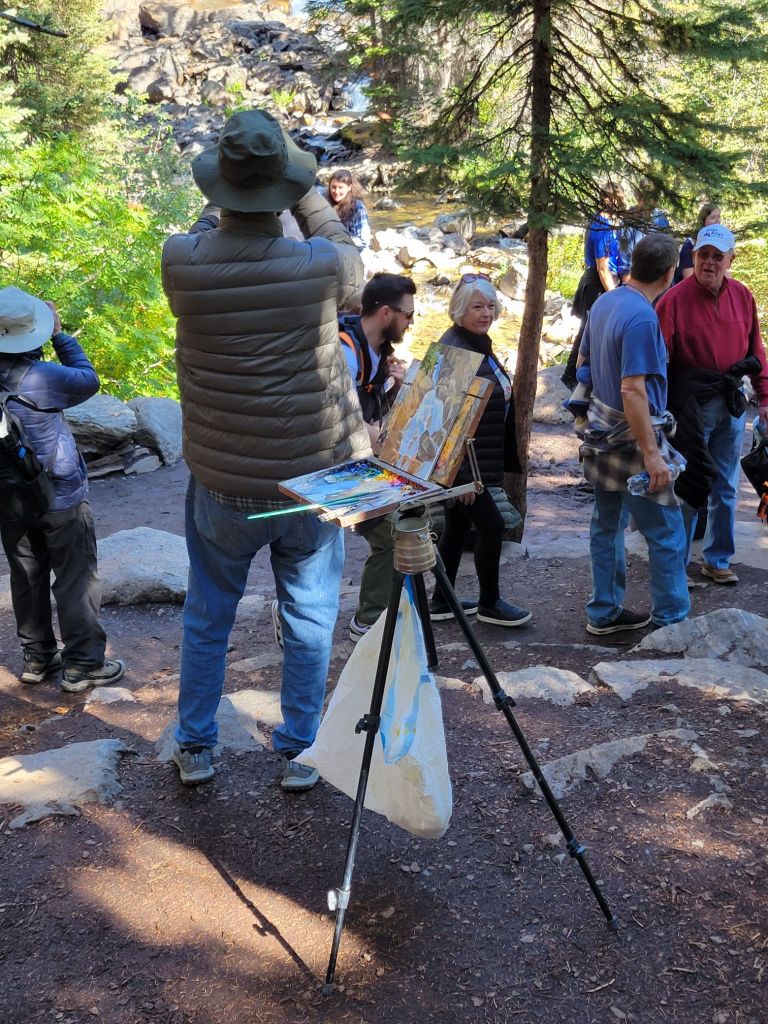
More plein air painters! These weren’t even the last ones we saw. So jealous!
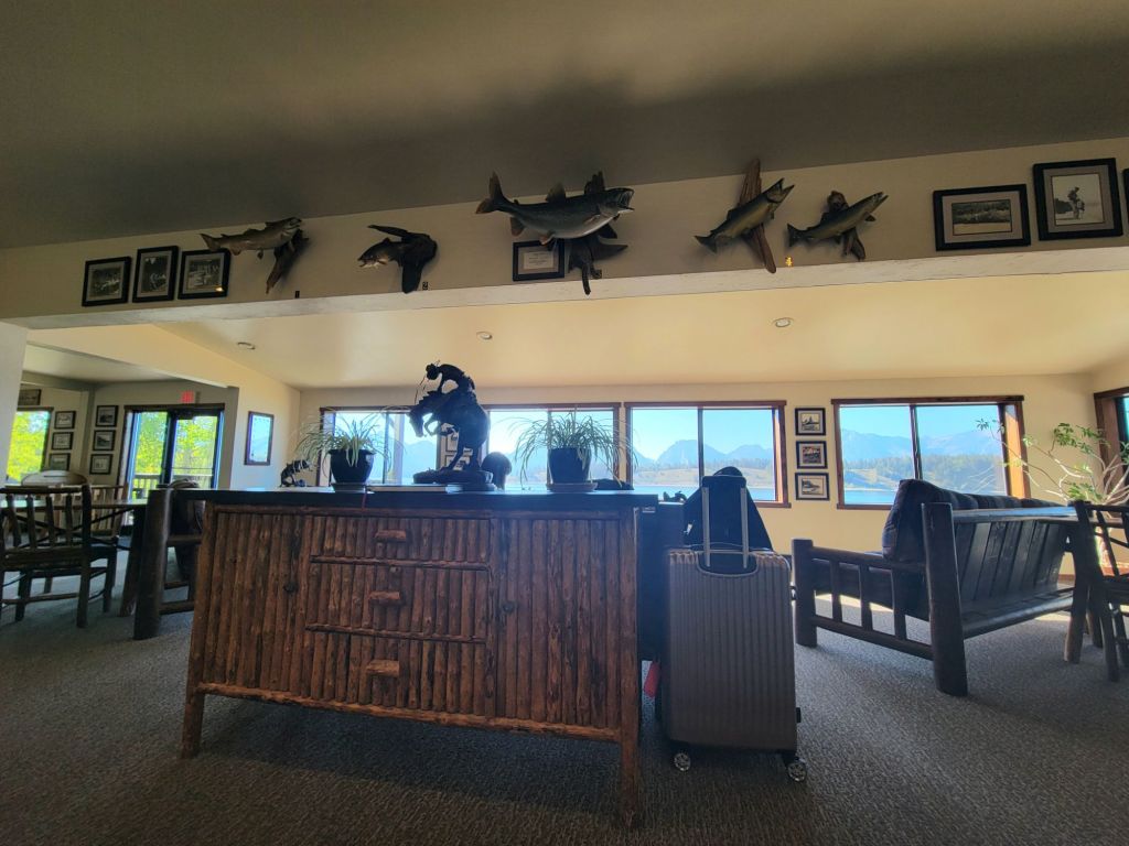
Signal Mountain Lodge is beautiful. The lobby area has a huge picture window overlooking the Teton mountain range and Jackson Lake.
The rafting trip didn’t start until 4:30, so I knew that we would not be getting great photos of the Teton mountains. It is simply impossible to get good photos of them in the afternoon because of the direction of the sun.
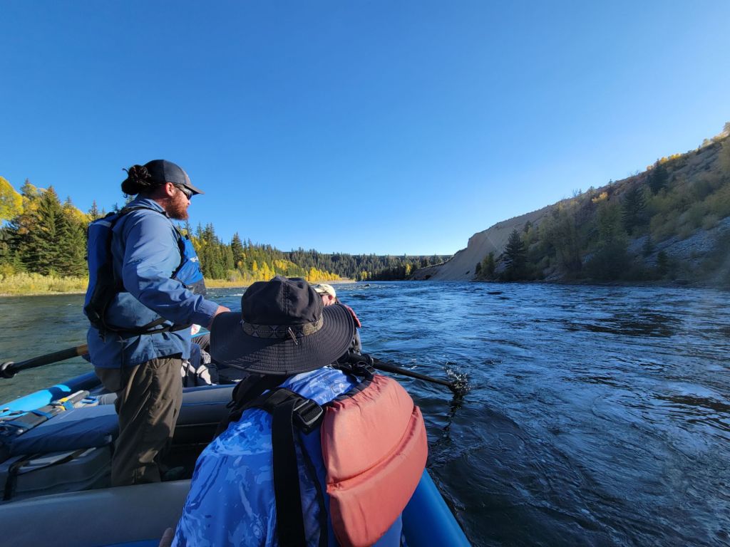
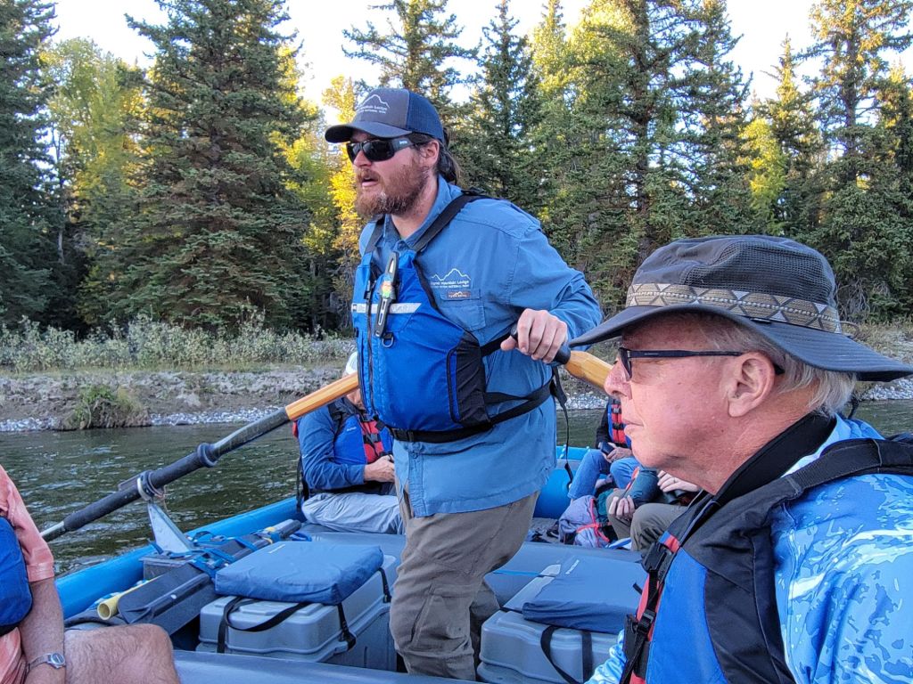
But I love any opportunity to get on the water, so off we went.
It did not disappoint.
Our guide, Joe, reminded me a lot of Scott. He was incredibly knowledgeable.
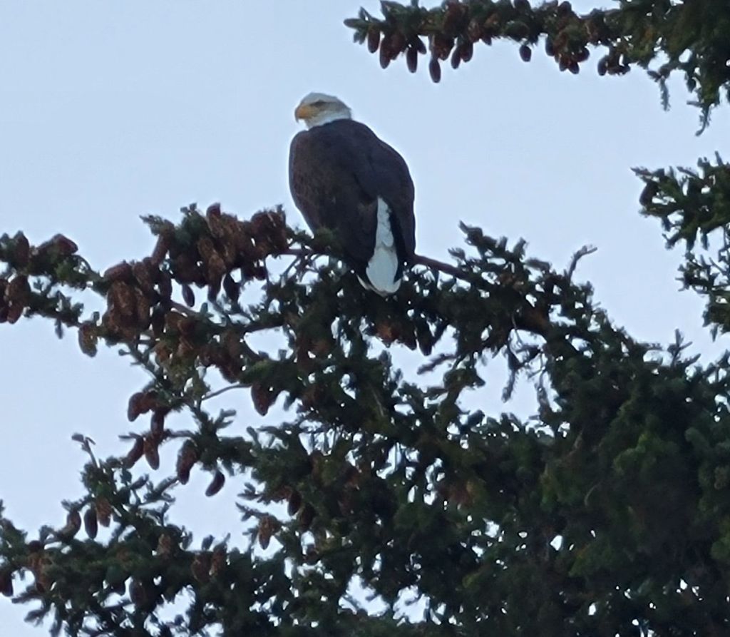
Some of the wildlife we saw on our rafting trip included deer, a red fox, a hawk, a beaver, lots of merganser ducks, and eagles.
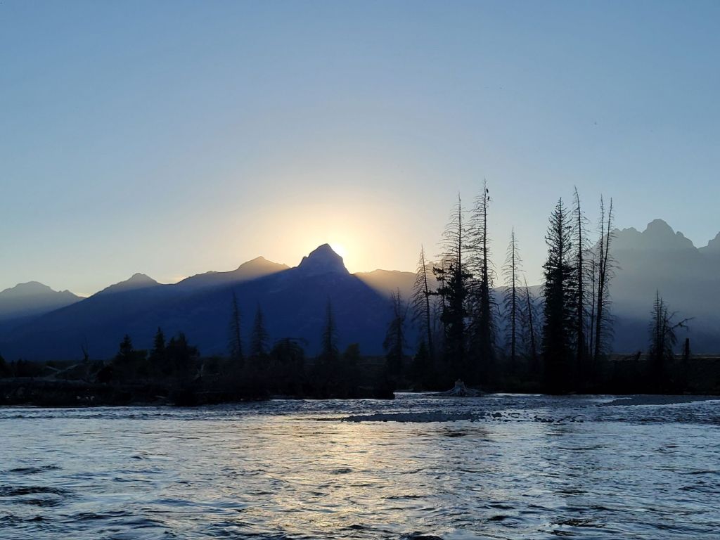
Those two dots in the tall tree on the left are a pair of bald eagles.This was the third bald eagle we saw on our boat trip.Sunset over the Teton MountainsThe silhouette of the mountains as we were driving back to the campground
The Night Sky
Since the park gets very dark at night, and it was a crescent moon, we decided to go back out and see if we could get some photos of the Milky Way.
This is the best I was able to accomplish with my cell phone.
On our way into the park on Wednesday, we encountered another gaggle of cars, which we instantly knew meant there was wildlife to see.
It turned out to be a bull moose, who was feeling trapped by all the tourists. He kept darting one way and then another, trying to find some way past all the people. He finally managed to dash across the street into a field.
Our first stop of the day was Schwabacher Landing, which is a popular location for taking photographs of the Teton mountains.
Maybe we got there too late in the morning, but I did not like any of the photos I took. The mountains looked like cardboard cutouts, and they were overshadowed by the foreground.
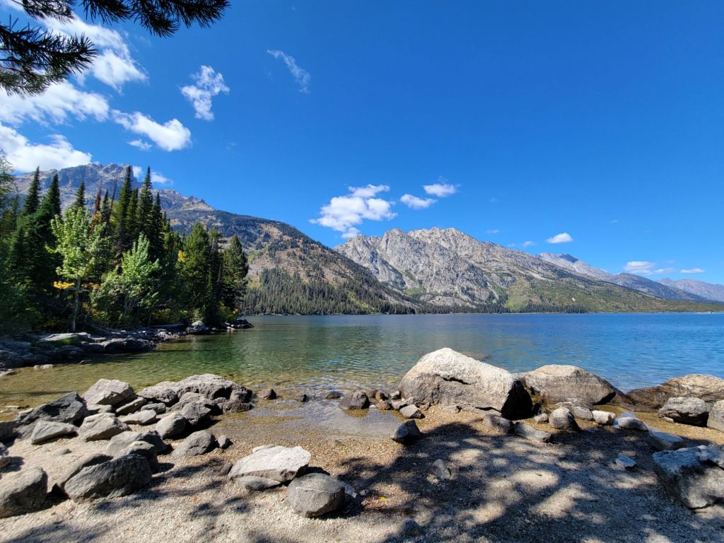
Jenny Lake
Next, we headed to Jenny Lake. We purchased tickets for the ferry ride across the lake, where we hiked to Hidden Falls.
My photos of the falls turned out terribly, but I managed to capture a photo of this artist painting the falls en plein air. He was painting in oils and was quite good. I was kind of jealous, to be honest.
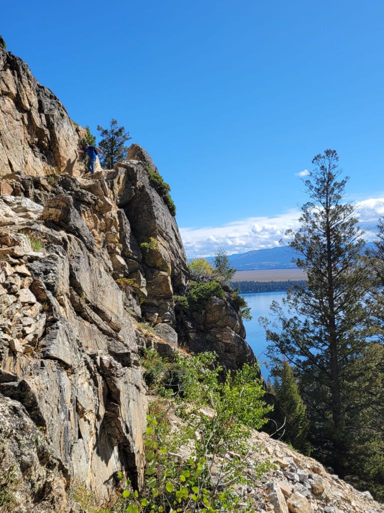
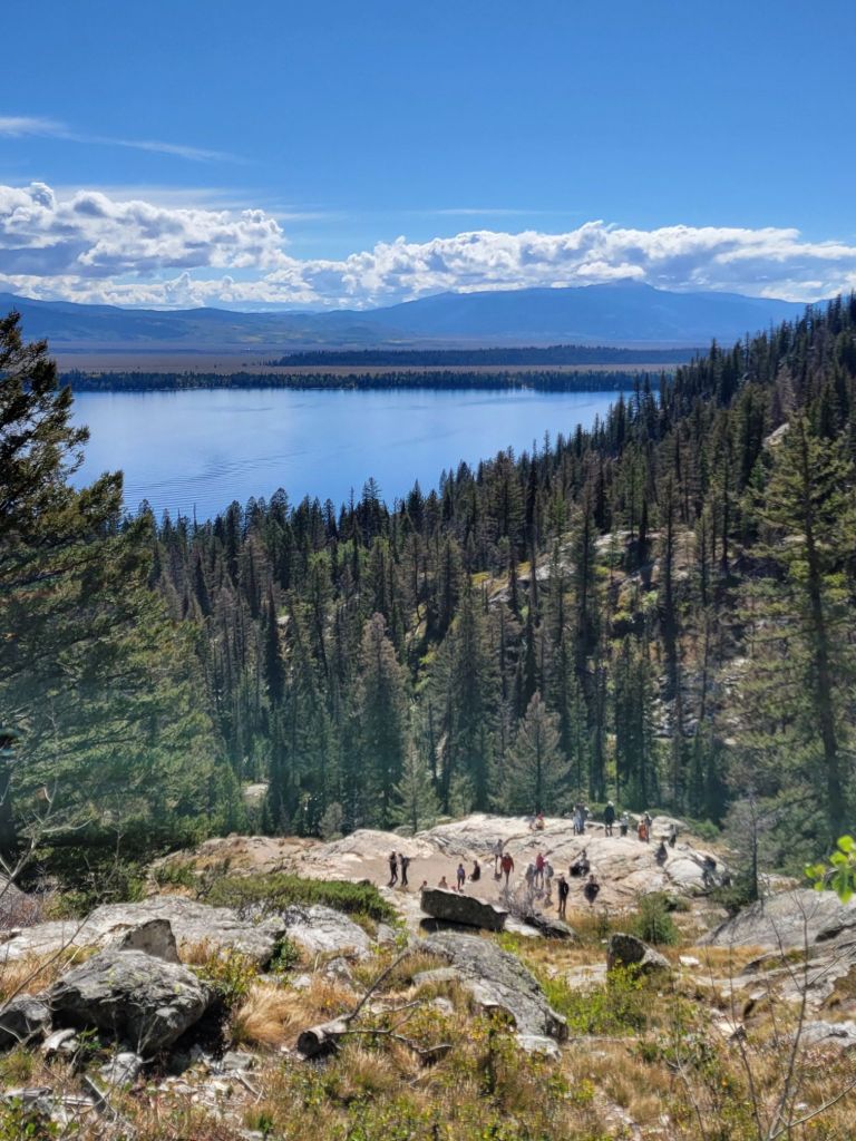
After Hidden Falls, we continued our hike up to Inspiration Point.
Yes, I actually climbed up the side of that rock cliff!
Coming down was another story. At one point, I sat down because I was so terrified. Some gentleman at the bottom offered to come up and assist me, but I managed to complete it by myself. Yay!
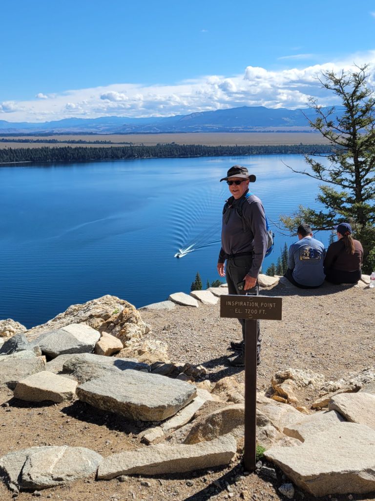
The size of the ferry boat on the lake in the photo below should give you an idea of how high up we were. The sign Greg is standing behind says Inspiration Point el. 7200 ft.
After climbing down from Inspiration Point, we chose to hike around the lake rather than take the ferry boat back.
Another hiker asked if she could join us on the hike back since she was worried about encountering a bear on her own.
On the hike back to the Jenny Lake visitor center, we got to see another moose. Unfortunately, he was shy and didn’t want to have his picture taken.
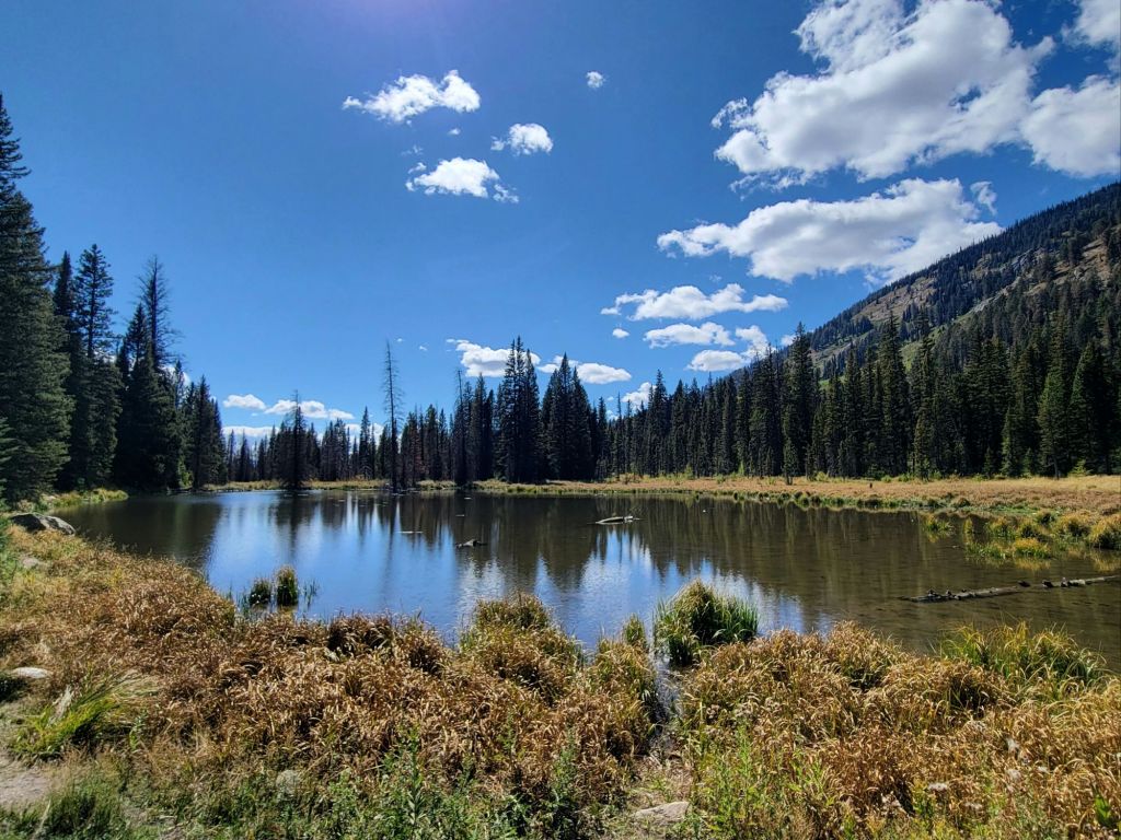
Shortly after that, someone else we encountered on the trail told us that they had seen a moose at Moose Pond, so we took a short detour to check that out.
It was a beautiful day for a hike, but by the time we finally got back to the Jenny Lake visitor center, we were beat. Greg said he was more tired from that hike than he had been from any other hike we’ve ever taken.
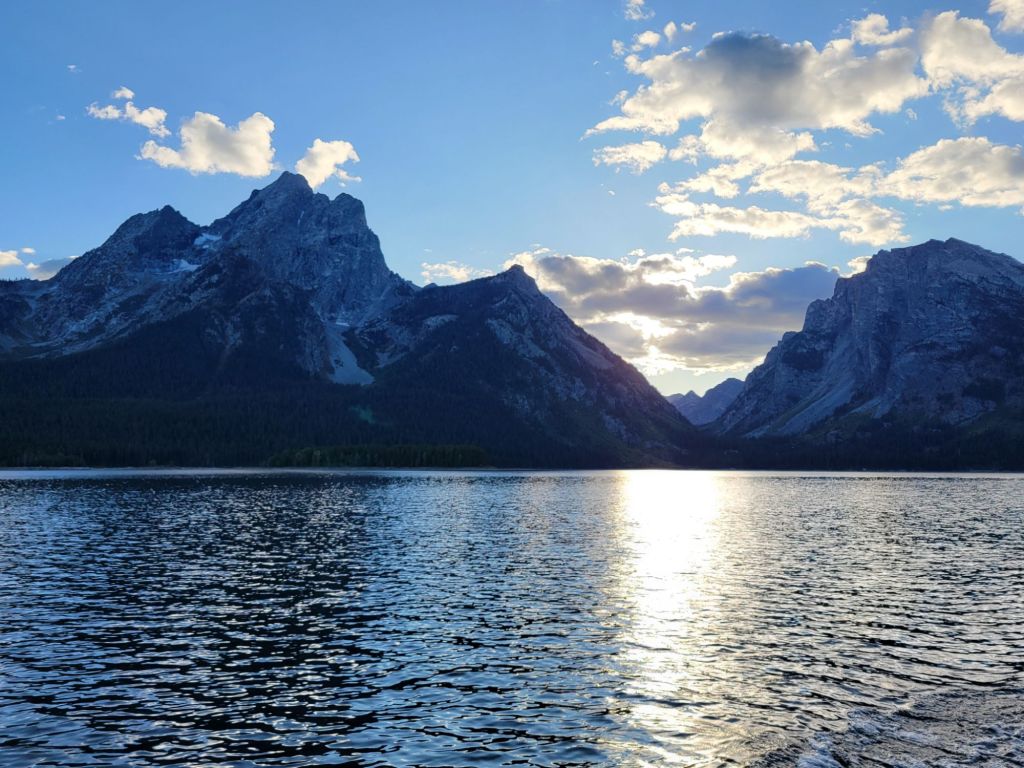
Scenic Boat Tour
Back at the car, we inhaled our lunch (it was 3:00 p.m. by this point). Then we decided to head over to Jackson Lake Lodge to see whether we could buy tickets for a scenic boat tour.
The girl at the concierge desk told us that the very last scenic boat tour for the season was leaving at 5:15. We booked our tickets and then headed to the bar to relax until it was time to head to the marina.
Five-fifteen is a terrible time to take a scenic boat tour if the goal is to get lovely photos of the Teton mountains rising over the water. The first 45 minutes of the tour involved traveling directly into the sun, which made taking photos of the mountains impossible. By the time the boat captain finally turned around to head back to the marina, the sun was setting behind the mountains, leaving them in shadow.
Despite that, I did enjoy the tour, and I learned a lot. Our tour guide was delightful.
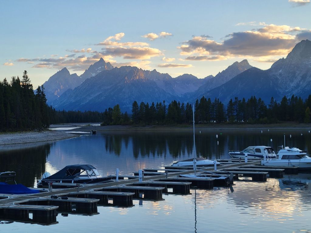
Sunset
Since the sun was setting when we arrived back at the marina, Greg and I quickly hopped in the car and headed to another popular spot for taking photos of the mountains.
It was a beautiful sunset, but I don’t feel like I got very good photos of it.
I love all of the beautiful fall colors in the foreground of this photo. Fall has definitely come to the Tetons!
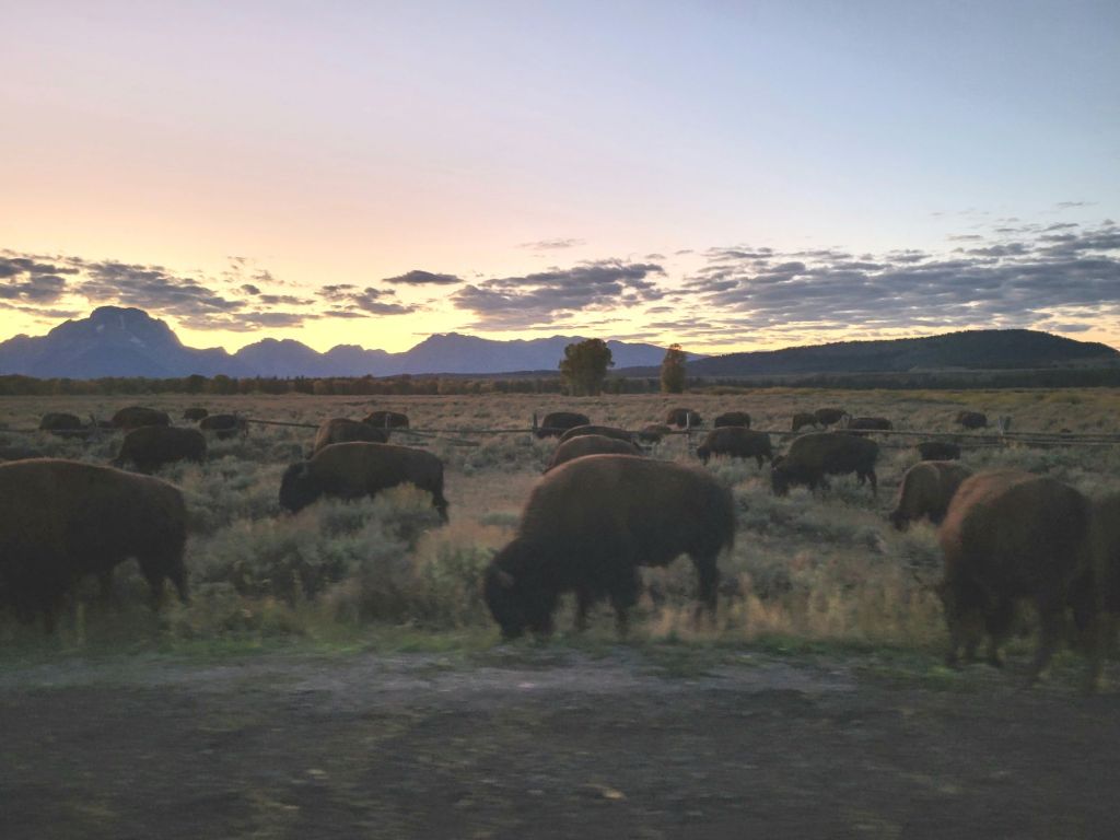
We encountered another traffic jam on the way back to the campground. This time it was a herd of bison on the side of the road.
When we finally arrived back at the campground at 9:00 p.m., we promptly collapsed into bed.