The Black Hills area has two highways that are impassable to RVs and large vehicles. They are Needles Highway and Iron Mountain Road, both part of Custer State Park.
I had decided before this trip began that we would not risk driving either of them. Greg decided he had different ideas.
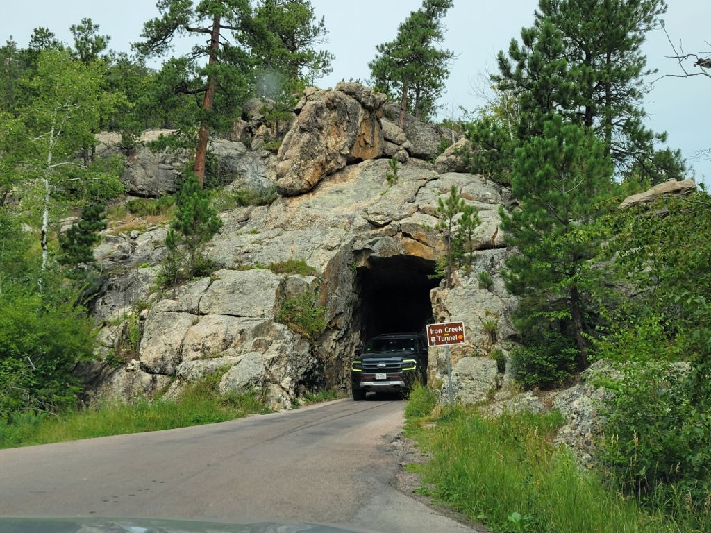
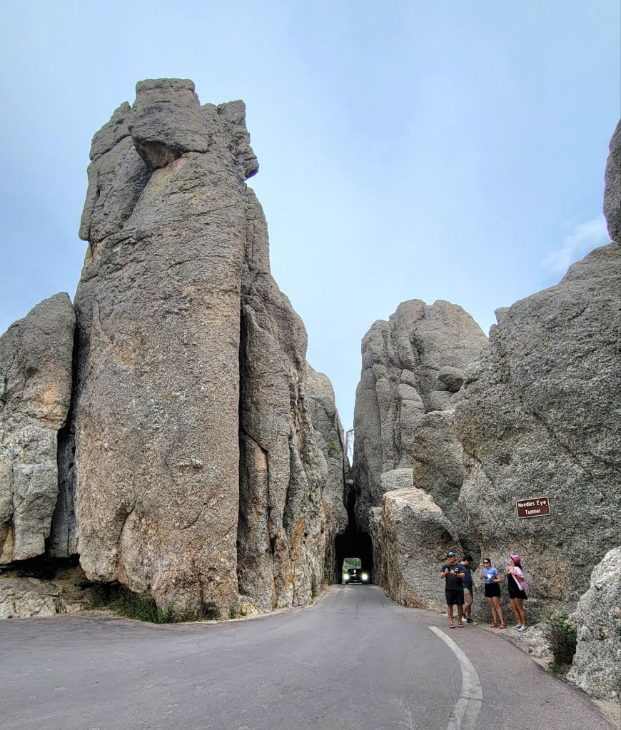
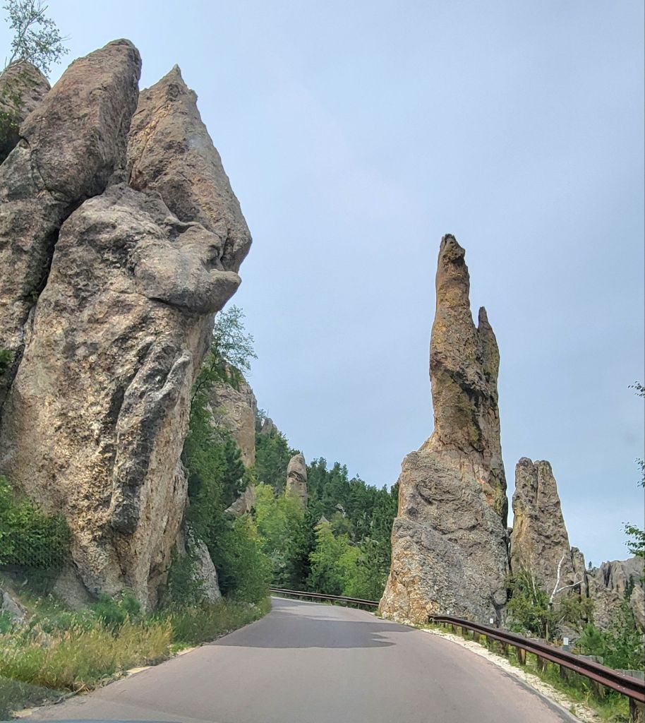
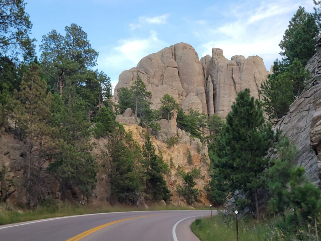
So Wednesday we headed for Needles Highway. Needles Highway has numerous sharp switchbacks and three narrow tunnels, the narrowest of which is 8 ft wide. Our truck is a little over 7 ft wide.
Possibly thanks to the lorazepam and Propranolol I took before we headed out, I had a blast. It was a great day.
And the pictures!
Waiting to go through our first tunnel on Needles Highway, Iron Creek Tunnel
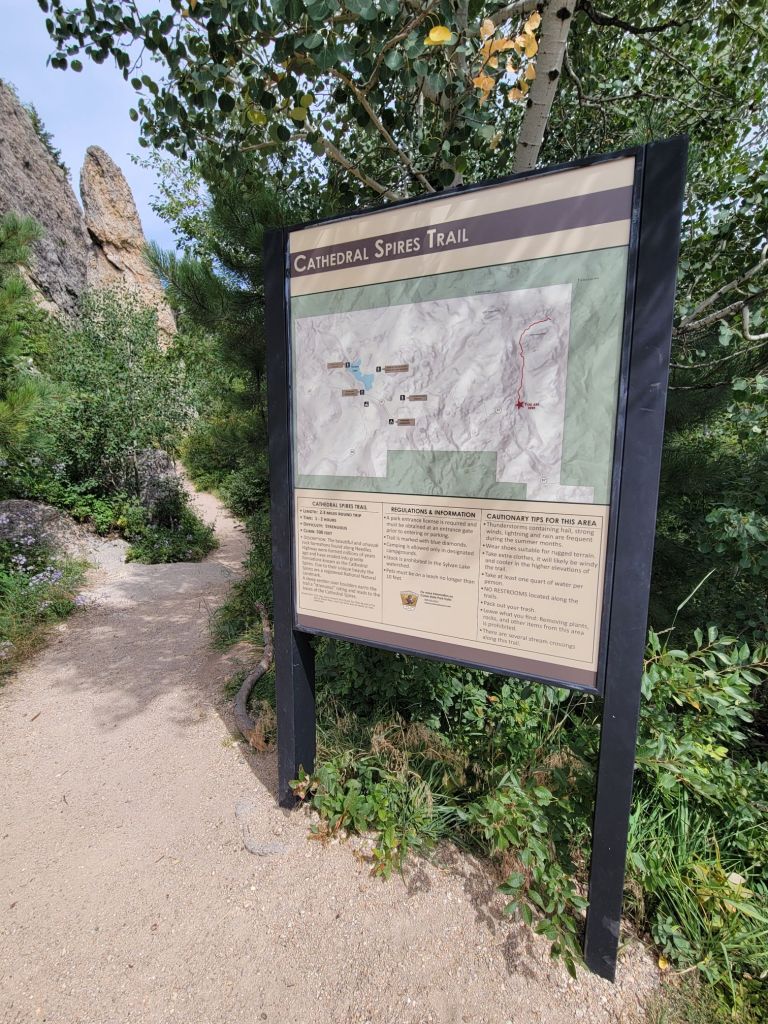
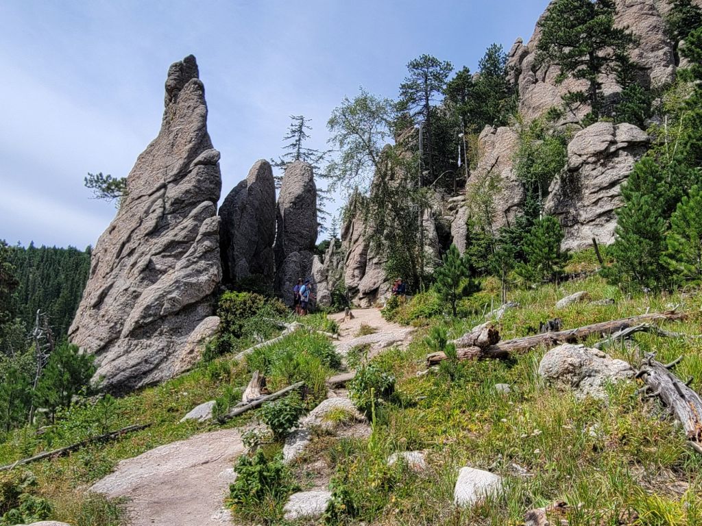
The first thing we did was stop at the Cathedral Spires Trail. This trail is a little over two miles round trip, but before you get to the cathedral spires, you have to climb over quite a few boulders.
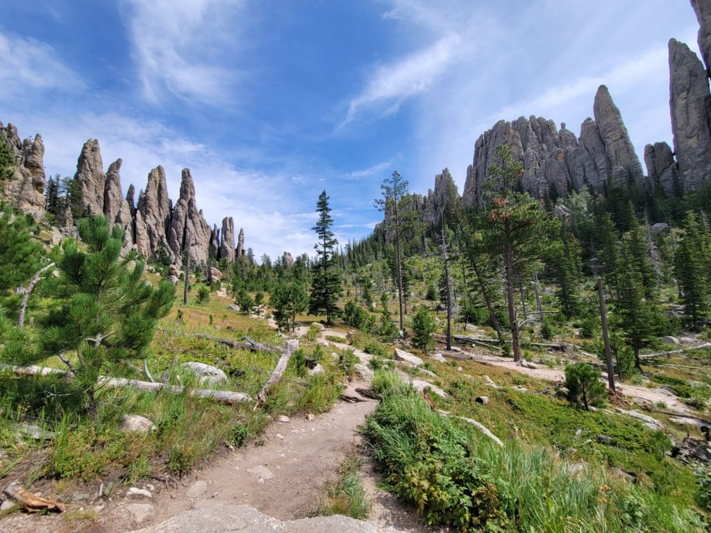
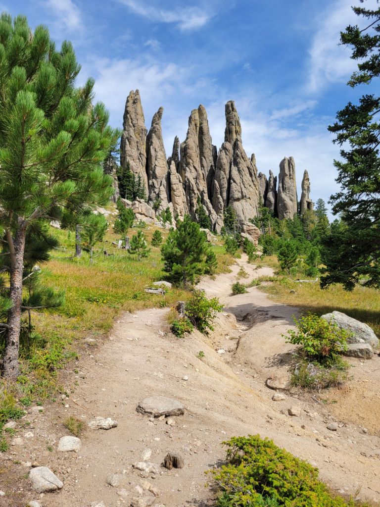
Greg got as far as the boulders and decided not to risk going any further. I ventured on, mostly because the trail was strenuous, and I was damned if I was going to give up before we got to the good stuff!
The good stuff
Next up was the Needles Eye Tunnel. Greg had nerves of steel, and we emerged unscathed. Phew!
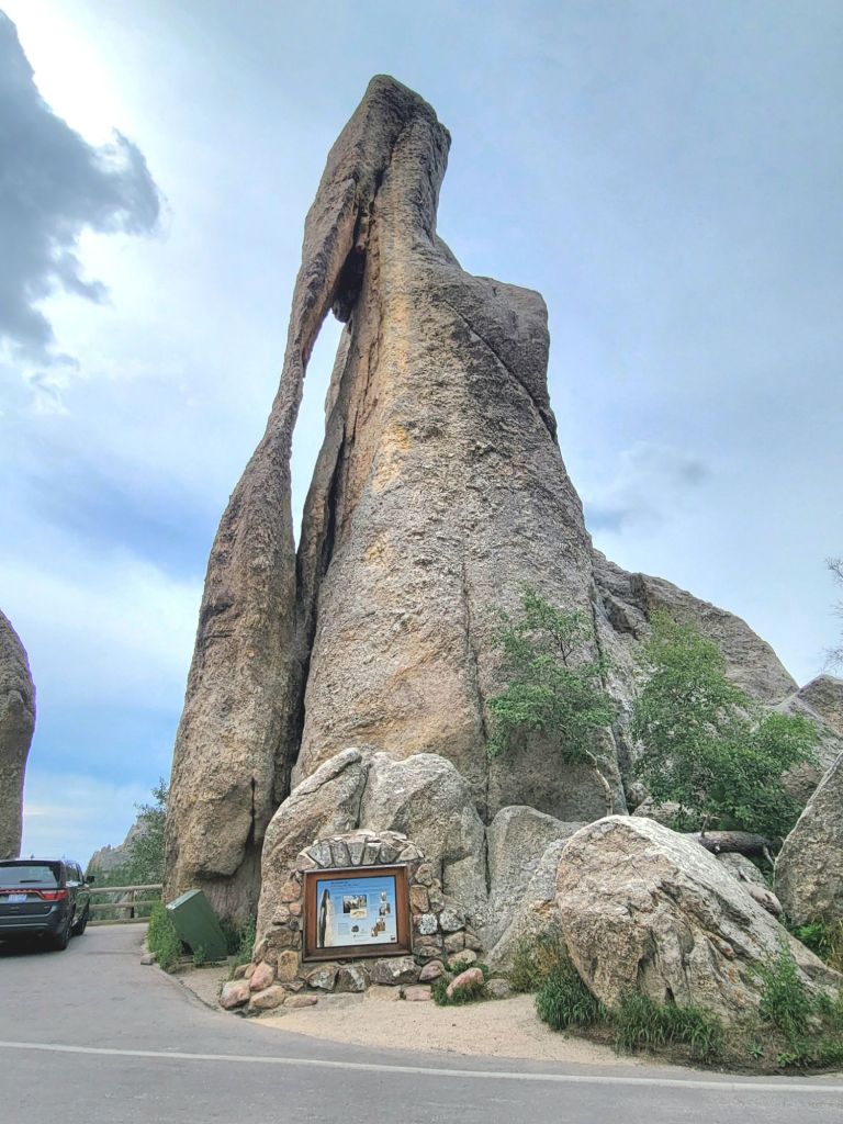
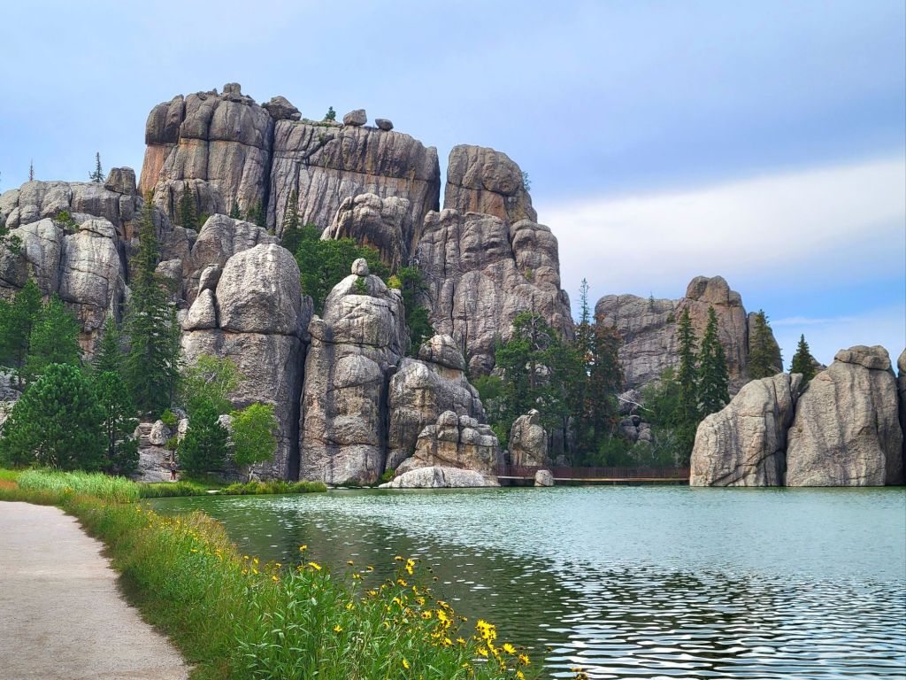
The rock formation that gave Needles Highway its nameThere’s nothing more exciting than making a sharp curve between two narrow rock formations, hoping no other trucks are heading toward you.
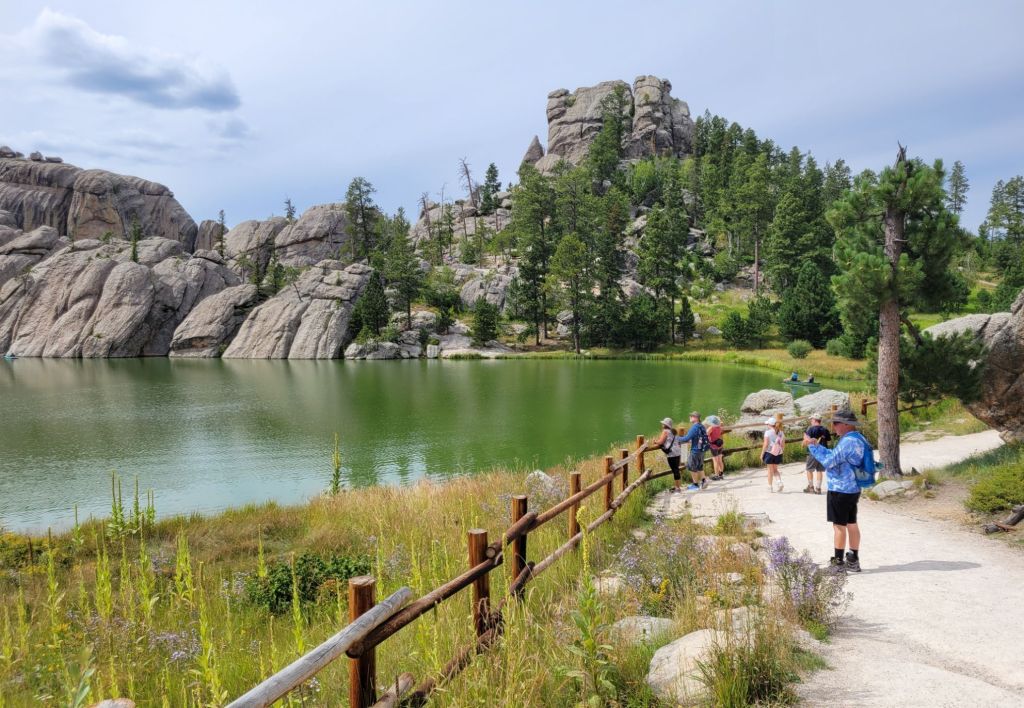
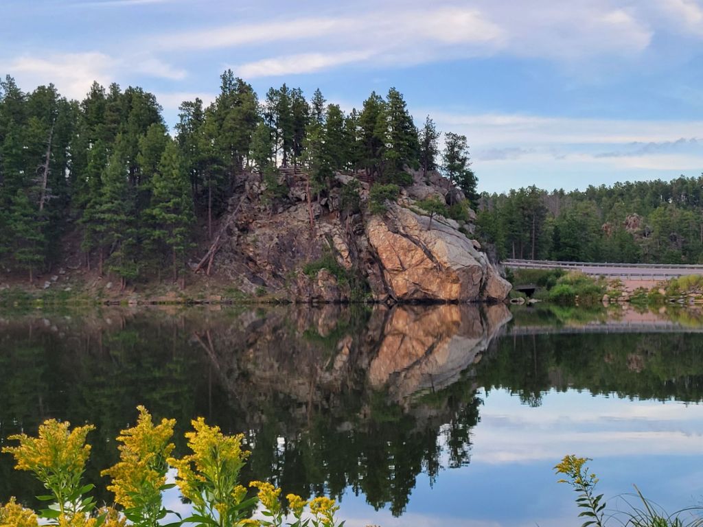
Sylvan Lake
Needles Highway took us to Sylvan Lake, the most popular lake in Custer State Park.
This is not surprising. Sylvan Lake is really beautiful.
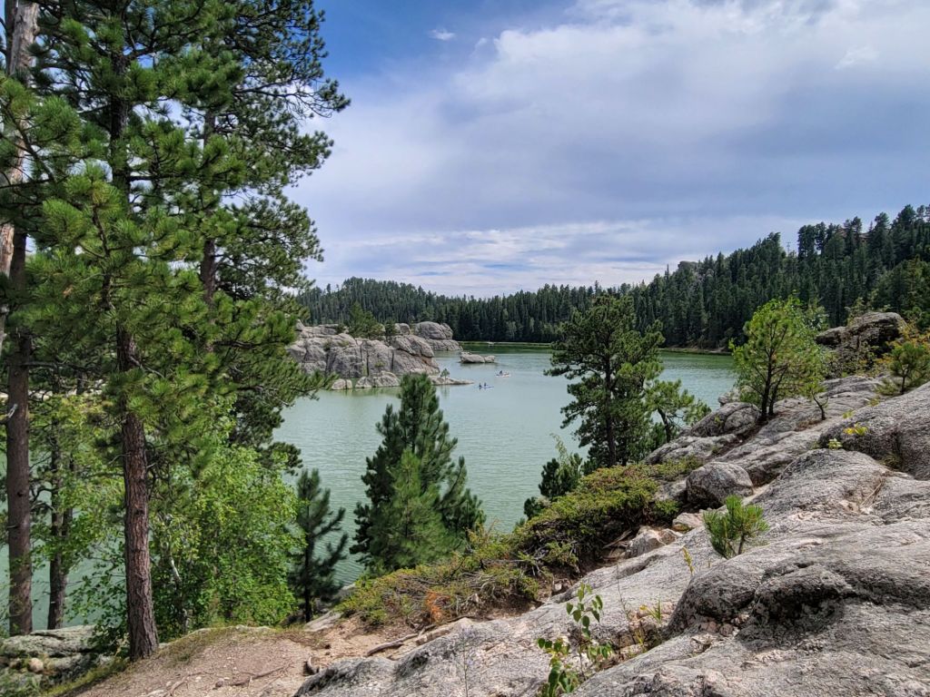
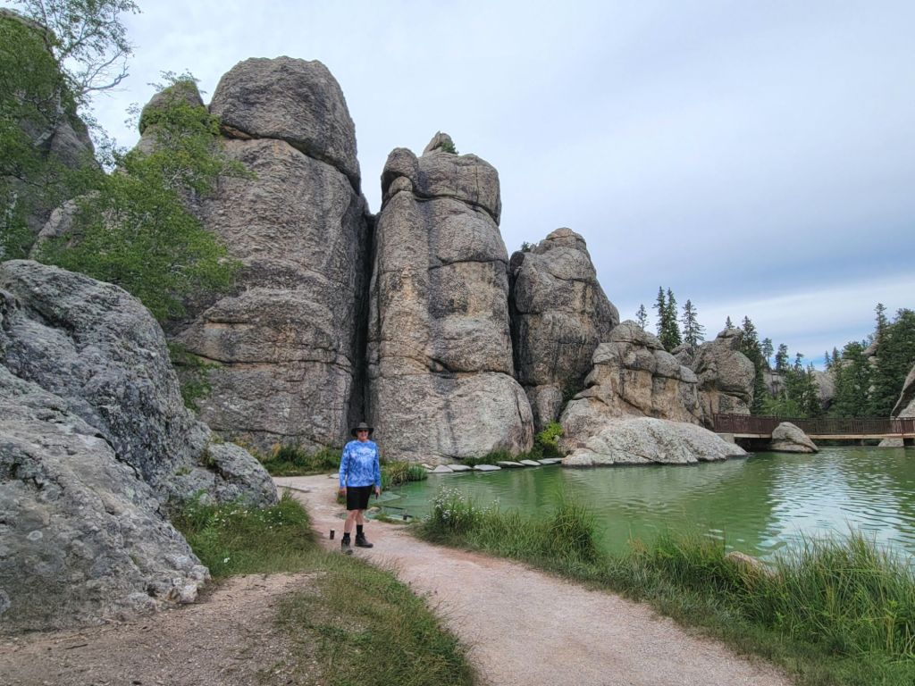
Greg and I started down the Sylvan Lake Trail, but again, Greg decided not to climb over the rocks. He waited for me at a shaded picnic table while I continued on.
Once I got as far as I could go on the trail (it was closed halfway around), I headed back to Greg. Then we enjoyed some drinks at the Sylvan Lake Lodge before walking the trail along the other side of the lake.
On to Billings, Montana!
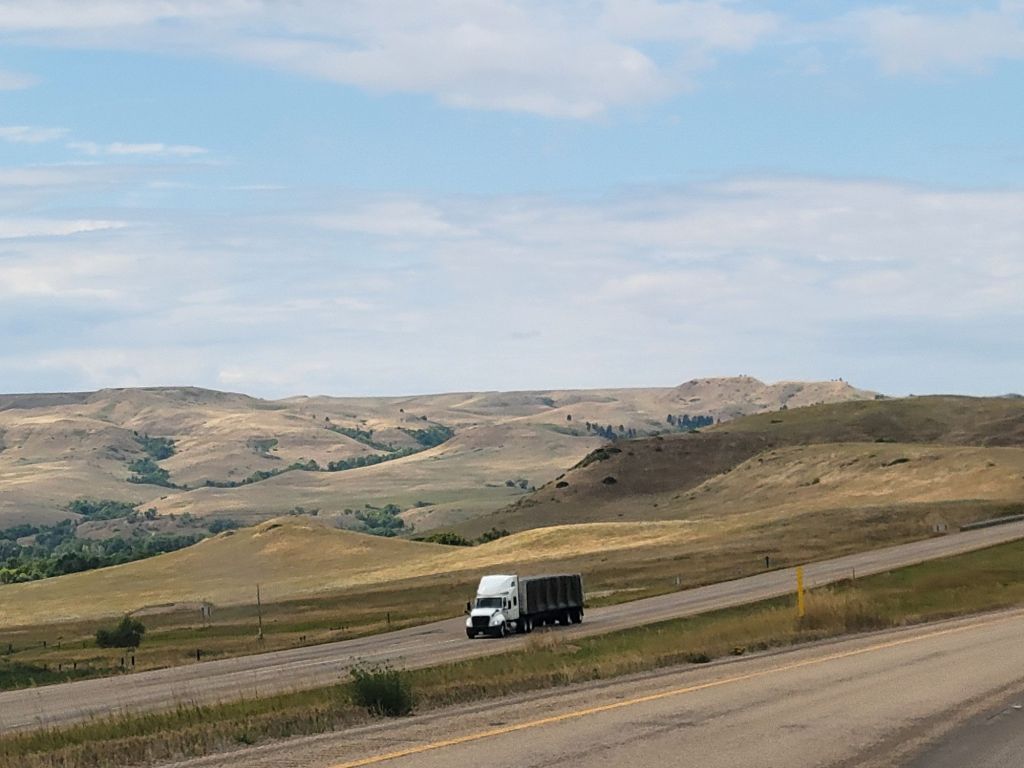
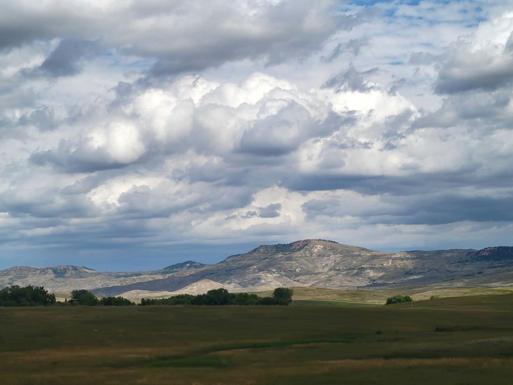
Wyoming
I can’t resist posting just a little bit about our drive through Wyoming.
Good grief, this state is gorgeous!
I can’t get enough of the scenery.
Here are some of my favorite photos that I took while driving to Billings.
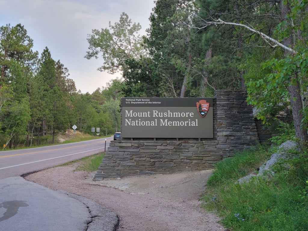
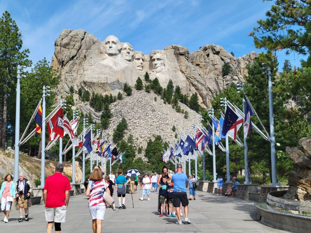
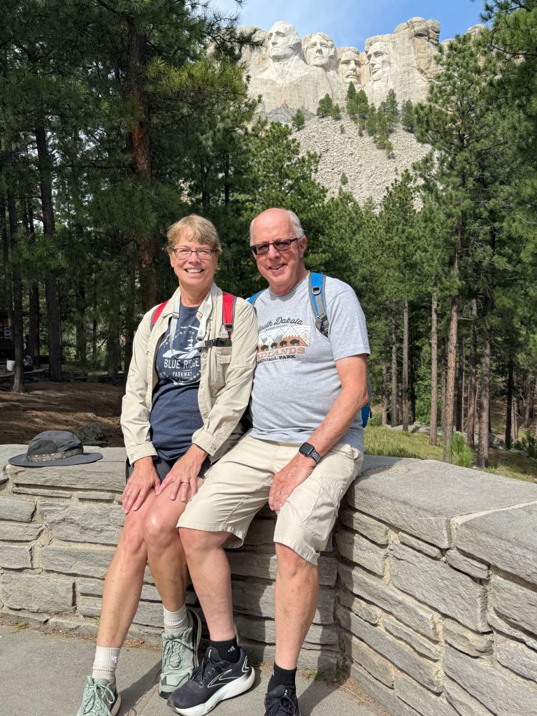
The road up to Mount Rushmore was beautiful. I enjoyed it more than the Spearfish Canyon Scenic Byway.
Once we were at Mount Rushmore, we wandered down the Avenue of Flags, where I learned that Pennsylvania was the second colony to become a state. Who knew?
Next, we watched the informational video in the visitor center, which told the story of how Mount Rushmore came to be, and why Washington, Jefferson, Roosevelt, and Lincoln were the presidents chosen to be represented.
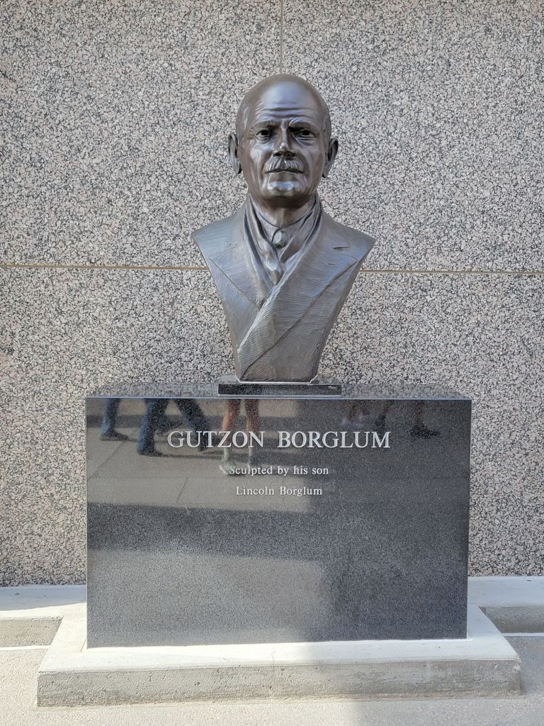
The sculptor. He died before the memorial was finished, but his son finished the work. Plus, many of his family members continue to be involved in Mt. Rushmore.
Then we checked out the Sculptor’s Studio, where we learned that the presidents’ profiles were originally supposed to include the entire upper torso, but lack of funds and problems with the mountain prevented that.
We also learned that Thomas Jefferson was originally on the far left side of the memorial, but the sculptor had to move him due to incompatibilities between the sculpture’s design and the rock face.
Greg listens to a park ranger describing the process of carving the statues.
Greg decided that he wanted to do the audio tour of the Presidential Trail, so we went back to the visitor center, picked up the equipment, and headed out.
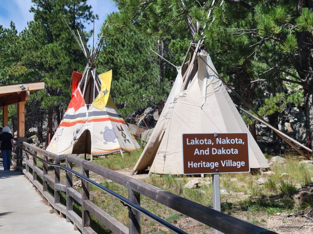
Almost the first thing we came to was an exhibit about the Lakota, Dakota, and Nakota Native Americans.
A member of the Lakota tribe was giving a presentation. He talked about the struggles that Native Americans have in the US today. They have lost their land. They struggle to hold on to their culture, and they are treated like second-class citizens in their own country. No wonder they struggle with addictions and poor health!
Here he is, holding a picture of his grandmother.
Along the way, we took photos of the presidents. Lots and lots of photos!
Honestly, looking at the sculptures on the face of the mountain made me sad at first. Why do humans have to leave their mark on everything good and beautiful in the world? That lovely mountain is defaced for all time.
But then I learned about the sculptor, Gutzon Borglum. He was very patriotic, and he chose which presidents to memorialize with great thought and care.
It made me remember America’s potential. I felt connected to all the Americans who came before me who believe in freedom and the promise of what America can be when she’s at her best.
Abe Lincoln, entertaining the audience with interesting stories about the battles of Gettysburg and Vicksburg.
We didn’t get to finish the audio tour along the Presidential Trail because Greg wanted to get back in time to hear Abraham Lincoln talk about the Civil War and recite the Gettysburg Address.
Lincoln made an interesting point about freedom. He said that some people might ask why Lincoln didn’t give the Confederacy the freedom to leave the Union, since America was founded on the principle of freedom (particularly freedom from a tyrannical government).
He said that even freedom has limits. The Confederate states had agreed to be part of the United States and to follow the Constitution. They couldn’t simply break that contract when things didn’t go their way.
And, of course, there was the obligatory selfie photo.
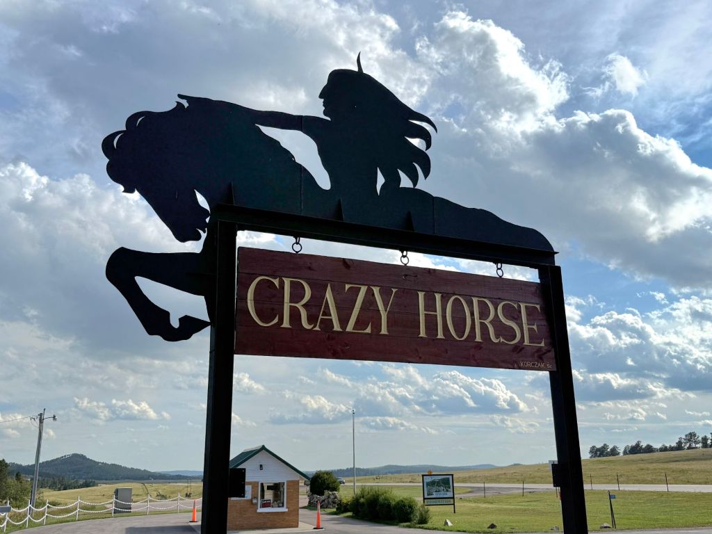
We ate lunch at the cafe at Mount Rushmore. (I didn’t realize we would be there so long, or I would have packed a lunch. Instead, I had some really lousy pot roast in the cafe.) Then we headed to Crazy Horse.
Crazy Horse Memorial
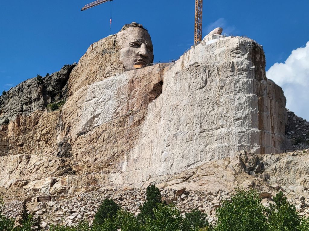
The Crazy Horse Memorial was a revelation to me. I didn’t realize it wasn’t already complete. In fact, it has a long way to go!
This is what the final statue will look like.
Right now, just the head and the pointing hand are complete. It may take 30 to 50 more years to finish the sculpture, which means I will never get to see it completed. Hopefully, my kids will make the effort to go.
I think the entire memorial site will be well worth a visit. In addition to the museum, they have cultural events, and they even have a university for Native American students there.
When we arrived at the visitor center, we purchased tickets for the bus tour down to the memorial site. Our bus driver was very informative.
Once we got back to the visitor center, we watched the informational video about how the sculpture was conceived and learned about the family that is ensuring its completion. (Another family affair, just like Mt. Rushmore.)
It is a fascinating story. I have great admiration for the sculptor who started it all, Korczak Kiolkowski, his wife, his children, and his grandchildren.
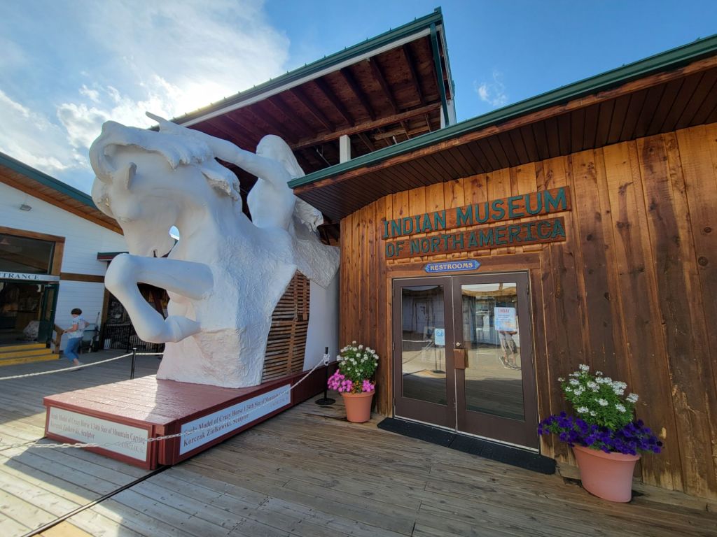
We also toured the Indian Museum of North America, which contains an enormous collection of Native American art. It was beautiful, but there was so much to absorb! My attention span wasn’t up to the challenge.
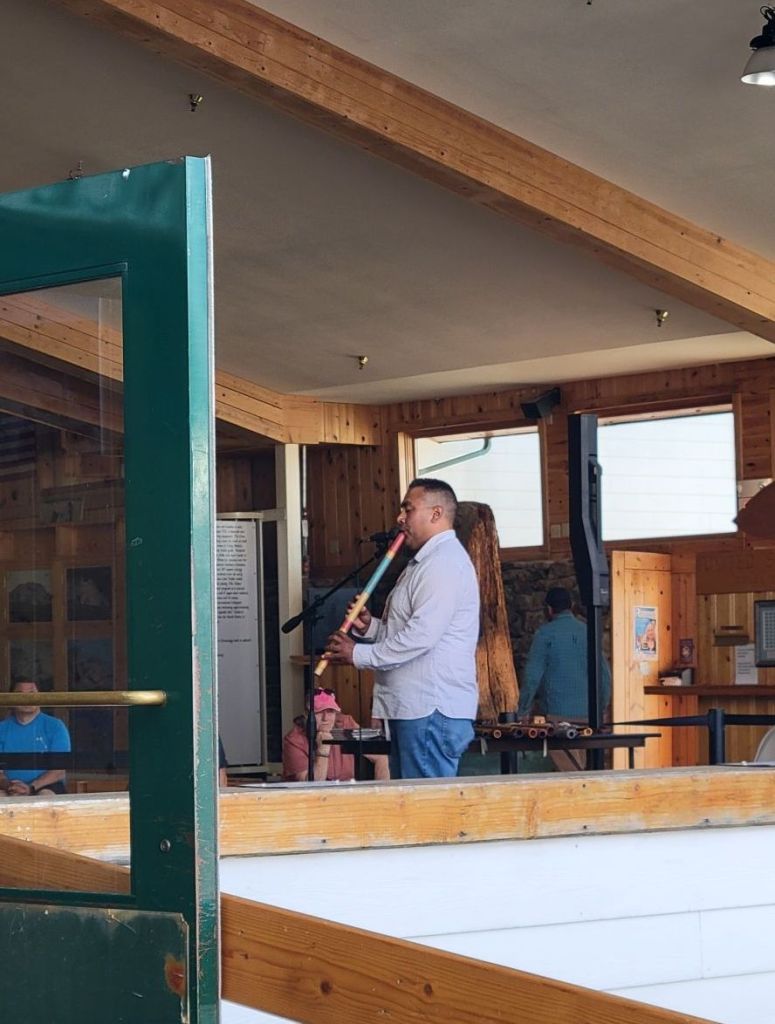
And we listened to a presentation about Native American musical instruments.
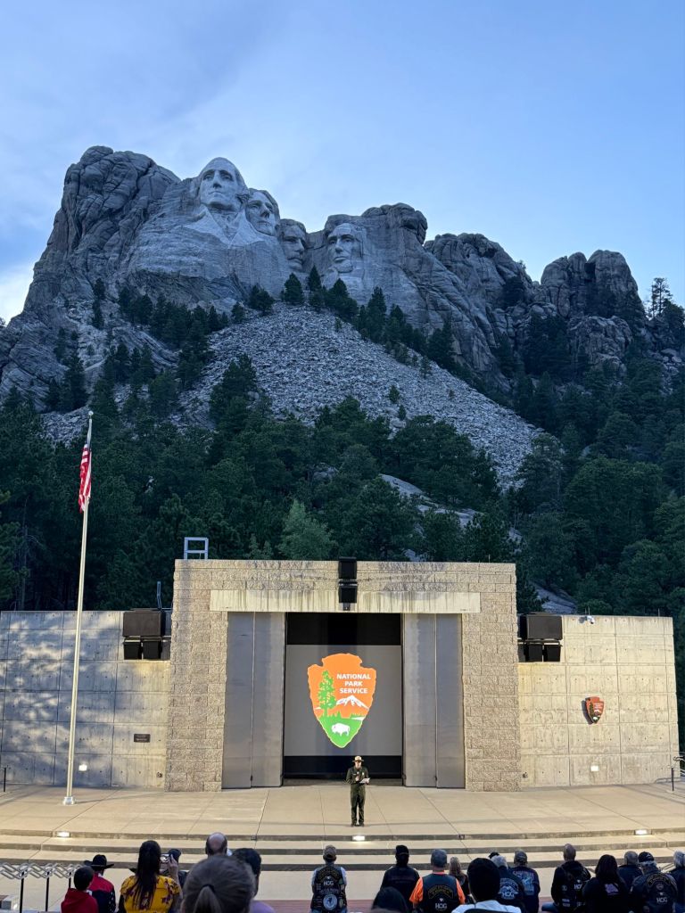
Mt. Rushmore Lighting Ceremony
After dinner at the campground, we headed back to Mount Rushmore for the evening lighting ceremony. (Thankfully, it was only 15 minutes away.)
First, there was a talk by a park ranger about the meaning of patriotism. It was excellent.
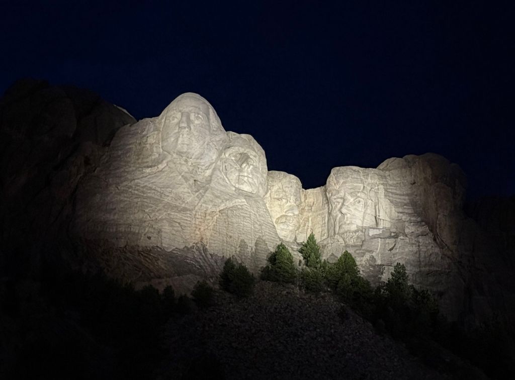
Next, we watched a movie about the lives and significance of each of the presidents represented on Mount Rushmore.
Then they lit the faces of the presidents, and we all sang The Star-Spangled Banner together.
And finally, they invited all veterans and gold star families to come onto the stage to be recognized. Afterwards, the veterans helped lower the flag.
The entire experience was very moving and capped a truly phenomenal day.
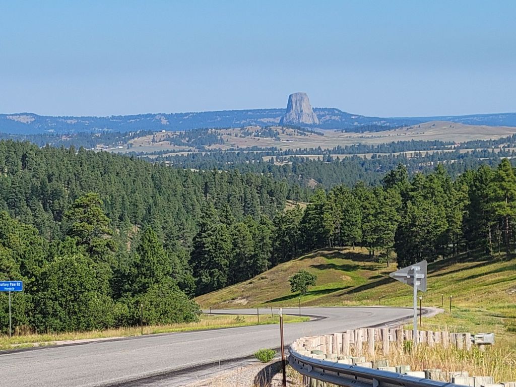
Monday was another early morning. We hopped in the car around 7:15 a.m. and drove two hours to Wyoming to see Devil’s Tower. (In total, Greg clocked six hours of driving this day.)
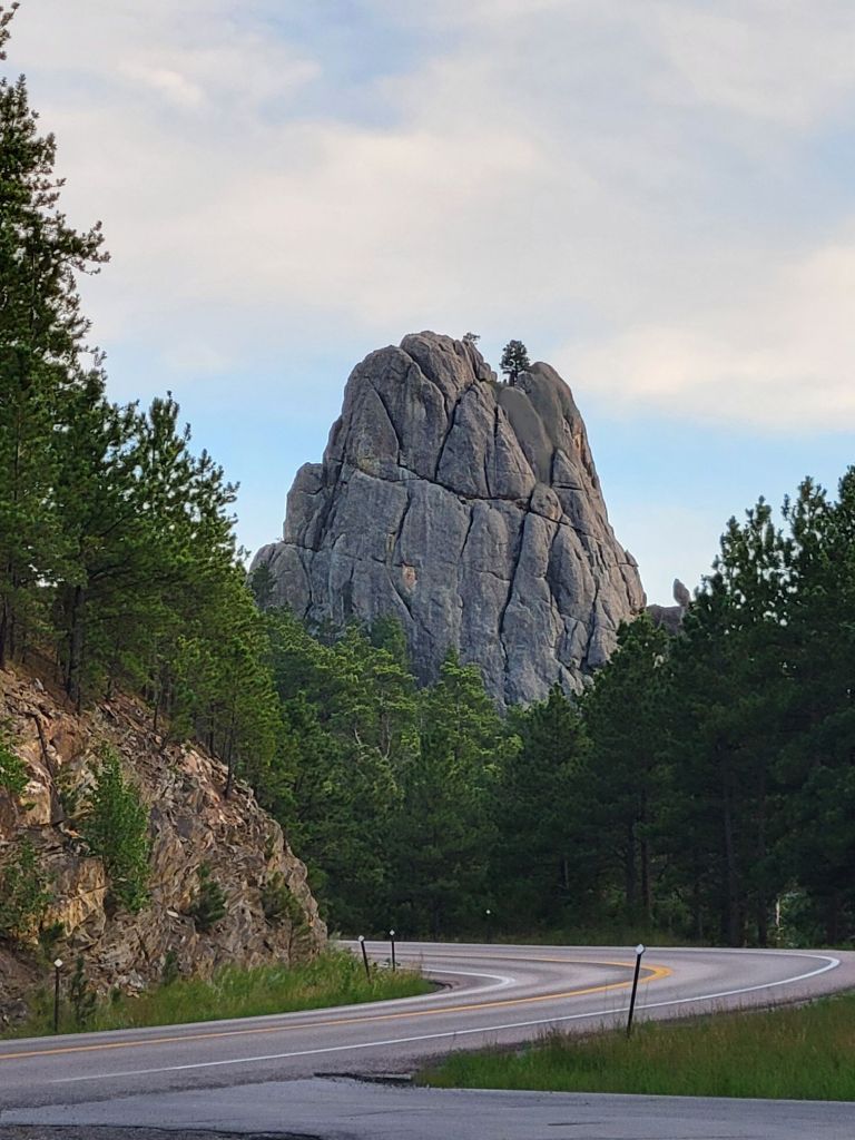
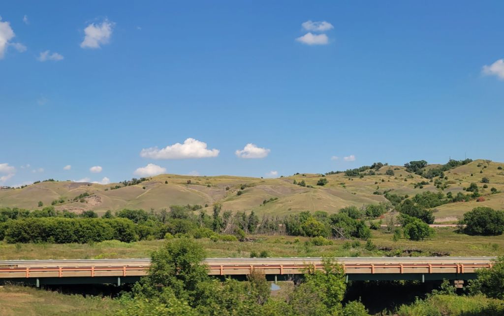
Along the way, we drove past this interesting rock formation. I have no idea what it is.
As we got closer to Devil’s Tower, we could see it for miles in the distance.
I think it’s more impressive from a distance than closeup.
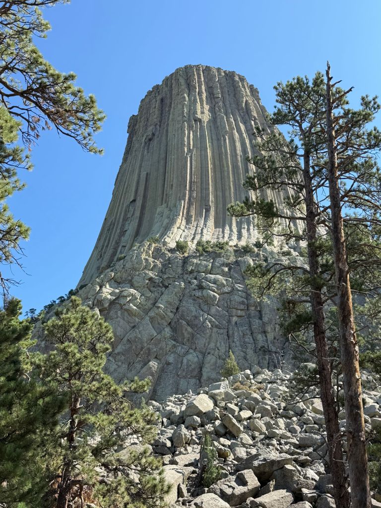
After stopping by the visitor’s center, where we learned that the tower is 867 ft from base to summit, we walked the mile and a half Tower Trail, along with a thousand of our closest friends.
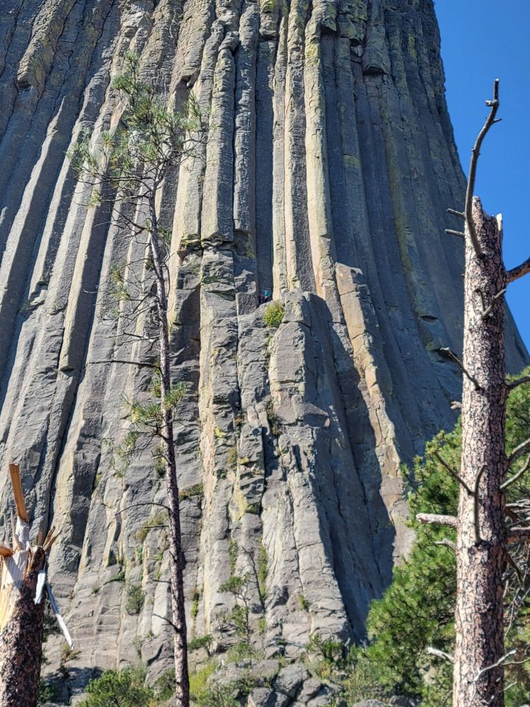
There were even some intrepid climbers tackling the tower!
There is a climber in a teal blue shirt standing on a shadowed ledge around the middle mark of this photo. It was very difficult to see the climbers because they were so tiny in comparison to the ginormous rock formation.
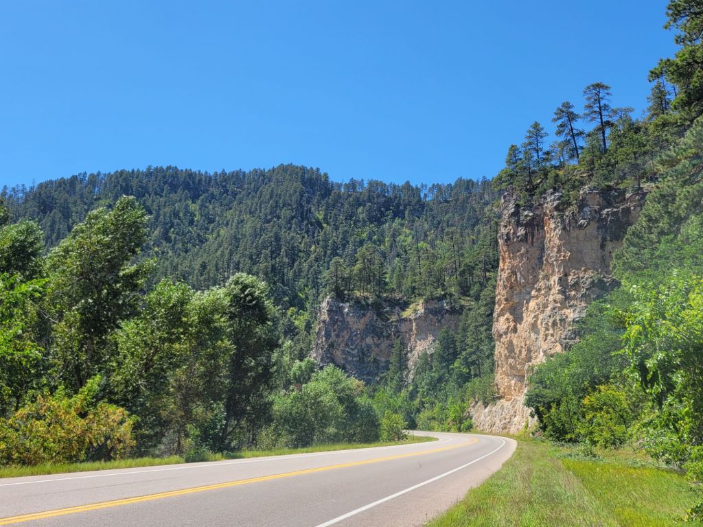
Spearfish Canyon Scenic Byway
Next, we headed to the Spearfish Canyon Scenic Byway. This is a 22-mile drive through Spearfish Canyon on Route 14A. It goes from Spearfish to Cheyenne Crossing.
In addition to places where you can pull over to take photographs, there are a number of hiking trails through the area. However, after our bike ride yesterday, followed by the hike around Devil’s Tower, Greg and I decided to forgo any more hikes that day.
I don’t feel like I got many good pictures during the drive. The pull-outs didn’t seem to be in places with the best views.
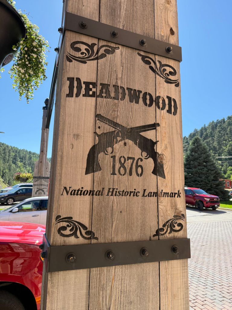
Deadwood
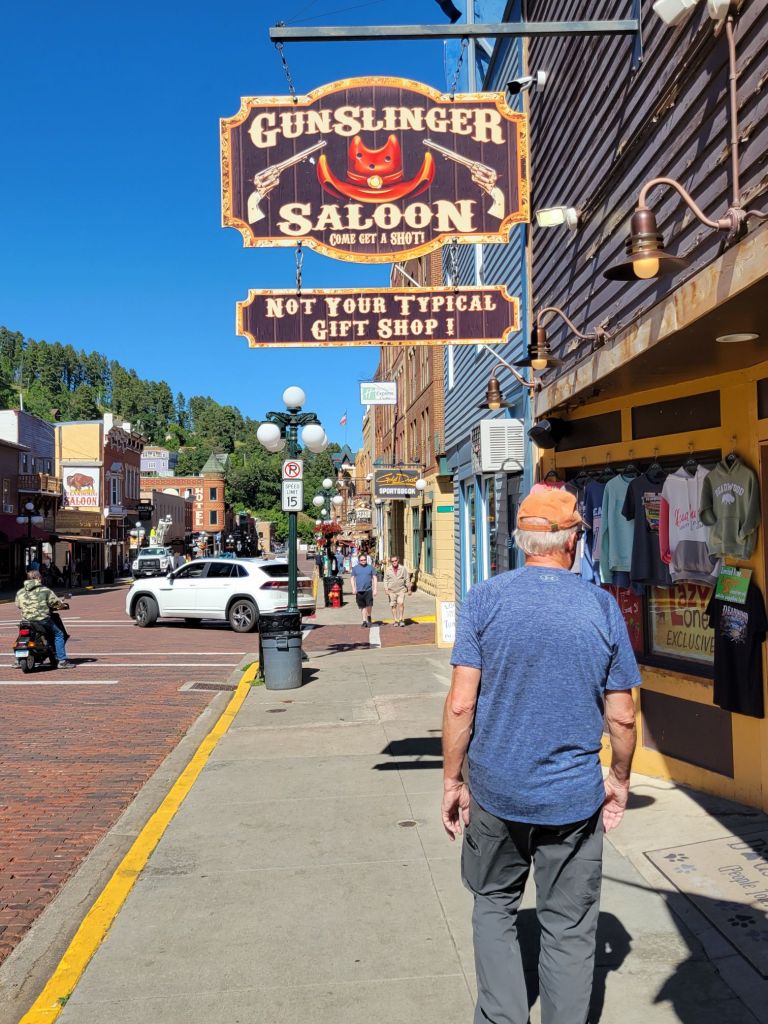
On the road again, we headed for historic Deadwood.
There, we stopped by the visitor center, then wandered down Main Street and had dinner at the Buffalo Bodega, where I enjoyed some mediocre prime rib.
I expected Main Street to be full of touristy shops. Instead, it seemed to be full of casinos.
After dinner we watched a reenactment of a wild west shootout.
Then we started the hour and a half drive back to the campground.
Of everything we did this day, I feel like Devil’s Tower was the only thing I would have regretted missing if we hadn’t done it.
After three very early mornings, it felt wonderful to sleep in. I got up at 6:30, but when Greg woke up later, I went back to bed for a nap.
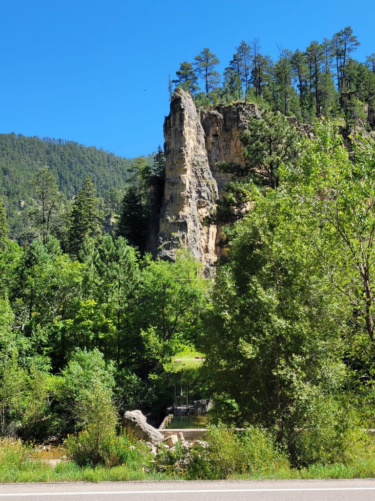
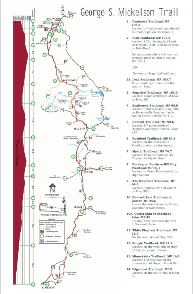
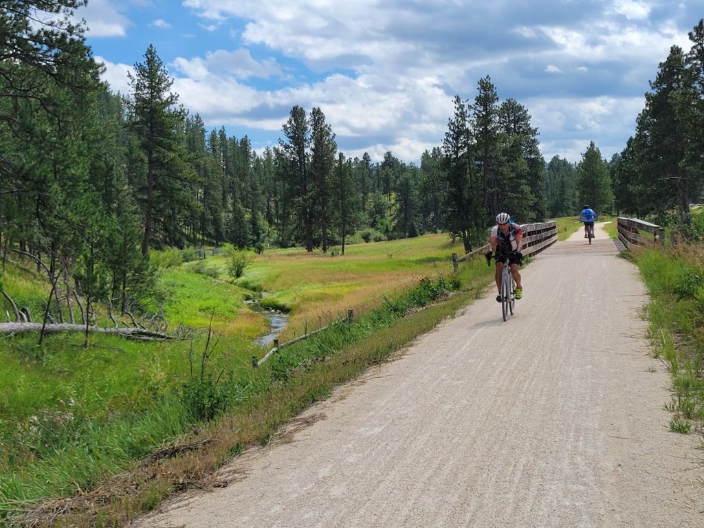
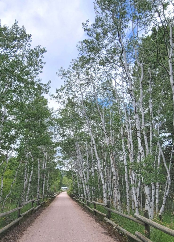
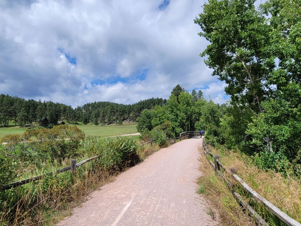
Once we were both awake and functional, we hopped on our bikes and took a ride down the Mickelson Trail, heading in the direction of Hill City. There was a trailhead right from the campground.
Access from campground to Mickelson Trail
The Mickelson Trail is a 108-mile rail-to-trail that goes from Deadwood in the north to Edgemont in the south.
We rode about 16 miles, round trip. It was quite relaxing. The weather was 65°, mostly sunny, with a breeze that occasionally had a bit of a bite to it.
The scenery was lovely.
After we got back, we relaxed on our deck for a little while, ate lunch, and then headed to the grocery store in search of food and a new coffee pot.
Our old coffee pot gave up the ghost this morning. Sadly, we were not able to find a new one.
However, when we got back to the camper, Greg was able to jury rig the old coffee pot to get it working again. (And hopefully, it will stay working!)
Life is not worth living without fresh coffee in the morning.
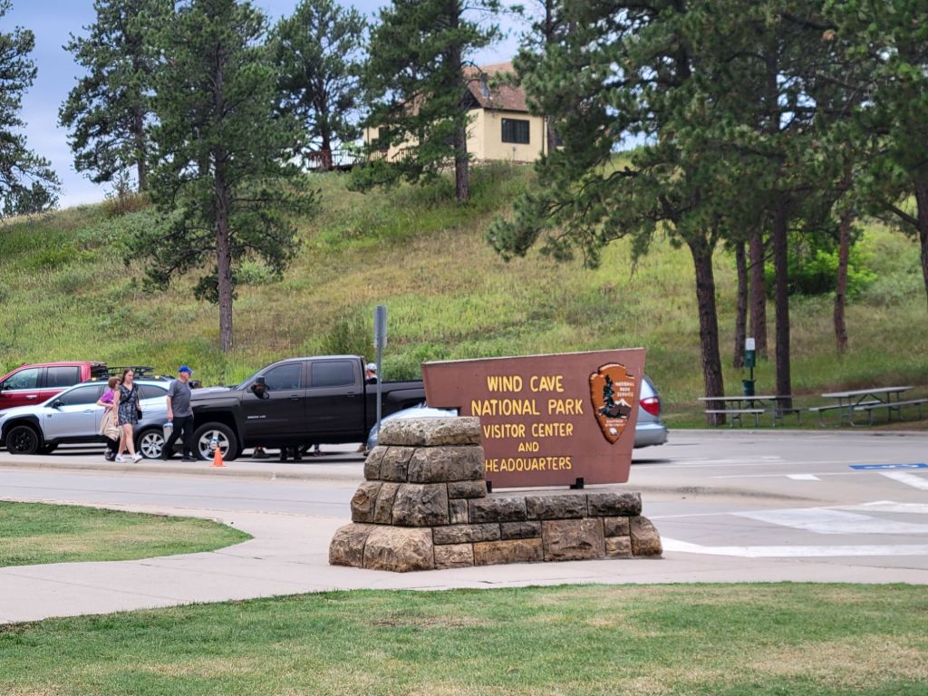
Saturday was another early morning. We had 9:00 a.m. tickets for the Fairgrounds tour of Wind Cave.
Wind Cave was a surprise. I expected it to be similar to Jewel Cave, since they are only 20 miles apart and may even be connected at some yet-undiscovered point.
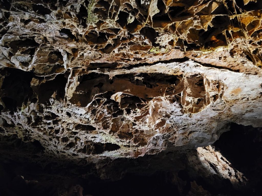
However, it was vastly different. The cave is absolutely covered in this formation called boxwork, which looks a little like honeycombs.
95% of the boxwork in the United States is in Wind Cave.
I had some trouble fully appreciating this cave. Our tour guide moved us through very quickly. There was a lot of ground to cover. I didn’t get a chance to take many pictures.
Plus, the lighting at floor level was poor, which made walking along uneven floors challenging.
On top of that, for some reason I was feeling dizzy and lightheaded that morning. I was afraid that I was going to have to ask to leave in the middle of the tour, which would not have gone over well with our guide at all!
It was a fascinating cave, though, simply because it was so different from anything I had seen before.
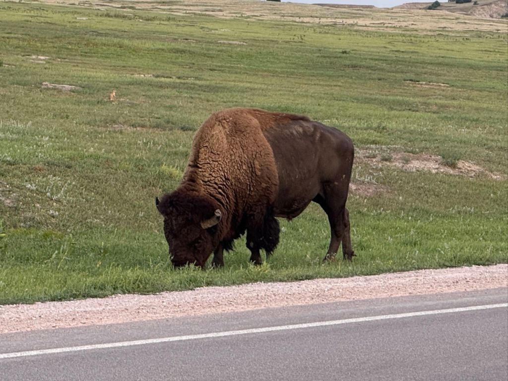
On our way to our next stop, we encountered this majestic fellow.
The Mammoth Site
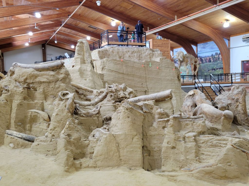
Next up was a tour of the Mammoth Site in Hot Springs, South Dakota.
At the Mammoth Site, the bones of up to 61 Columbian and woolly mammoths were discovered in what was once, a very long time ago, a sinkhole.
The sinkhole was fed by a warm spring, creating a pond with steep, slippery sides. The mammoths would enter the pond to eat the grasses that grew along the sides, drink, or bathe, and then they wouldn’t be able to get out again.
Greg and I took the audio tour around the site. It was very interesting. We learned a lot about determining the age and gender of mammoths.
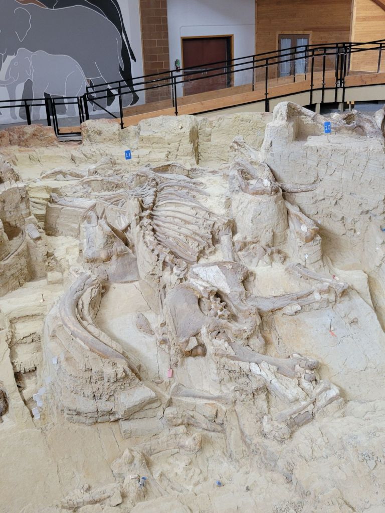
The deeper, spring-fed portion of the pond.This is the skeleton of a mammoth (minus its skull) lying on its side. The shallow end of the sinkhole. So many tusks!Greg, posing in front of a replica of a Columbian mammoth and a woolly mammoth skeleton.
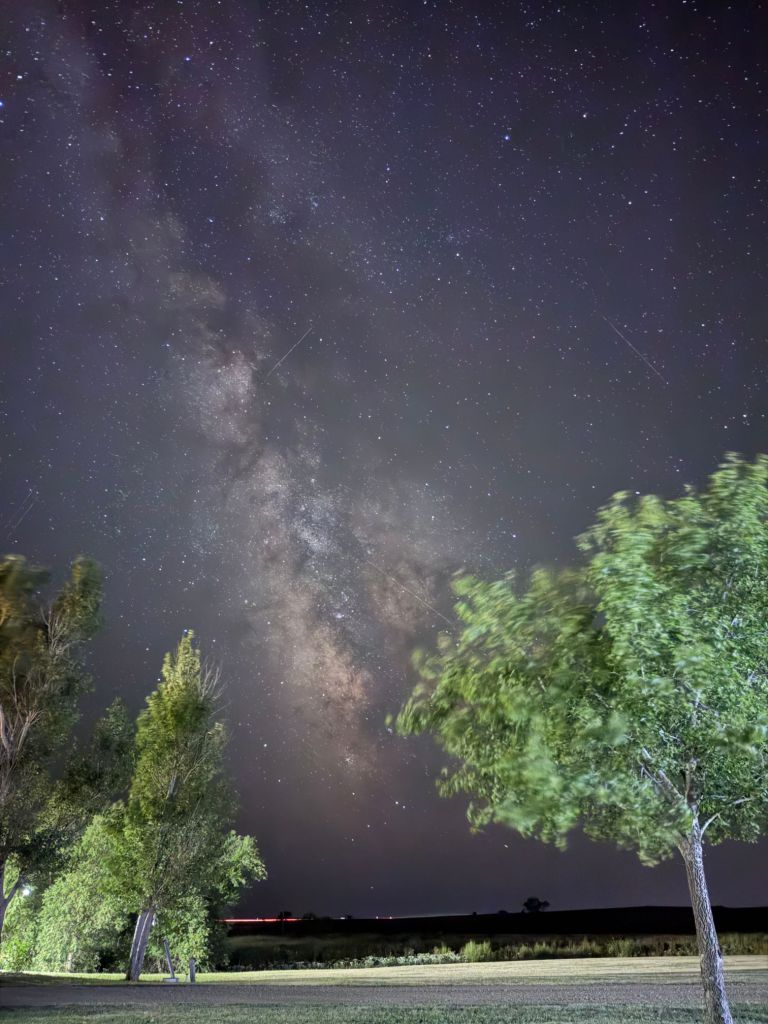
This photo was taken with Greg’s cell phone camera, which is better than mine. He may have even caught a meteor, although it might have been a satellite.
Last night, Greg and I decided to try our hand at photographing the Milky Way. Greg had been spending his free hours researching the best way to do it, and he was eager to try out what he had learned.
All we have are our cell phones and tripods, so we probably won’t be able to get professional level quality, but I think we did a good job so far.
We should have many more opportunities in the coming weeks to try again.
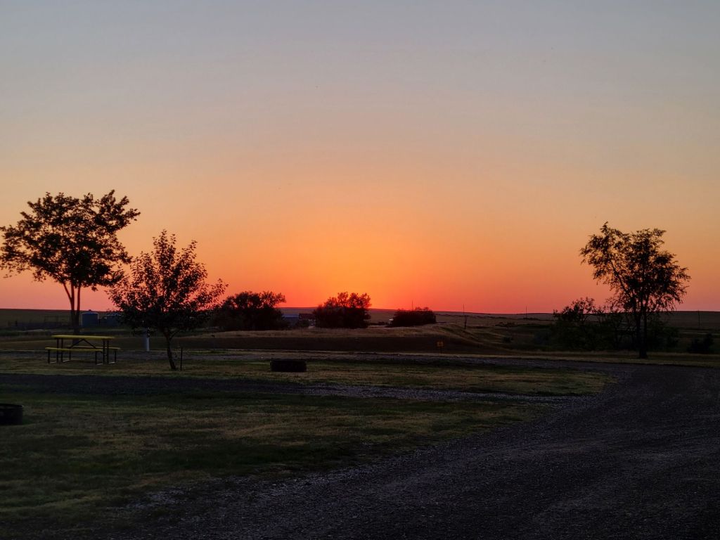
Of course, before you get the stars, you get the sunset.
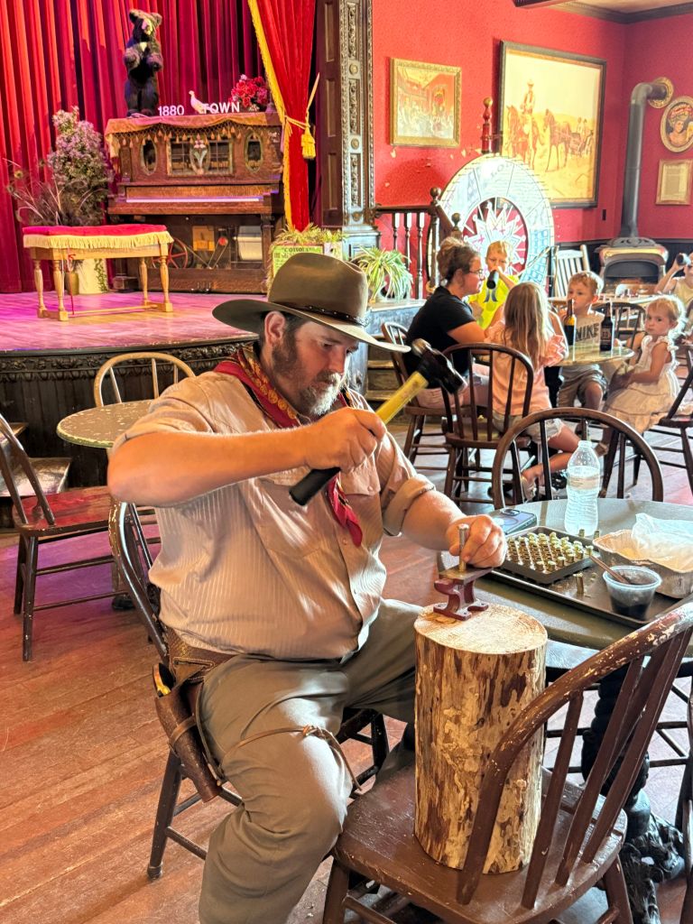
1880s Town
One of the items on our itinerary for when we were in Hill City had been to take the 1880s Train from Hill City to the 1880s Town.
As it turned out, last night we stayed about a quarter mile from the 1880s Town. I had no idea that we were going to be so close when I made our camping reservation.
So after hitching up the trailer this morning, we headed over there to check that off our itinerary (the town, not the train).
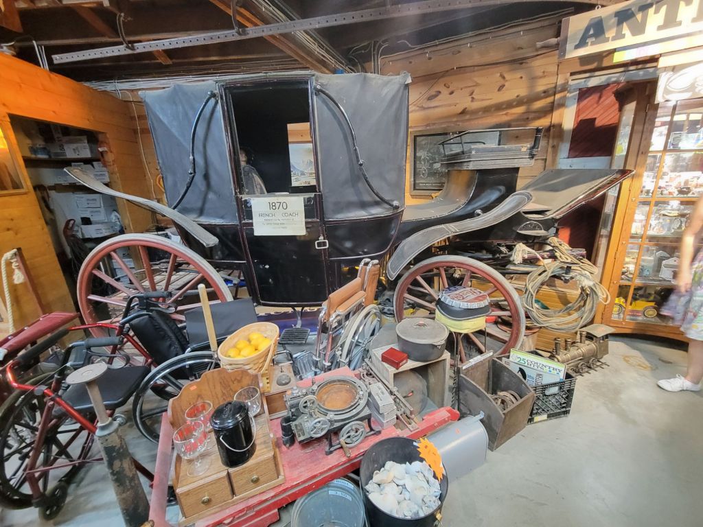
This guy was making bullets in the saloon.They had lots of memorabilia from the movie Dances with Wolves.There was a museum packed with so many artifacts and antiques from the late 1800s that it was overwhelming.Each building in town contained a veritable treasure trove of historical relics.
I imagine that a history buff would be in heaven here. Sadly, I am no history buff. The town felt very authentic to me, though, and I enjoyed that.
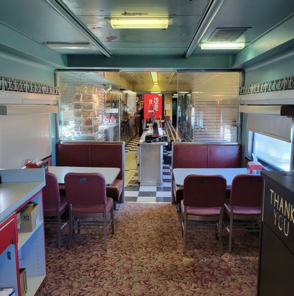
In the middle of our tour of the town, we stopped into the Santa Fe Train Diner to have an early lunch. The food? Blech.
Larsson’s Crooked Creek Resort
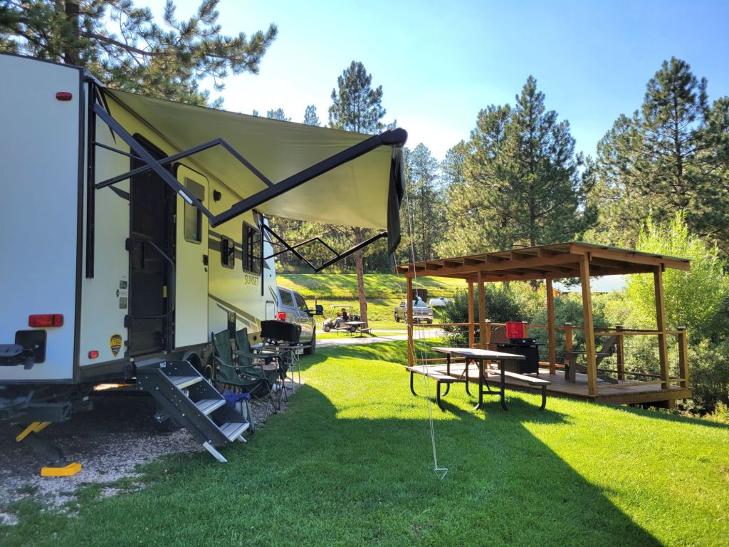
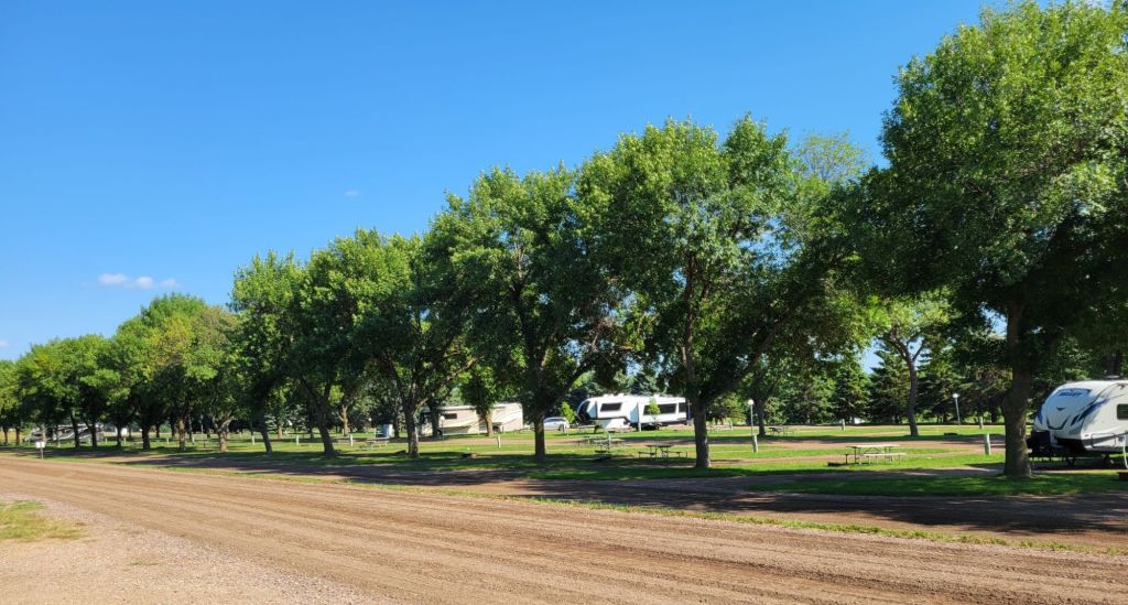
We are now at our campsite in the Black Hills area of South Dakota. We have a “presidential” site, complete with our own covered patio, Adirondack chairs, and a gas fire pit.
We will be here a week to see everything we can see in the Badlands and Black Hills area.
The new hitch seems to be working like a dream. Yay! The only time we really felt any swaying today was when we got hit by a super strong gust of wind. It made the drive to our next campground much more pleasant (the lack of swaying, not the wind).
Dignity of Earth and Sky
I had hoped to make two stops on our way to Midland, South Dakota, where we are staying tonight. The first was the Corn Palace in Mitchell. And the second was the Dignity of Earth and Sky statue at the rest area in Chamberlain.
Greg put his foot down over going to the Corn Palace, so that was a no-go. I didn’t give him a choice about seeing the Dignity statue. We were going!
Dignity of Earth and Sky is a 50-foot high stainless steel statue that depicts a Native American woman holding a star quilt. I thought it was pretty impressive.
I felt a little like I was taking my life in my hands by following this path, but I did it anyway.
Also at the rest area is a Lewis and Clark interpretive center. Greg and I took a tour through that as well.
Then we hopped in the car to continue our journey.
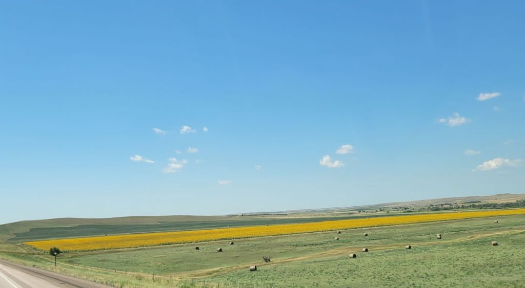
Almost immediately after leaving the rest area, we crossed over the Missouri River.And we got to see some hills! Okay, one hill.And lots of fields of sunflowers.And a whole lot a nothin’.
When we arrived at the campground, the temperature was 100 degrees.
Needless to say, there was no way I was going to be able to drag Greg outside to do any additional sightseeing. Sigh.
Tomorrow we are off to Hill City, where the real fun begins.
The last two days have been a bust. Our plan yesterday had been to ride our bikes on the greenway along the river.
We loaded the bikes onto the car, and just as we were getting ready to head off, Greg got an alert on his phone that lightning was in the area. We decided to wait until after the thunderstorms had passed, but sadly, every time we checked the weather report, it looked like thunderstorms were imminent.
We eventually took the bikes back off the car and went to the movies instead. We can happily attest that the new Fantastic Four movie is worth the money — assuming you like science fiction, that is.
The thunderstorms waited until the middle of the night before they hit, and boy, did they hit! It was quite the show of thunder, lightning, and wind.
Lucky Greg got to go out in the pouring rain at 2:00 a.m. to make sure the cover hadn’t blown off the bikes.
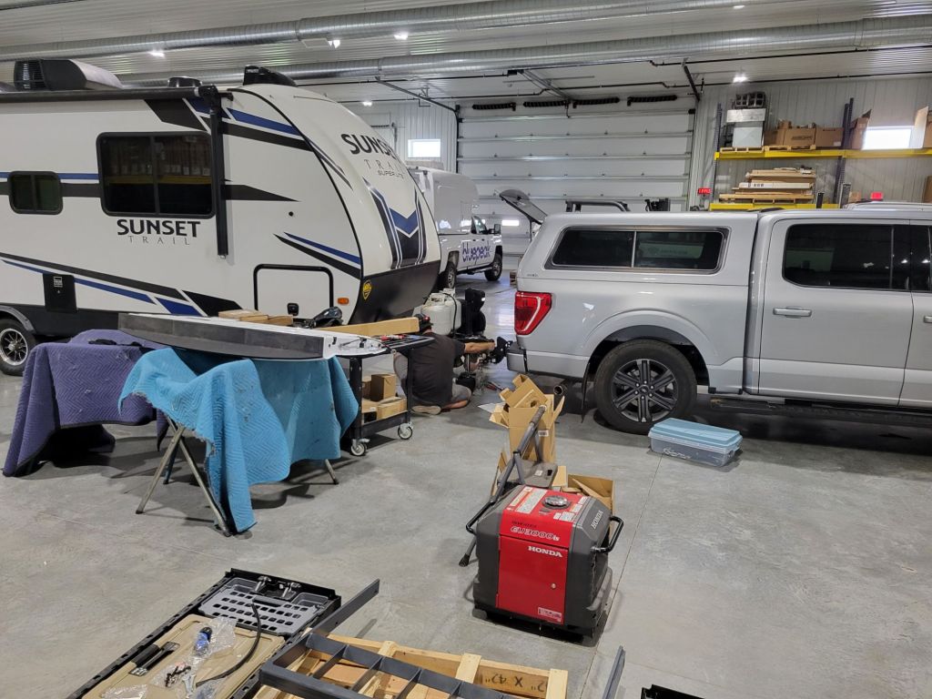
New hitch!
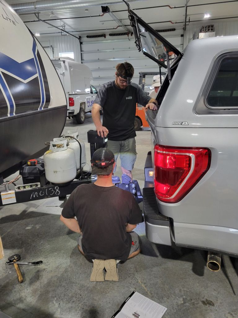
This morning, we hitched up the trailer and took it into Sioux Falls to get the new hitch installed.
While we were waiting in the showroom, I had the pleasure of visiting with an elderly gentleman who was waiting for a pickup truck that was getting a sprayed-in bed liner.
From what he told me, his post-retirement job is to pick up used trucks from auto auctions and deliver them to the truck dealership he works for. He gets paid $8 an hour, which he told me is a raise from his original payment of $6 an hour.
There is no doubt in my mind that if he voted, he voted for Trump. I’m coming to the conclusion that Americans have pretty similar values. The differences between them are their experiences (largely resulting from where they live) and media exposure.
These guys looked like they were conducting major surgery while they worked. It was hilarious.
Weekday camping
I absolutely love camping during the week (as opposed to weekend camping).
We are currently staying at a Yogi Bear Jellystone campground, which is geared toward families. This place was absolutely packed this weekend. Look at it now!
We practically have the place to ourselves. Weekday camping is THE BEST!
Tomorrow, we are off to Midland, South Dakota. It’s a one-night stop on our way to our final destination on this leg of the trip: Hill City, South Dakota.
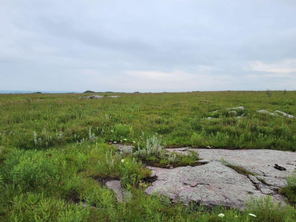
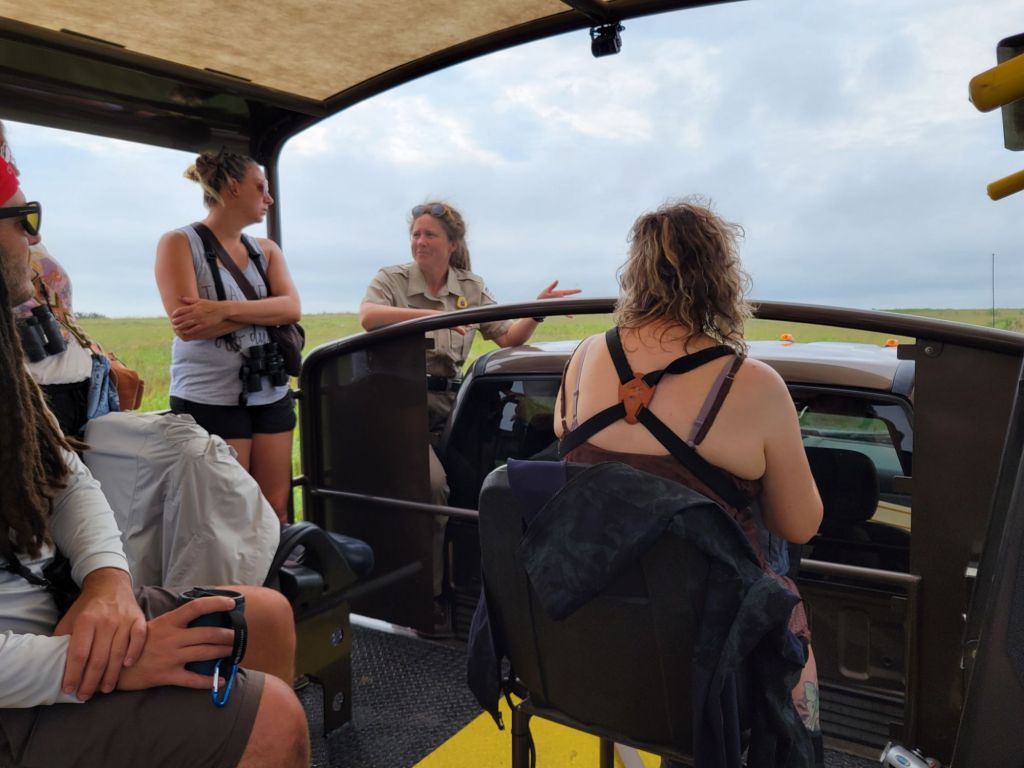
This morning, Greg and I took the Prairie and Bison Bus Tour at Blue Mounds State Park.
We got to see the bison herd almost as soon as the tour started.The prairie was beautiful and so different from anything I’ve seen before.
I learned some pretty cool facts on the tour:
The prairie needs to be burned every few years to keep it healthy and prevent it from evolving. People have been burning prairies for thousands of years.
No bison currently living in the US is purebred due to cattle/bison inbreeding many years ago by ranchers.
Only 4% of the original long grass prairie remains in the U.S.
The soil that makes up the prairie of Blue Mounds State Park is at most 3 ft. deep. Underneath the soil is up to 350 ft of Sioux quartzsite. Because of that, the root system goes sideways rather than down.
Bison like to hang out together, so it is rare to find one on its own.
The various parks that breed bison swap the bulls between them in order to prevent too much inbreeding.
We saw some cool wildlife on our tour, too. Thanks to another woman on the tour, who had a powerful set of binoculars, we got to see a red tail hawk and a falcon. We also got to see some pheasants.
Our tour guide was delightful.
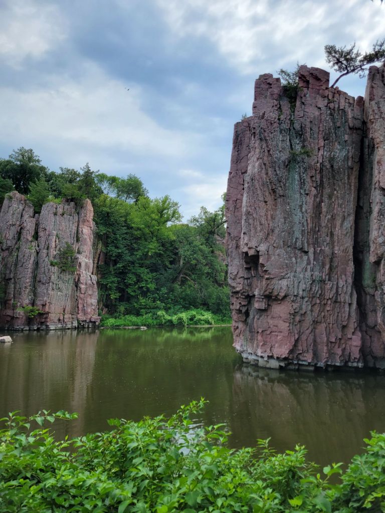
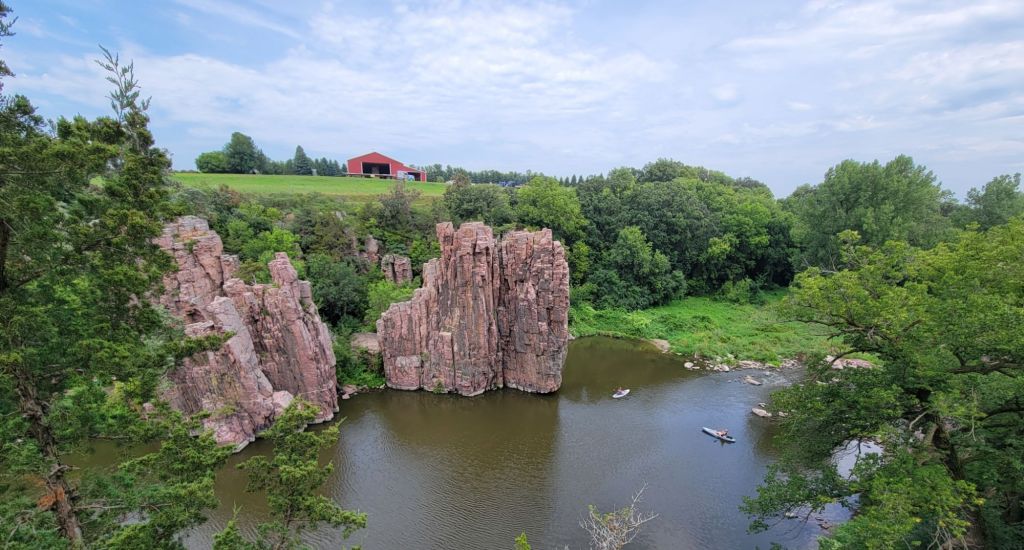
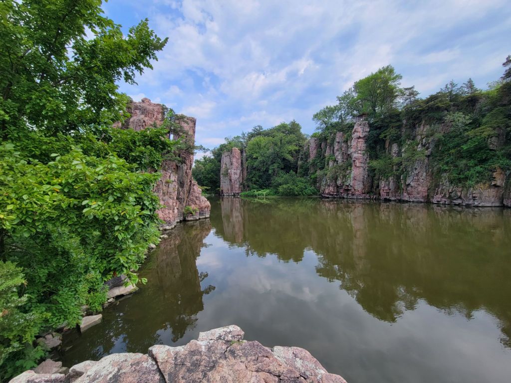
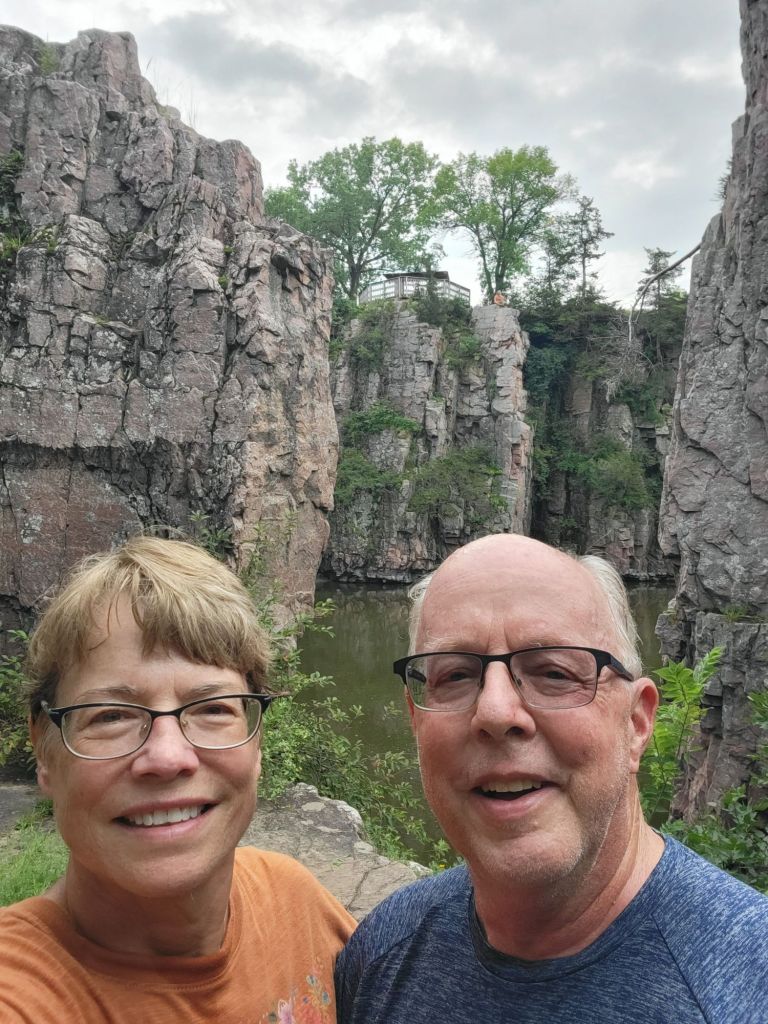
Palisades State Park
Next, we headed to Palisades State Park. This was a cute park with some beautiful quartzsite cliffs along Split Rock Creek.
I could post about 20 pictures from this park. I thought it was beautiful.
I really wanted to be one of those kayakers!
One more photo, just because.
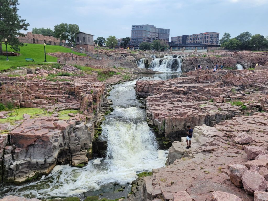
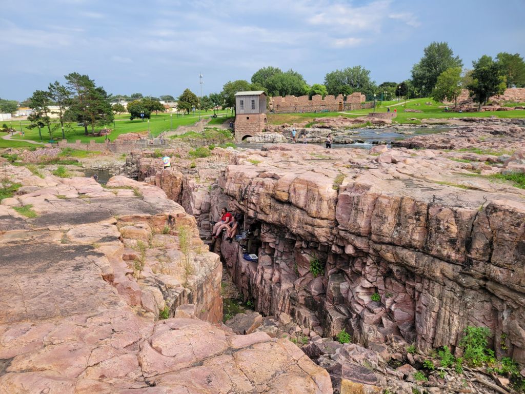
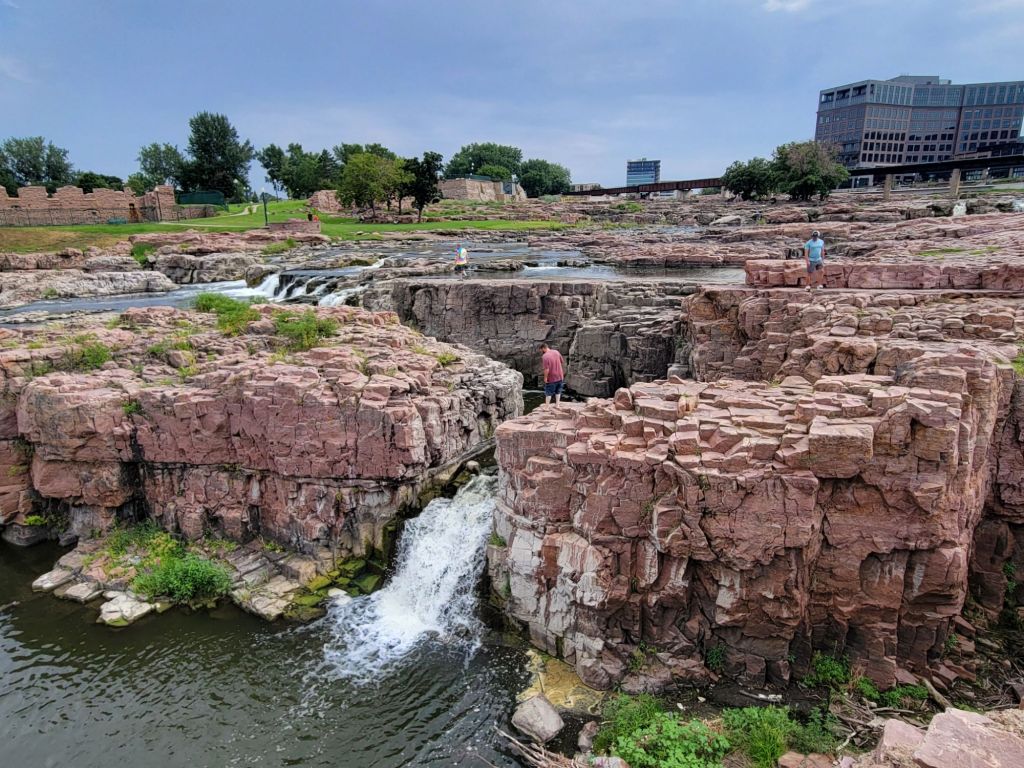
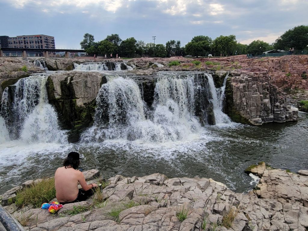
Falls Park
Next, we headed to Falls Park in downtown Sioux Falls.
The feels-like temp today was between 100 and 103 degrees, despite the cloud cover (humidity over 70 percent), and Greg was beat by this point, so he took a little convincing to keep going. But after a short stint in the air-conditioned camper, he was game.
And in the end, we were both glad that we went. Wow. Falls Park was a pleasant surprise!
It’s a wonderful community park with a water playground for kids, shops, picnic areas, and restaurants. But the highlight of the park is the falls.
You don’t see something like this right in the heart of a city very often. It was very cool. (By the way, that building is a cafe.)
Miscellany
Some observations about Wisconsin and South Dakota:
The names of county roads in Wisconsin are letters of the alphabet (e.g. County Road V, County Road E). In South Dakota, the names of county roads are numbers (e.g. County Road 478, County Road 452).
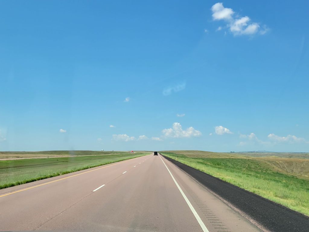
The roads are so straight!
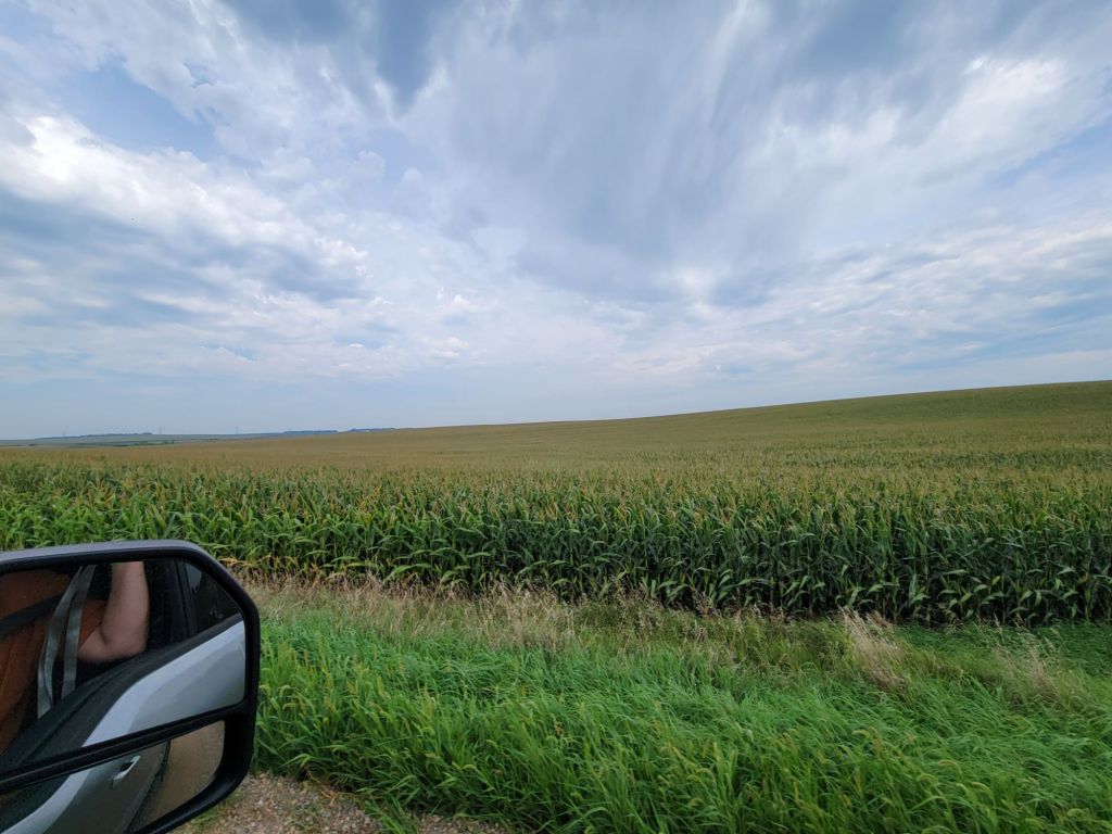
The fields of crops (corn or soybeans) are so vast that they disappear into the horizon. It’s all farmland here.
People in South Dakota say hi to you when walking past you.
The roads in Wisconsin are in terrible condition. So are a lot of the roads in South Dakota. Even I-90, which is a major highway!
The roads in South Dakota are sparsely traveled. We went nearly 20 miles today and only passed one other car.
We’ve been feeling a bit like we’re driving across the top of the world, even though our elevation is only 1200 ft. above sea level. I think it’s because the landscape is so flat that the horizon is very far away.