No Kings protest

Greg and I started our morning at Lake Mead by attending the No Kings protest in nearby Henderson.

The crowd filled both sides of the street. The event organizer told us that a thousand people had signed up to attend in this Red city.

We didn’t feel like we should let our vacation get in the way of doing our patriotic duty.

I wasn’t really sure what to expect, but it was a lot of fun!

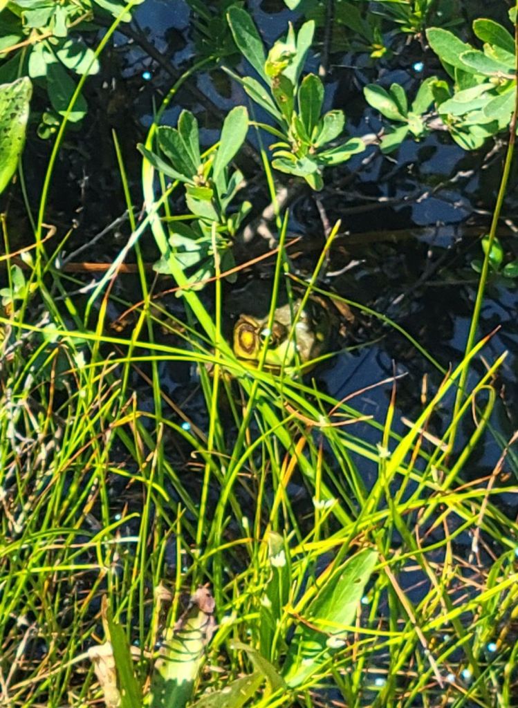
Even the frogs were in attendance!

There were some great signs, too!

Some folks wore their patriotism…

Even the dogs were showing their patriotism!

And many of the cars passing by honked their horns to show their support, waved American flags, or gave us the thumbs up!

After the rally, Greg and I had fast food for lunch before heading back to the campground.

Kayaking on Lake Mead

After finishing setting up the camper at our site last night, Greg and I drove down to the beach to see where we might be able to launch our kayak. Greg had his heart set on kayaking while we were here.

The sun was just beginning to set, and the sky was a lovely shade of blue and pink.

We even got to see a couple pairs of mallard ducks.

So after the No Kings protest and our fast food lunch, we headed to the beach with our kayak.

There was a separate beach just for kayaks and canoes.

After our kayak trip, we headed to the laundromat to do what we hope will be our last load of laundry for this trip.

Grand Canyon

Well, if you want to see the Grand Canyon without crowds, the time to go is mid-October.

On Wednesday, the weather was cold and windy. We decided to drive Desert View Drive and stop at the various overlooks along the way. The idea of a hike in that cold wind was unappealing.

We started at the Desert View Watchtower, the furthest point along Desert View Drive.
The inside of the Desert View Watchtower was covered in Native American art and petroglyphs.

The weather on Thursday was significantly better, largely because the wind was non-existent.

Our original plan had been to bike Hermit Road, but we decided it was still too cold to spend a lot of time outdoors. Instead, we opted for the shuttle bus.

I’ve come to the conclusion that no photograph can do justice to the Grand Canyon. The closest one can come to portraying the magnitude and awesomeness of this geographical feature is through paintings.

Painted by Thomas Moran
Painted by Benjamin Chambers Brown
Painted by Gunnar Widforss
Painted by Stefan Baumann

I am looking forward to trying my hand at capturing the Grand Canyon in watercolor once we get home.

The Colorado River, still looking muddy.

Sadly, we only had two days at the Grand Canyon, and we didn’t make the most of them. I would have loved to have hiked the South Kaibab Trail, but neither one of us was feeling energetic enough.

I would also have loved a plane ride through the canyon!

Today, we arrived at our final planned stop for this camping trip, Lake Mead and Hoover Dam.

Almost there! It doesn’t look like we are coming up on a lake!
Our campground is right on Lake Mead.

After this stop, we begin the long journey home.

Lower Antelope Canyon

Our tour of Lower Antelope Canyon was canceled on Sunday due to flooding, but we were able to reschedule for Monday.

We had an amazing time. Our guide, a young Native American woman named Jo, was wonderful. She was cheery, relaxed, patient, and everything you could want in a guide. Informative, too.

Entering the canyon.

Lower Antelope Canyon is quite different from Upper Antelope Canyon.

First of all, we walked to the entrance of Lower Antelope Canyon rather than drove. Second, Lower Antelope Canyon involved climbing up and down ladders, both to get into and out of the canyon as well as while we were walking through it. And whereas the floor of Upper Antelope Canyon was fairly wide, the passageways of Lower Antelope Canyon were much tighter.

The toe holes in the rock face on the left are how people used to climb this wall. They would use the toe holes and pull themselves up with a rope.
The man and child in the photo above were foreign tourists. Greg and I never did figure out what language they were speaking.
Can you see the face of the Indian woman with her hair blowing back in the photo above?
None of these photos were edited. I don’t know how we got such beautiful colors.
This photo (above) shows how narrow and maze-like much of the canyon was.
Can you see the face of the Indian chieftain in the rock on the left?
To get out of the canyon, we had to climb a set of stairs. This is what the slot canyon looked like from outside.

After our tour of Lower Antelope Canyon, we headed back to the campground and relaxed for the rest of the day. (Well, aside from one quick trip to the grocery store.)

There is so much more we could have done while we were staying in Page, but it was really nice to just relax around our campsite much of the time.

Onward to the Grand Canyon!

Navajo Canyon boat tour

We have really lucked out with the weather on this trip. The forecast called for showers the morning of our Navajo Canyon boat tour, but the sun was out, and the temperature was perfect.

That is Tower Butte in the distance. You can take a helicopter ride and land on the top, which gives you a 360° view of the surrounding area.
Navajo Canyon
The Navajo Tapestry. If you look carefully, you can see animals and Native American chieftains in the patterns on the rock face.
We were told that the white rock and the red rock are the same type of rock. However, the white rock has been calcified by the water. Where white changes over to red is the demarcation line of where the water level used to be.
Heading back to Wahweap Marina, which you can see in the distance.
Lunch at Wahweap Resort and Marina

After returning from our tour of Navajo Canyon, we had lunch at the resort. It was very good!

Wahweap Overlook

On our way back to the campground after lunch, we stopped at the Wahweap Overlook.

Other scenic overlooks

Since we had the time, we stopped at the other overlooks along the way. Lake Powell is basically a wide section of the Colorado River created by the Glen Canyon Dam. It has more than 96 water-filled side canyons, of which Navajo Canyon and Antelope Canyon are two.

Scenic Drive

Next, we took the short Scenic Drive, which provided an overlook of the Glen Canyon Dam and the Colorado River.

Page, Arizona

Our next stop after Arches and Canyonlands was supposed to be Mesa Verde. We even had a tour of the Cliff House scheduled.
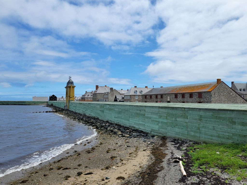
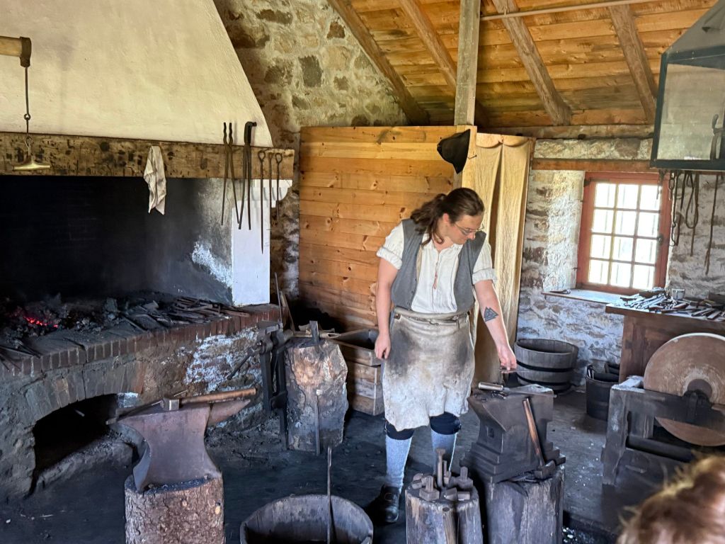
Sadly, the government shutdown nixed those plans. Mesa Verde is closed.

We decided to drop Mesa Verde and Monument Valley off of our itinerary and head straight to Page, Arizona.

Of course, that meant that the tours of Upper and Lower Antelope Canyon had to be rescheduled.

The only time we were able to schedule a tour of Upper Antelope Canyon was Friday morning, when the weather forecast was predicting that we would be experiencing the height of Tropical Storm Priscilla. We went ahead and booked the tour anyway. Time will tell whether we get to go on it.

Horseshoe Bend

We decided to visit Horseshoe Bend early this morning. What we didn’t realize is that the sun rises an hour earlier in Page than it did in Moab, so by the time we arrived at the parking lot for Horseshoe Bend, the sun was annoyingly high in the sky.

Oh, well. We will have other opportunities to visit it at better times of the day. We are only 15 minutes away.

This was the best photo I could get, considering the position of the sun.

Glen Canyon Dam

Next up was a stop at Glen Canyon Dam.

Once again, the government shutdown interfered with our plans. The Carl Hayden Visitor Center was closed.

However, we were able to access the overlook behind the visitor center. We were not able to walk across the dam, which I had been hoping we could do.

Antelope Canyon boat tour

Today was the last hot day we will have in Page, so I was eager to get on the water and experience Lake Powell.

The marina where we are staying offers boat tours, so after visiting Glen Canyon Dam, we headed over there to book one for the afternoon.

We had been told by someone who lives in Page that the storm was due to arrive around 5:00 p.m., so we figured we would be safe as long as we got our boat tour in before then.

Wrong!

No sooner had the boat left the dock than the heavens opened up.

Lightning flashed. Thunder cracked. We were hit by a deluge of rain.

I was sure the tour boat captain would immediately turn around and head back to the dock, but all she did was advise us not to touch the metal railings on the boat.

It turned out to be a great tour, despite the fact that our tour guide wasn’t able to deliver her spiel because the sound of the rain hitting the metal roof of the boat was too loud.

Look at those waterfalls! They are solely due to the amount of rain that was falling.

When we got back to the marina, we had to wait about half an hour for maintenance workers to clear the rocks and debris off the road from the flooding before we were able to head back to the parking lot.

I feel like we made the most of the day, in spite of the impediments put in our way.

Canyonlands National Park

Mesa Arch

This morning I hauled myself out of bed at 5:00 a.m. so that we could drive to Canyonlands National Park to see the sun rise through Mesa Arch.

Our first clue that this plan might go awry was the packed parking lot when we arrived. After walking the short trail to the arch, this is what greeted us:

To say that I was disappointed would be a vast understatement.

Not only was the arch crowded with people, but they were all simply standing in front of the arch chatting with one another.

There was no way to get close to the arch, much less take a photo. And no one showed the slightest inclination to step aside for those of us who might like a photo without strangers in it. I confess that I may have experienced a significant degree of rage.

One guy had a tripod set up in front of the arch, taking a video of the sun rising. It was impossible to get a photo without having that tripod in the frame. I was so tempted to give it a little push right into the canyon! 🤬

I was also tempted to stand behind them with my cell phone at the ready and shout, “Smile for the camera! I want a record of all the assholes here this morning!”

I didn’t do any of those things, of course. Instead, Greg and I slunk away and headed to Grand View Overlook to see what that might offer.

This photo was taken from an overlook on our way to Grand View.

I won’t lie. I will be very happy when we are done with canyons on this trip. I am tired of seeing Greg teetering on the edge of cliffs, praying that he won’t lose his balance or trip and fall in.

I’m not really worried about falling in, myself, since I never get close enough to the edge. But my fear of heights is always triggered, nevertheless.

Grand View Overlook

We decided not to walk the trail at Grand View. The position of the sun made it difficult to see into the canyon.

I wish park maps would tell you whether an overlook was east facing or west facing. It would be really helpful!

Mesa Arch–second attempt

After Grand View, we headed back to Mesa Arch to see whether the crowd had thinned now that the sun had fully risen.

Yay! I was finally able to get my shot of the arch. And to be honest, I don’t think it would have been much better if I had been able to take it at sunrise.

Lesson learned.

I did get at least one pretty photo at sunrise, though…

Dead Horse Point State Park

On the way back to the campground, we stopped at Dead Horse Point State Park.

This state park is a hidden gem, and I wish that we had visited it earlier so that we could have taken better advantage of everything it had to offer.

As it was, all we really did was drive to the end of the park road and take some photos of the canyon.

View of the Green River

The Mossy Cave Trail

We did not set our alarms last night because the weather forecast predicted a greater than 50% chance of rain until 11:00 a.m. this morning.

The weather forecast was wrong.

When we woke up, the chance of rain had dropped dramatically, so we got ourselves together and headed to the Mossy Cave Trail, which is a short trail just outside Bryce Canyon National Park. It leads to an unspectacular small cave and a quite lovely waterfall.

Navajo Loop Trail and Wall Street

I finally got my wish to do Wall Street.

Greg had decided that he should not do any more hiking, but he agreed to drive me over to Sunset Point so that I could hike the Navajo Loop Trail and Wall Street.

On the way, he told me that if he could find a parking place, he would join me on the hike. Yay!

Miraculously, we found a parking spot, so off we went!

It was SO. MUCH. FUN.

Starting off on the Navajo Trail
Working our way down…
…and down…
…and down
Those suckers are tall!
Walking through the hoodoos
Working our way back up
Taking a break to admire the view
Thor’s Hammer
Almost there!

We made it!

After our hike, we headed over to Bryce Lodge to check it out. There was a pizza restaurant there called Valhalla Pizzaria, and we couldn’t resist treating ourselves to pizza for lunch.

Tomorrow we head to Capitol Reef National Park.

Bryce Point

We made a spur of the moment decision this morning to stop by Bryce Point before heading to our next destination, Willis Creek Slot Canyon.

No wonder the parking lot was full yesterday. This overlook provides an amazing view of the Bryce Canyon Amphitheater!

We got there a little late. The sun was already up. And to make matters even more annoying, a group of folks who must have been on a photography tour had set up their tripods all around the overlook. Despite that, I got one or two photos that pleased me.

After Bryce Point, we stopped at Upper and Lower Inspiration points to take a few more photos.

Willis Creek Slot Canyon

Okay. I recognize that no other slot canyon can compare to Antelope Canyon in Arizona, but since I haven’t been there yet, forgive me for saying that Willis Creek Slot Canyon is awesome.

To get there, though, was no easy feat. It involved a seven-mile drive down a teeth-jarring BLM dirt road with a washboard surface, sharp turns, and steep inclines. Greg handled it like a champ. (There may have been moments when I shrieked.)

We also encountered a cow in the middle of the road at one point.

I had hoped that since we got there early, and since it was not an easy place to get to, we would be the only ones there. No such luck. Despite that, there were many times as we were walking that we were completely alone.

Another couple who were hiking the slot canyon showed us how to take vertical panorama shots, which give a much better sense of how tall things are. Some of these photos were taken using that method, and some were not, which explains why some of the walls look taller than others. Plus, there were about four slot canyons in all on the hike, each a little different than the one before.
This was a tiny little waterfall in one of the crevices of the canyon wall.

At one point a hummingbird flew in front of Greg. It paused about a foot in front of his face and looked him over before flying away. I was standing right behind him and got a really good view of the hummingbird. It was so cute!

Scenic Byway 12

Next, we decided to drive down Scenic Byway 12 to Devil’s Garden. Along the way, we encountered beautiful views and hail.

Devil’s Garden

Devil’s Garden is a small area of hoodoos out in the middle of nowhere.

To get to Devil’s Garden, we had to drive 12 miles down another BLM dirt road. When Greg realized that, he almost turned around to head back to Bryce Canyon, but it had taken us an hour and a half to get there, and I didn’t want to leave without seeing what we had come to see.

By the time we finished driving that 12 miles, Greg’s good mood was gone.

On top of that, thunderstorms were looming. After 10 minutes of wandering through the hoodoos, Greg decided it was time to head back. He didn’t want to be stuck on that dirt road during a downpour. I didn’t blame him.

I would have loved to have spent a little more time wandering through the hoodoos, though. It was fun!

And just to prove that there were indeed thunderstorms…

On the way back, we got to see a different angle of the hoodoos in Bryce Canyon National Park.

Navajo Loop/Queen’s Garden Trail

This morning we hauled ourselves out of bed at dawn (I’m not a fan of these early mornings) so that we could get to Sunset Point before the parking lot filled up.

From there, we hiked the Navajo Loop trail down into the Bryce Canyon Amphitheater.

Then we hooked up with the Queen’s Garden Trail.

And ended up at Sunrise Point.

Sometime before we leave, I would like to do the Navajo Loop Trail to the Wall Street Trail. I really want to wander through the maze of hoodoos.

Rainbow Point

After lunch, Greg decided it was time to terrify me again.

We drove the 18 miles to Rainbow Point, the highest point in Bryce Canyon National Park, at over 9000 feet above sea level. I had to keep my eyes closed for the last eight miles.

To our annoyance, the parking lot was packed. Greg ended up parking illegally in a “government vehicles only” slot. (He claims he didn’t see the sign. Ha!)

This was one of the rare times I didn’t mind breaking the rules. After that hair-raising trip up to Rainbow Point, I was damned if we were going to leave before seeing it!

It was interesting, but nothing I would have been devastated to miss.

After snapping a few photos as quickly as we could, we headed back down the mountain, stopping at various overlooks along the way.

My favorite by far was Natural Bridge.

We wanted to stop at Bryce Point as well, but there was a ranger blocking the road and a sign that said “lot full.” Argh!

Ugh. Crowds.

We have discovered that if we want to find parking at any of the lots in the national parks, we need to arrive by 9:00 a.m.

That’s no problem for our first stop of the day, because we’re usually arriving between 7:00 and 8:00 a.m. But anything we want to do after that becomes a challenge.

It’s really annoying.

On the other hand, the weather has been absolutely beautiful, and if we were doing this in the summer, we would be fighting both heat and crowds.

Foreign tourists

For those of you who might be wondering what it is like to tour the national parks while Trump is gleefully antagonizing non-Americans, let me say that it seems to have had little effect on tourism.

I would guess that between 15 to 20% of the tourists in the parks right now are foreigners. People are speaking French, German, Asian languages, and lots of languages that I can’t identify.

Today we met someone from Belgium, and we camped next to an Israeli family when we were in Zion. (They were absolutely delightful!) After they left, several young Germans took their place. On our other side were some middle easterners.

I have loved hearing all the different languages and chatting with people from all over the world.

Oh, and I haven’t noticed a decrease in service within the parks. I can’t say that the rangers in the visitor centers have been all that helpful, but there doesn’t seem to be a shortage of workers.

Emerald Pools Trail

My hips are starting to get stiff from all the exercise we’ve been doing. This morning I lost my balance trying to get my leg over the crossbar of my bike and toppled right over. Thankfully, nothing was injured but my dignity! 

Today we rode our bikes up to the Zion Lodge to hike the Emerald Pools Trail.

This photo was taken on the Pa’rus Trail.

The views along the walk to the Lower Emerald Pool were beautiful.

Below is a photo taken at the Lower Emerald Pool. The waterfall was difficult to see unless you took the photo directly into the sun. I lucked out with this one.

The trail went on from the Lower Emerald Pool to the Middle and Upper Emerald pools. However, Greg decided at this point that it would not be a good idea for him to continue.

Between the six miles of walking the day before, the 16 miles of biking, and a poor night’s sleep, he decided to err on the side of caution. I decided that I should do the same. (We need to have enough strength and energy left to do Bryce Canyon!)

Before heading back to the campground, we stopped by the Zion Lodge for a snack and a moment of rest in the beautiful lobby.

Once back at the campground, Greg took a nap while I scrolled Blue Sky. Then Greg fixed a leak in our sink (we hope).

Then it was time for our next adventure.

The Zion-Mt. Carmel Highway

No camping trip would be complete without Greg trying to terrify a few years off my life.

This time, that attempt involved a drive along the Zion-Mount Carmel Highway.

The Zion-Mount Carmel Highway is another one of those mountain roads with steep drop-offs and serpentine turns. And no shoulders! It also includes a mile-long narrow tunnel.

Luckily for me, I was so busy taking pictures through the windshield that I didn’t have a lot of time to fear tumbling over the edge of a cliff.

Some of my favorites:

The colors and shapes, oh, my! I was in heaven.

The Night Sky

Once it got dark, we drove the car over to the visitor center and walked to a new campground that is still under construction so that Greg could see if he could get any good pictures of the Milky Way with his new camera.

While he worked on that, I lay on my back in the dirt and admired the starry sky. Sometimes it’s nice to remember how small and insignificant we are to the universe.

Tomorrow we head to Bryce Canyon National Park.